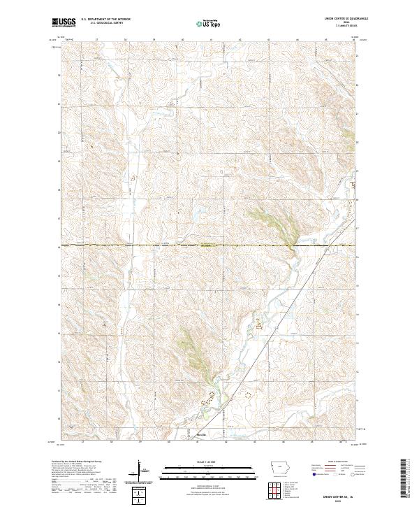
2022 Map of Union Center SE
USGS Topo · Published 2022About this map
Moville sits at the southern edge of this West Central Iowa landscape, where the town grid transitions into a vast network of section-line roads and creek drainages. The Plymouth Co Woodbury Co boundary line bisects the territory, separating the rolling hills of T90N from the lower agricultural plains of T89N. This area is defined by the winding course of the West Fork Little Sioux River, which is joined by several smaller tributaries including McElhaney Cr and Mud Cr. The surveyor's grid is remarkably intact here, with north-south corridors like Nature Ave and Pioneer Ave providing the primary framework for the rural homesteads and farmsteads that dot the countryside. This modern survey reflects the enduring structure of the midwestern agricultural heartland, capturing the relationship between the drainage of the Little Sioux basin and the strictly managed road network of the contemporary era.
Find a feature on this map
40 named features on this map. Tap any name to fly to it.
Don’t see what you’re looking for? This feature index may not catch every label — zoom into the map to look around manually.
Map Details
Editions of this 2022 Union Center SE Map
This is the sole edition of this map. No revisions or reprints were ever made.
Other maps of this area

1954 · Fort Dodge
USGS Topo · 1:250,000

1955 · Sioux City
USGS Topo · 1:250,000

1957 · Fort Dodge
USGS Topo · 1:250,000

1958 · Sioux City
USGS Topo · 1:250,000

1958 · Fort Dodge
USGS Topo · 1:250,000

1959 · Sioux City
USGS Topo · 1:250,000

1962 · Union Center
USGS Topo · 1:62,500

1964 · Lawton
USGS Topo · 1:24,000

1964 · Moville
USGS Topo · 1:24,000

1969 · Correctionville NW
USGS Topo · 1:24,000