1900s (20th Century) Maps of Mount Ayr, Iowa
Explore 10 historic maps of Mount Ayr from the 1900s (20th Century). These maps offer a rare glimpse into what life looked like during the 1900s — showing old roads, neighborhoods, homes, and landmarks that have changed or disappeared over time.
Whether you're researching your family's past, planning a metal detecting trip, or studying how Mount Ayr's landscape evolved across the 1900s, these high-resolution maps are a powerful tool for exploring the history of this region.
- Focus on a specific era: All maps on this page are from the 1900s, giving you a focused view of this time period.
- See what’s changed: Compare century-old streets, trails, and buildings to today's modern landscape using overlays and satellite layers.
- Research with precision: Use these maps for genealogy, historical research, land use analysis, or educational projects.
- View, download, or print: Maps are fully viewable online in high resolution, and can be downloaded or printed for your own records.
Start exploring Mount Ayr's history through authentic maps from the 1900s. This is your window into the past.
Mount Ayr, IA maps
(10)- 1940 Map of Blockton, 1954 Print
 1940 Blockton1954 Print · USGSLife along the Iowa and Missouri border in the early 1940s was centered on small rural school districts and family farms. Researchers can trace the exact locations of vanished community hubs like Irena, Jackson Ch, and Victory Sch before the consolidation of rural landmarks.2 unique versions available
 - 1943 Map of Blockton
 1943 Blockton1943 Print · USGSThe Iowa-Missouri borderlands are captured here in the early 1940s, showing a landscape of small townships and rural school districts. Genealogists can locate specific local landmarks such as Lone Star Sch, Irena, and the Middle Fork Lotts Creek.3 unique versions available
 - 1945 Map of Mount Ayr, 1954 Print
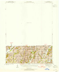
 1945 Mount Ayr1954 Print · USGSThe Iowa-Missouri borderlands come into focus at the end of the war, showing a landscape of small townships and family farms. Genealogists can trace local roots through landmarks like Petry Cem, Friendship Ch, and the many rural schools including Lone Rock Sch.2 unique versions available
 - 1947 Map of Mount Ayr
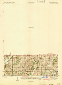
 1947 Mount Ayr1947 Print · USGSThe Missouri-Iowa border comes into focus in the mid-1940s, capturing the rural townships of Lincoln and Hamilton at a peak of local community density. Researchers can trace the exact locations of family homesteads near Hatfield or find the remote Turkey Grove Cem and Arrington Sch.2 unique versions available
 - 1955 Map of Nebraska City, 1967 Print
 1955 Nebraska City1967 Print · USGSThe four-state region surrounding the Missouri River valley appears here in the mid-1950s, a landscape of rail-dependent market towns and rural school districts. Genealogists can locate family landmarks like the Rock Bluff School, St Oswald Church, and the Clarinda State Hospital.3 unique versions available
 - 1957 Map of Nebraska City
 1957 Nebraska City1957 Print · USGSThe four-state junction of Nebraska, Iowa, Missouri, and Kansas comes alive in this mid-fifties survey of the Missouri River valley. Genealogists and historians can trace the rail-and-road networks connecting Nebraska City, Maryville, and the Squaw Creek National Wildlife Refuge.
 - 1958 Map of Nebraska City
 1958 Nebraska City1958 Print · USGSThe Missouri River Valley and its fertile four-state borderlands are captured here during the mid-century expansion of the regional highway and rail networks. Genealogists can trace family roots through numerous rural landmarks like Moulton School, Shady Grove Church, and the Clarinda State Hospital.
 - 1981 Map of Benton
 1981 Benton1981 Print · USGSRinggold County in the early eighties shows a rural landscape transitioning between the rail era and modern conservation. Trace the path of the Chicago and North Western line or locate family history near Benton Cem and the settlement of Delphos.
 - 1981 Map of Mount Ayr, 1982 Print
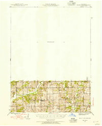
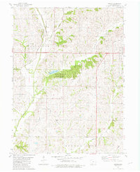
 1981 Mount Ayr1982 Print · USGSMount Ayr in the early eighties remains a vital agricultural center defined by the converging forks of the Grand River. Local historians can trace the Old Railroad Grade or locate numerous rural burial sites like Rose Hill Cemetery and Shaha Cem.
 - 1985 Map of Mount Ayr
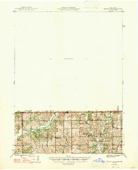
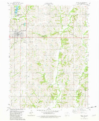
 1985 Mount Ayr1985 Print · USGSThe Iowa-Missouri borderlands are captured here in the mid-eighties, showing a landscape defined by the branching forks of the Platte River and Grand River. Researchers can trace the heritage of rural communities and conservation sites like Lake of Three Fires State Park and Rose Hill Cemetery.2 unique versions available
End of results
Showing maps 1-10 of 10
Top cities near Mount Ayr
- Grant City historical maps
- Diagonal historical maps
- Kellerton historical maps
- Tingley historical maps
- Shannon City historical maps
- Redding historical maps
See more
Frequently asked questions
- What are the different types of historical maps available for Mount Ayr?
- What is the oldest map of Mount Ayr?
- Where can I purchase historical maps of Mount Ayr for my home or office?
- Where can I download high-res historical maps of Mount Ayr?
- Are there historical topographic maps available for Mount Ayr?
- Is there historical aerial imagery available for Mount Ayr?
- Where are historical maps of Mount Ayr sourced from?