2020s Maps of Eldridge, Sheridan Township
Explore 4 historic maps of Eldridge from the 2020s. These maps offer a rare glimpse into what life looked like during the 2020s — showing old roads, neighborhoods, homes, and landmarks that have changed or disappeared over time.
Whether you're researching your family's past, planning a metal detecting trip, or studying how Eldridge's landscape evolved across the 2020s, these high-resolution maps are a powerful tool for exploring the history of this region.
- Focus on a specific era: All maps on this page are from the 2020s, giving you a focused view of this time period.
- See what’s changed: Compare century-old streets, trails, and buildings to today's modern landscape using overlays and satellite layers.
- Research with precision: Use these maps for genealogy, historical research, land use analysis, or educational projects.
- View, download, or print: Maps are fully viewable online in high resolution, and can be downloaded or printed for your own records.
Start exploring Eldridge's history through authentic maps from the 2020s. This is your window into the past.
Eldridge, Sheridan Township maps
(4)- 2022 Map of Donahue, 2022 Print
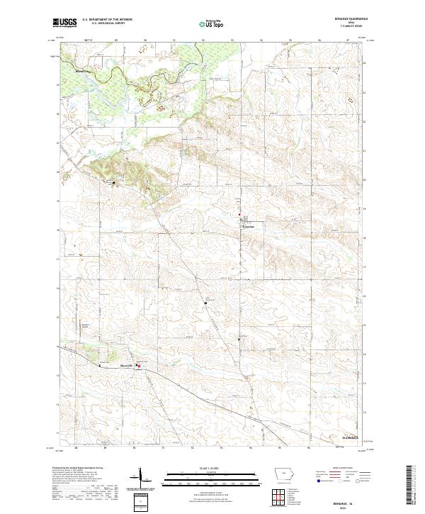 2022 Donahue2022 Print · USGSThis Scott County landscape showcases the rural heart of Iowa at the turn of the millennium. Genealogists can trace family roots through several local burial grounds, including Allens Grove Cem, Maysville Cem, and Linn Grove Cem.
 - 2022 Map of Davenport West, 2022 Print
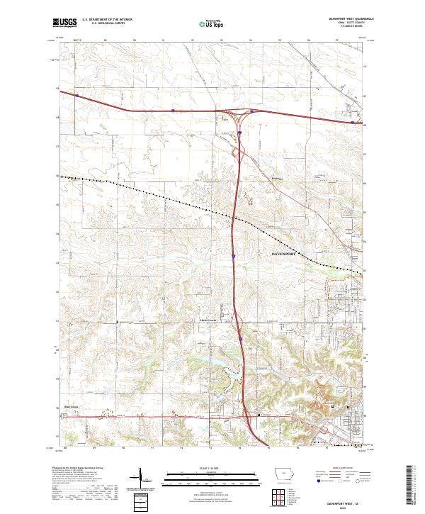 2022 Davenport West2022 Print · USGSWestern Scott County is shown in this recent survey as residential neighborhoods reach toward rural farmland. You can trace family history at the Fairmont Cem or explore the geography of Little Groves and the creeks of Duck Cr.
 - 2022 Map of Eldridge, 2022 Print
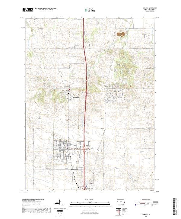 2022 Eldridge2022 Print · USGSScott County's fertile plains are documented here in the early 2020s, showcasing the expansion of residential life around Eldridge and Park View. Researchers can locate numerous family and parish grounds like Saint Anns Catholic Cem and the Kay Family Cem.
 - 2022 Map of Davenport East, 2022 Print
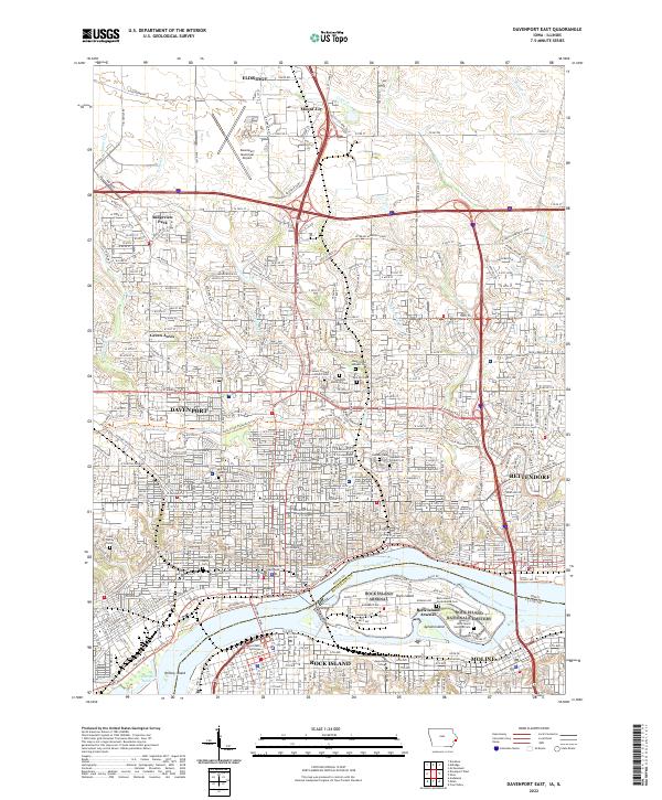 2022 Davenport East2022 Print · USGSThe Quad Cities area is captured in this modern survey of the river crossing between Iowa and Illinois. Genealogists and local historians can trace the expansive Rock Island National Cem or locate urban landmarks like the Scott County Courthouse and Saint Marys Church.
End of results
Showing maps 1-4 of 4
Top cities near Eldridge
- Davenport historical maps
- Moline historical maps
- Bettendorf historical maps
- Rock Island historical maps
- East Moline historical maps
- Silvis historical maps
See more
Top neighborhoods of Eldridge
- Meadow View Estates historical maps
- Northland historical maps
- The Farms at Elm Creek historical maps
- Eldridge Acres historical maps
- The Village of Cobbler's Knotch historical maps
- Burmeister historical maps
Frequently asked questions
- What are the different types of historical maps available for Eldridge?
- What is the oldest map of Eldridge?
- Where can I purchase historical maps of Eldridge for my home or office?
- Where can I download high-res historical maps of Eldridge?
- Are there historical topographic maps available for Eldridge?
- Is there historical aerial imagery available for Eldridge?
- Where are historical maps of Eldridge sourced from?