Old Maps of Story County, Iowa for Metal Detecting
Plan your next treasure hunt with 133 historic maps of Story County. Find old homesites, ghost towns, trails, and gathering spots that may be lost to time — perfect for identifying promising metal detecting locations.
- Locate forgotten sites: Uncover places like long-lost settlements, abandoned rail lines, or gathering spots.
- Plan better hunts: Use map overlays combined with LiDAR or satellite views to narrow in on historically rich areas.
- Made for detectorists: Thousands of hobbyists use these maps to discover relics, coins, and hidden history.
Use these historic maps to boost your research and find new opportunities beneath the surface of Story County.
Story County, IA maps
(133)- 1911 Map of Slater, 1960 Print
 1911 Slater1960 Print · USGSCentral Iowa at the dawn of the twentieth century was a landscape of rail-driven prairie towns and a schoolhouse at nearly every mile. Genealogists can trace the rural roots of local families through specific sites like Nip-and-tuck School, Polk City Junction, and Huxley.
 - 1912 Map of Ames, 1956 Print
 1912 Ames1956 Print · USGSStory and Hamilton counties appear here in the early twentieth century as a thriving network of rail-side towns and rural school districts. Researchers can trace the grounds of Iowa State College or find vanished schoolhouses like Tiernagel School and Hobbs School.3 unique versions available
 - 1913 Map of Slater
 1913 Slater1913 Print · USGSCentral Iowa's farm country and rail corridors are captured here just before the First World War, showing a landscape tightly knit by steam and electric lines. Genealogists can locate dozens of neighborhood landmarks like Nip-and-tuck School, the Sydnes School, and the early plats of Slater and Huxley.2 unique versions available
 - 1914 Map of Ames
 1914 Ames1914 Print · USGSStory County at the start of the twentieth century was a landscape of fertile farmland and burgeoning rail towns like Story City and Ames. Genealogists and researchers can trace the precise locations of dozens of country schoolhouses, including Zenorville School and Espeland School, alongside the grounds of Iowa State College.3 unique versions available
 - 1954 Map of Waterloo, 1968 Print
 1954 Waterloo1968 Print · USGSCentral Iowa at the height of its mid-century agricultural and rail boom features the growing hubs of Waterloo and Cedar Falls. Genealogists and researchers can trace the rail corridors of the Chicago Great Western and find local landmarks like Iowa State College and Brushy Ridge.4 unique versions available
 - 1954 Map of Des Moines, 1973 Print
 1954 Des Moines1973 Print · USGSCentral Iowa's evolving landscape is captured here in the early seventies, just as major reservoirs were reshaping the river valleys. Genealogists and historians can trace the rail corridors of the Burlington Northern or locate family roots near Pella, Indianola, and Knoxville.2 unique versions available
 - 1955 Map of Waterloo
 1955 Waterloo1955 Print · USGSCentral Iowa in the mid-fifties presents a dense landscape of rail-connected farming towns and growing river cities. Researchers can trace ancestral roots and old transport routes through Waterloo, Marshalltown, and Ames, while locating rural Cemeteries and local Quarries.2 unique versions available
 - 1956 Map of Des Moines
 1956 Des Moines1956 Print · USGSCentral Iowa in the mid-fifties shows a landscape defined by bustling rail hubs and deep-rooted agricultural research. Genealogists and researchers can trace the growth of Des Moines and Ames, locate the Sac and Fox Indian Reservation, or study the paths of the Skunk River and South Skunk River.
 - 1957 Map of Des Moines
 1957 Des Moines1957 Print · USGSCentral Iowa's post-war landscape is defined here by the converging rail lines and river valleys that shaped its earliest settlements. Genealogists and historians can trace the paths of the Rock Island Railroad and locate community landmarks in Des Moines, Ames, and Newton.
 - 1969 Map of Des Moines
 1969 Des Moines1969 Print · USGSCentral Iowa's fertile plains and growing capital are captured here during the late sixties, a time of major highway expansion and reservoir construction. Genealogists and researchers can trace rural township boundaries, local cemeteries, and rail lines serving towns like Pella, Grinnell, and Oskaloosa.
 - 1972 Map of Elkhart, 1975 Print
 1972 Elkhart1975 Print · USGSNorth of Des Moines in the early seventies, this rural landscape reveals the tightly organized farm grids and rail towns of Polk County. Genealogists can locate family landmarks like Keller Cem, White Oak Ch, and the streets of Alleman.
 - 1972 Map of Loring, 1975 Print
 1972 Loring1975 Print · USGSAgricultural life in central Iowa during the early 1970s centers on the South Skunk River and the small hamlet of Loring. Researchers can trace local history through sites like the Brethren Cem, Holy Cross Ch, and an Old Railroad Grade.
 - 1972 Map of Polk City, 1975 Print
 1972 Polk City1975 Print · USGSCentral Iowa was undergoing a massive landscape shift in the early seventies as the Saylorville project took shape. Researchers can trace the original rail path of the Chicago and North Western and locate quiet rural landmarks like Sheldahl Cem and Crocker.2 unique versions available
 - 1975 Map of Ames NW, 1978 Print
 1975 Ames NW1978 Print · USGSThe intersection of Hamilton and Story counties is captured here in the mid-seventies, showing a landscape of fertile township sections and stream valleys. Genealogists can trace family heritage at SS Peter & Paul Cem or Center Cem, and locate the old Chicago and North Western rail line.
 - 1975 Map of Nevada, 1978 Print
 1975 Nevada1978 Print · USGSStory County's landscape in the mid-seventies shows a bustling rail-and-river hub at the height of its mid-century growth. Researchers can trace the civic footprint of Nevada through the Courthouse and Oak Park Academy or locate local landmarks like Knoll Cem and the Paul Landing Strip.
 - 1975 Map of State Center NW, 1978 Print
 1975 State Center NW1978 Print · USGSMarshall County farmsteads and creek valleys are documented here in the mid-seventies, showing the rural landscape before further consolidation. Researchers can locate St Anthony, several Gravel Pits, and local landmarks like Illinois Grove Cem.
 - 1975 Map of Mingo, 1978 Print
 1975 Mingo1978 Print · USGSMid-Iowa's agricultural landscape comes into focus during the 1970s at the junction of Story, Jasper, and Polk counties. Researchers can trace rural genealogy and transport through Mingo, the Old RR Grade at Farrar, and local landmarks like Ashton Ch and Deeter Cem.
 - 1975 Map of Ames West, 1978 Print
 1975 Ames West1978 Print · USGSThe western edges of Ames and the Iowa State University campus are captured here in the mid-seventies, showing the city's expansion toward Ontario. Researchers can trace old school sites like Sawyer Sch, the College Cem, and the path of the Chicago and North Western railroad.2 unique versions available
 - 1975 Map of Story City, 1978 Print
 1975 Story City1978 Print · USGSStory City and its neighboring prairie townships are captured here in the mid-seventies as the regional rail and river network shaped local life. Researchers can trace family sites at Mt Olive Cem, follow the Chicago and North Western tracks, or locate the Old Railroad Grade near Roland.
 - 1975 Map of Huxley, 1978 Print
 1975 Huxley1978 Print · USGSStory County in the mid-seventies reveals a landscape shaped by the South Skunk River and a dense network of competing railroads. Genealogists can locate several family-anchored sites like Fjelberg Cem, Palestine Ch, and the town of Cambridge.
 - 1975 Map of State Center, 1978 Print
 1975 State Center1978 Print · USGSCentral Marshall County thrived in the mid-seventies as a hub of rail activity and rural settlement. Researchers can trace the Chicago and Northwestern line or locate family sites like Sacred Heart Cem and St Johns Ch.
 - 1975 Map of Slater, 1978 Print
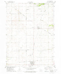 1975 Slater1978 Print · USGSStory County agricultural and rail networks are preserved here in the mid-seventies, showing the intersection of heavy rail lines and academic research. Genealogists and local historians can trace family roots through Bethany Cem or locate old rail spurs like the Chicago Milwaukee St Paul and Pacific near Slater and Kelley.
 - 1975 Map of Rhodes, 1978 Print
 1975 Rhodes1978 Print · USGSRhodes and the surrounding Marshall County farmland are captured in the mid-seventies, showing a landscape defined by rail and river. Genealogists can locate several rural burial grounds including Wilkey Cem, Day Cem, and St Josephs Cem alongside the Chicago Milwaukee St Paul and Pacific tracks.
 - 1975 Map of Ames East, 1978 Print
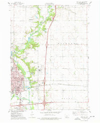 1975 Ames East1978 Print · USGSAmes was expanding along the Skunk River in the mid-1970s, as agricultural research and transit networks shaped the local landscape. Researchers can locate the National Animal Disease Laboratory, the Born Cem, and the tracks of the Chicago and North Western railroad.2 unique versions available
 - 1975 Map of Baxter, 1978 Print
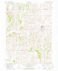 1975 Baxter1978 Print · USGSThe town of Baxter and its surrounding townships are shown here during the mid-1970s, capturing the organized grid of Iowa's agricultural heartland. Genealogists and local historians can locate several rural burial grounds, including Restland Cem and Independence Cem, alongside the CHICAGO AND NORTH WESTERN rail line.
Showing maps 1-25 of 133
Top cities of Story County
- Ames historical maps
- Nevada historical maps
- Huxley historical maps
- Story City historical maps
- Kelley historical maps
Frequently asked questions
- What are the different types of historical maps available for Story County?
- What is the oldest map of Story County?
- Where can I purchase historical maps of Story County for my home or office?
- Where can I download high-res historical maps of Story County?
- Are there historical topographic maps available for Story County?
- Is there historical aerial imagery available for Story County?
- Where are historical maps of Story County sourced from?