1970s Maps of Palestine Township, Iowa
Explore 4 historic maps of Palestine Township from the 1970s. These maps offer a rare glimpse into what life looked like during the 1970s — showing old roads, neighborhoods, homes, and landmarks that have changed or disappeared over time.
Whether you're researching your family's past, planning a metal detecting trip, or studying how Palestine Township's landscape evolved across the 1970s, these high-resolution maps are a powerful tool for exploring the history of this region.
- Focus on a specific era: All maps on this page are from the 1970s, giving you a focused view of this time period.
- See what’s changed: Compare century-old streets, trails, and buildings to today's modern landscape using overlays and satellite layers.
- Research with precision: Use these maps for genealogy, historical research, land use analysis, or educational projects.
- View, download, or print: Maps are fully viewable online in high resolution, and can be downloaded or printed for your own records.
Start exploring Palestine Township's history through authentic maps from the 1970s. This is your window into the past.
Palestine Township, IA maps
(4)- 1972 Map of Elkhart, 1975 Print
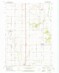 1972 Elkhart1975 Print · USGSNorth of Des Moines in the early seventies, this rural landscape reveals the tightly organized farm grids and rail towns of Polk County. Genealogists can locate family landmarks like Keller Cem, White Oak Ch, and the streets of Alleman.
 - 1972 Map of Polk City, 1975 Print
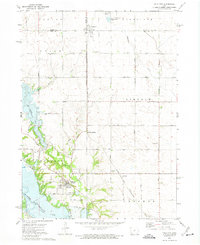 1972 Polk City1975 Print · USGSCentral Iowa was undergoing a massive landscape shift in the early seventies as the Saylorville project took shape. Researchers can trace the original rail path of the Chicago and North Western and locate quiet rural landmarks like Sheldahl Cem and Crocker.2 unique versions available
 - 1975 Map of Huxley, 1978 Print
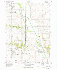 1975 Huxley1978 Print · USGSStory County in the mid-seventies reveals a landscape shaped by the South Skunk River and a dense network of competing railroads. Genealogists can locate several family-anchored sites like Fjelberg Cem, Palestine Ch, and the town of Cambridge.
 - 1975 Map of Slater, 1978 Print
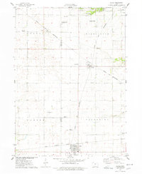 1975 Slater1978 Print · USGSStory County agricultural and rail networks are preserved here in the mid-seventies, showing the intersection of heavy rail lines and academic research. Genealogists and local historians can trace family roots through Bethany Cem or locate old rail spurs like the Chicago Milwaukee St Paul and Pacific near Slater and Kelley.
End of results
Showing maps 1-4 of 4
Top cities near Palestine Township
- Ankeny historical maps
- Ames historical maps
- Johnston historical maps
- Altoona historical maps
- Grimes historical maps
- Boone historical maps
See more
Top neighborhoods of Palestine Township
Frequently asked questions
- What are the different types of historical maps available for Palestine Township?
- What is the oldest map of Palestine Township?
- Where can I purchase historical maps of Palestine Township for my home or office?
- Where can I download high-res historical maps of Palestine Township?
- Are there historical topographic maps available for Palestine Township?
- Is there historical aerial imagery available for Palestine Township?
- Where are historical maps of Palestine Township sourced from?