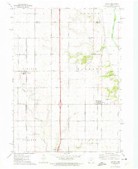
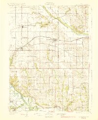
1972 Map of Elkhart
USGS Topo · Published 1975About this map
Agricultural lands north of Des Moines define this early 1970s landscape, where the grain-heavy economy of central Iowa is visible through a grid of section-line roads and strategic rail corridors. The Chicago and North Western railroad serves the settlement of Alleman, while the Chicago Rock Island and Pacific line runs through Elkhart. These two small hubs anchor a territory otherwise dominated by farmsteads and a network of named waterways including White Oak Creek, Fourmile Creek, and the South Skunk River in the northeast. Genealogy and local history are preserved in several locations, from the Keller Cem and Brethren Cem to the White Oak Ch. The map also captures modern infrastructure of the era, such as the newly established Ankeny Memorial Gardens and the presence of a Radio Tower and Sewage Disposal Pond, reflecting the gradual transition of this rural area.
Find a feature on this map
42 named features on this map. Tap any name to fly to it.
Don’t see what you’re looking for? This feature index may not catch every label — zoom into the map to look around manually.
Map Details
Editions of this 1972 Elkhart Map
This is the sole edition of this map. No revisions or reprints were ever made.
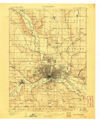
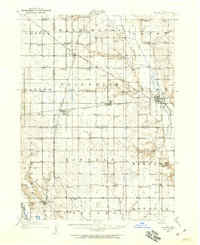
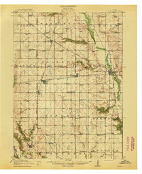
Other maps of this area

1905 · Des Moines
USGS Topo · 1:62,500
1907 · Des Moines
USGS Topo · 1:62,500
1911 · Slater
USGS Topo · 1:62,500
1913 · Slater
USGS Topo · 1:62,500
1930 · Mitchellville
USGS Topo · 1:62,500

1954 · Des Moines
USGS Topo · 1:250,000

1956 · Des Moines
USGS Topo · 1:250,000
1956 · Des Moines NW
USGS Topo · 1:24,000
1956 · Des Moines NE
USGS Topo · 1:24,000
1956 · Des Moines
USGS Topo · 1:62,500