1960s Maps of Tama County, Iowa
Explore 10 historic maps of Tama County from the 1960s. These maps offer a rare glimpse into what life looked like during the 1960s — showing old roads, neighborhoods, homes, and landmarks that have changed or disappeared over time.
Whether you're researching your family's past, planning a metal detecting trip, or studying how Tama County's landscape evolved across the 1960s, these high-resolution maps are a powerful tool for exploring the history of this region.
- Focus on a specific era: All maps on this page are from the 1960s, giving you a focused view of this time period.
- See what’s changed: Compare century-old streets, trails, and buildings to today's modern landscape using overlays and satellite layers.
- Research with precision: Use these maps for genealogy, historical research, land use analysis, or educational projects.
- View, download, or print: Maps are fully viewable online in high resolution, and can be downloaded or printed for your own records.
Start exploring Tama County's history through authentic maps from the 1960s. This is your window into the past.
Tama County, IA maps
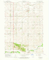
(10)- 1960 Map of Marshalltown, 1962 Print
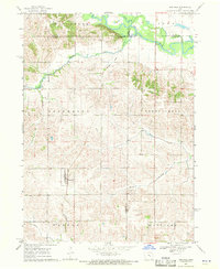
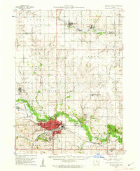 1960 Marshalltown1962 Print · USGSIn the early 1960s, Marshalltown stood as a bustling rail and manufacturing center along the Iowa River. Genealogists can trace family names through several historic sites, including Riverside Cem, Rose Hill Memorial Gardens, and the rural Prairieville Cem.2 unique versions available
 - 1960 Map of Le Grand, 1962 Print
 1960 Le Grand1962 Print · USGSMarshall County farm country and the industrial river valley are captured here in the early sixties. Researchers can trace the dual rail lines of the Chicago Great Western and the Chicago and North Western or locate family plots at Rock Valley Cem and Pleasant Hill Cem.2 unique versions available
 - 1960 Map of Conrad East, 1966 Print
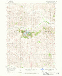
 1960 Conrad East1966 Print · USGSMid-century Marshall County agriculture and commerce meet in this survey of the Grundy and Tama county borders. Genealogists and historians can trace the paths of the Chicago and North Western rail line through Beaman and locate family sites at Vienna Cem or Oakland Cem.
 - 1963 Map of Buckingham, 1964 Print
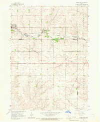
 1963 Buckingham1964 Print · USGSThe rural agricultural landscape of Black Hawk and Tama counties is captured here in the early sixties. Researchers can trace the Chicago and North Western rail line and locate community landmarks like Buckingham, Voorhies, and Blessing Ch.2 unique versions available
 - 1963 Map of Eagle Center, 1964 Print
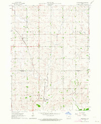
 1963 Eagle Center1964 Print · USGSIn the early 1960s, this agricultural region at the junction of Black Hawk and Tama counties maintained a network of small community centers. Genealogists can trace family footprints through sites like Township Cem, Geneseo Ch, and St Mary Sch.2 unique versions available
 - 1968 Map of Belle Plaine SW, 1970 Print
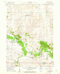
 1968 Belle Plaine SW1970 Print · USGSPoweshiek County agricultural lands are captured here in the late sixties, centered on the newly established waterfront of Holiday Lake. Genealogists and local historians can trace family farm plots near Kent Chapel or follow the waters of Walnut Creek.
 - 1968 Map of Belle Plaine, 1970 Print
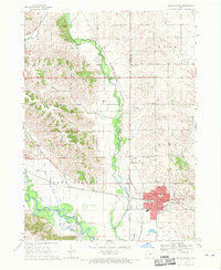 1968 Belle Plaine1970 Print · USGSBenton and Tama counties appear here in the late sixties, centered on the rail hub of Belle Plaine and the Iowa River. Genealogists can locate several local burial sites including St Marys Cem, Irving Cem, and National Cem.2 unique versions available
 - 1968 Map of Chelsea, 1970 Print
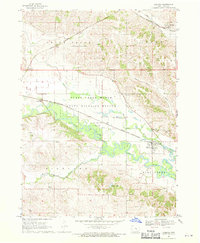 1968 Chelsea1970 Print · USGSThe Iowa River valley in the late sixties reveals a landscape of vital wetlands and intersecting rail lines near Chelsea. Genealogists and local historians can locate numerous rural burial grounds like Stayskal Cem and Rector Cem alongside the tracks of the Chicago Milwaukee St Paul and Pacific railroad.
 - 1968 Map of Hartwick, 1970 Print
 1968 Hartwick1970 Print · USGSThe rural landscape around Hartwick is shown in the late sixties, where the Iowa River meets the borders of several counties. Genealogists and local historians can trace family plots at Union Cem or Holan Cem and locate an Old Railroad Grade through the northern hills.
 - 1969 Map of Des Moines
 1969 Des Moines1969 Print · USGSCentral Iowa's fertile plains and growing capital are captured here during the late sixties, a time of major highway expansion and reservoir construction. Genealogists and researchers can trace rural township boundaries, local cemeteries, and rail lines serving towns like Pella, Grinnell, and Oskaloosa.
End of results
Showing maps 1-10 of 10
Top cities of Tama County
- Tama historical maps
- Toledo historical maps
- Traer historical maps
- Dysart historical maps
- Gladbrook historical maps
- Garwin historical maps
See more
Frequently asked questions
- What are the different types of historical maps available for Tama County?
- What is the oldest map of Tama County?
- Where can I purchase historical maps of Tama County for my home or office?
- Where can I download high-res historical maps of Tama County?
- Are there historical topographic maps available for Tama County?
- Is there historical aerial imagery available for Tama County?
- Where are historical maps of Tama County sourced from?