
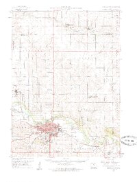
1960 Map of Marshalltown
USGS Topo · Published 1962About this map
Marshalltown serves as the industrial and transport hub of central Iowa in this early 1960s study, defined by the extensive operations of the Chicago and North Western railroad and its proximity to the Iowa River. The city's residential growth is evidenced by numerous neighborhood anchors like Franklin Sch, Anson Sch, and Woodbury Sch. Beyond the urban core, the landscape transitions into a well-organized agricultural grid dotted with small settlements such as Albion, Marietta, and Beaman. Local history is preserved in several rural burial grounds, including Oakland Cem and Vienna Cem. Economic activity outside the city is marked by a Quarry near Le Grand and various gravel pits, while aviation infrastructure is represented by the Marshalltown Municipal Airport to the north. The map effectively captures the era's mid-century civic development, from the Sewage Disposal plants to Legion Memorial Park.
Find a feature on this map
74 named features on this map. Tap any name to fly to it.
Don’t see what you’re looking for? This feature index may not catch every label — zoom into the map to look around manually.
Map Details
Editions of this 1960 Marshalltown Map
2 editions found
Other maps of this area

1954 · Waterloo
USGS Topo · 1:250,000

1954 · Des Moines
USGS Topo · 1:250,000

1955 · Waterloo
USGS Topo · 1:250,000

1956 · Des Moines
USGS Topo · 1:250,000

1957 · Des Moines
USGS Topo · 1:250,000

1960 · Marshalltown
USGS Topo · 1:24,000

1960 · Le Grand
USGS Topo · 1:24,000

1960 · Conrad West
USGS Topo · 1:24,000

1960 · Conrad East
USGS Topo · 1:24,000

1969 · Des Moines
USGS Topo · 1:250,000