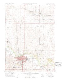
1960 Map of Marshalltown
USGS Topo · Published 1962About this map
Marshalltown serves as the industrial and transport hub of this mid-century landscape, positioned where the Chicago and North Western railway intersects with the Iowa River. The city is densely detailed with civic infrastructure, including the Armory, Marshalltown Municipal Airport, and numerous schools such as Woodbury Sch and Franklin Sch. The surrounding townships like Vienna and Taylor are characterized by a precise grid of rural schools and small settlements like Green Mountain and Conrad. Local genealogy is well-supported by several burial grounds including Riverside Cem, Vienna Cem, and the Rose Hill Memorial Gardens (Cem). Along the river, specialized sites like a Fish Hatchery and Gaging Station near Le Grand indicate the managed nature of the regional waterways and the importance of the river to the local economy.
Find a feature on this map
76 named features on this map. Tap any name to fly to it.
Don’t see what you’re looking for? This feature index may not catch every label — zoom into the map to look around manually.
Map Details
Editions of this 1960 Marshalltown Map
2 editions found
Other maps of this area

1954 · Waterloo
USGS Topo · 1:250,000

1954 · Des Moines
USGS Topo · 1:250,000

1955 · Waterloo
USGS Topo · 1:250,000

1956 · Des Moines
USGS Topo · 1:250,000

1957 · Des Moines
USGS Topo · 1:250,000

1960 · Marshalltown
USGS Topo · 1:24,000

1960 · Marshalltown
USGS Topo · 1:62,500

1960 · Le Grand
USGS Topo · 1:24,000

1960 · Conrad West
USGS Topo · 1:24,000

1960 · Conrad East
USGS Topo · 1:24,000