
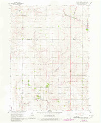
1960 Map of Conrad West
USGS Topo · Published 1966About this map
Wolf Creek and its many tributaries, including Asher Creek, Little Asher Creek, and Chicken Creek, carve a rolling agricultural landscape at the border of Grundy and Marshall counties. The settlement of Conrad serves as the primary hub in the northeast corner, where the Chicago and North Western railroad line intersects the township grid. This 1960 field check documents a rural economy defined by surveyed sections and scattered infrastructure, such as the Quarry located just south of the main town site. Further south, the Prairieville Cem sits as a quiet landmark within Taylor township. The map illustrates the transition from the open fields of Felix and Liscomb to the established corporate boundaries of small-town Iowa, reflecting a mid-century period of stable land use and local industry.
Find a feature on this map
15 named features on this map. Tap any name to fly to it.
Don’t see what you’re looking for? This feature index may not catch every label — zoom into the map to look around manually.
Map Details
Editions of this 1960 Conrad West Map
2 editions found
Other maps of this area

1954 · Waterloo
USGS Topo · 1:250,000

1955 · Waterloo
USGS Topo · 1:250,000

1960 · Marshalltown
USGS Topo · 1:24,000

1960 · Marshalltown
USGS Topo · 1:62,500

1960 · Le Grand
USGS Topo · 1:24,000

1960 · Conrad East
USGS Topo · 1:24,000

1975 · Union
USGS Topo · 1:24,000
1975 · La Moille
USGS Topo · 1:24,000

1979 · Grundy Center
USGS Topo · 1:24,000

1979 · Eldora
USGS Topo · 1:24,000