
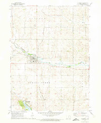
1979 Map of Grundy Center
USGS Topo · Published 1980About this map
Grundy Center serves as the focal point of this Iowa landscape, where the town's grid is anchored by the Courthouse and a prominent Hospital. The settlement is closely tied to the Chicago and North Western rail line, which skirts the northern edge of the community near the Sewage Disposal plant. A network of waterways, including Black Hawk Creek and Minnehaha Creek, meanders through the surrounding agricultural townships of Palermo, Washington, Clay, and Lincoln.
Find a feature on this map
19 named features on this map. Tap any name to fly to it.
Don’t see what you’re looking for? This feature index may not catch every label — zoom into the map to look around manually.
Map Details
Editions of this 1979 Grundy Center Map
This is the sole edition of this map. No revisions or reprints were ever made.
Other maps of this area

1954 · Waterloo
USGS Topo · 1:250,000

1955 · Waterloo
USGS Topo · 1:250,000

1960 · Marshalltown
USGS Topo · 1:62,500

1960 · Conrad West
USGS Topo · 1:24,000

1960 · Conrad East
USGS Topo · 1:24,000

1971 · Dike
USGS Topo · 1:24,000

1971 · Lincoln
USGS Topo · 1:24,000
1971 · Gladbrook
USGS Topo · 1:24,000

1979 · Holland
USGS Topo · 1:24,000

1980 · Wellsburg
USGS Topo · 1:24,000