
1979 Map of Holland
USGS Topo · Published 1980About this map
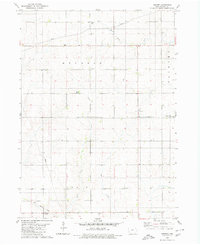
The town of Holland serves as the central hub of this Grundy County landscape, situated at a junction of rail and road infrastructure in the late 1970s. The Chicago Rock Island and Pacific railroad bisects the terrain, connecting the local economy to broader markets, while the surrounding townships of Colfax and Pleasant Valley maintain a strong agrarian character. This survey captures the social fabric of the rural community, specifically through its ecclesiastical landmarks like Colfax Center Ch and Pleasant Valley Ch. To the north, the small settlement of Fern sits near a locally significant Roadside Park, while the southern portion of the sheet is defined by the winding course of Black Hawk Creek. Other hydrological features including Beaver Creek and the Middle Fork and South Fork of the local river system provide a clear picture of the region's natural drainage before modern developments altered these drainage patterns.
Find a feature on this map
20 named features on this map. Tap any name to fly to it.
Don’t see what you’re looking for? This feature index may not catch every label — zoom into the map to look around manually.
Map Details
Editions of this 1979 Holland Map
This is the sole edition of this map. No revisions or reprints were ever made.
Other maps of this area

1954 · Waterloo
USGS Topo · 1:250,000

1955 · Waterloo
USGS Topo · 1:250,000

1971 · Dike
USGS Topo · 1:24,000

1971 · Lincoln
USGS Topo · 1:24,000

1971 · Stout
USGS Topo · 1:24,000

1979 · Grundy Center
USGS Topo · 1:24,000

1980 · Aplington
USGS Topo · 1:24,000

1980 · Wellsburg
USGS Topo · 1:24,000
1980 · Ivester
USGS Topo · 1:24,000
1980 · Parkersburg
USGS Topo · 1:24,000