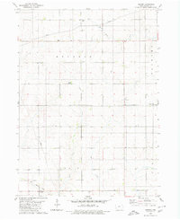
1980 Map of Ivester
USGS Topo · Published 1980About this map
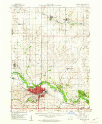
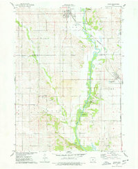
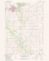
Ivester stands as a focal point in this portion of Grundy County, surrounded by a productive landscape of well-defined townships including Melrose, Palermo, Felix, and Clay. The terrain is etched by the meandering paths of Black Hawk Creek, Wolf Creek, and Dowd Creek, which dictate the drainage patterns across these agricultural sections.
Find a feature on this map
18 named features on this map. Tap any name to fly to it.
Don’t see what you’re looking for? This feature index may not catch every label — zoom into the map to look around manually.
Map Details
Editions of this 1980 Ivester Map
This is the sole edition of this map. No revisions or reprints were ever made.
Other maps of this area

1954 · Waterloo
USGS Topo · 1:250,000

1955 · Waterloo
USGS Topo · 1:250,000
1960 · Marshalltown
USGS Topo · 1:62,500
1960 · Conrad West
USGS Topo · 1:24,000
1960 · Conrad East
USGS Topo · 1:24,000
1975 · Union
USGS Topo · 1:24,000
1979 · Grundy Center
USGS Topo · 1:24,000
1979 · Holland
USGS Topo · 1:24,000
1979 · Steamboat Rock
USGS Topo · 1:24,000
1979 · Eldora
USGS Topo · 1:24,000