
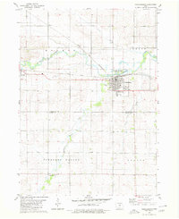
1980 Map of Aplington
USGS Topo · Published 1980About this map
The Illinois Central Gulf railroad serves as the primary industrial axis for this agricultural landscape, connecting the elevators and street grids of Aplington and Austinville. Situated along the boundary of Butler Co Grundy Co, the terrain is defined by the winding course of Beaver Creek and its various tributaries, including the North Fork and South Fork Beaver Creek. The map documents a well-established rural social structure, evidenced by several country churches and schools that anchored these farming communities.
Find a feature on this map
25 named features on this map. Tap any name to fly to it.
Don’t see what you’re looking for? This feature index may not catch every label — zoom into the map to look around manually.
Map Details
Editions of this 1980 Aplington Map
This is the sole edition of this map. No revisions or reprints were ever made.
Other maps of this area

1954 · Waterloo
USGS Topo · 1:250,000

1955 · Waterloo
USGS Topo · 1:250,000

1979 · Holland
USGS Topo · 1:24,000

1979 · Ackley NE
USGS Topo · 1:24,000

1979 · Ackley
USGS Topo · 1:24,000

1979 · Steamboat Rock
USGS Topo · 1:24,000

1979 · Dumont South
USGS Topo · 1:24,000

1979 · Butler Center
USGS Topo · 1:24,000

1980 · Wellsburg
USGS Topo · 1:24,000
1980 · Parkersburg
USGS Topo · 1:24,000