
1979 Map of Butler Center
USGS Topo · Published 1980About this map
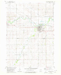
Butler Center and Allison anchor this landscape during the late 1970s, illustrating the agricultural and water-management patterns of Butler County. The West Fork Cedar River winds through the central portion of the map, feeding into the expansive Big Marsh State Wildlife Area. This wetland feature includes multiple water-control structures such as a floodgate, indicating a managed ecological environment. The transition from the rural village of Butler Center to the more developed edge of Allison is visible through the placement of civic infrastructure, including the northern Fairground and local sewage disposal ponds. For genealogists, the map provides precise locations for several burial grounds, including Allison Cem, Butler Center Cem, and Monroe Cem. The transportation network is defined by the C & N W railroad line and a system of creeks like Kilson Creek and Johnson Creek that drain the surrounding townships.
Find a feature on this map
23 named features on this map. Tap any name to fly to it.
Don’t see what you’re looking for? This feature index may not catch every label — zoom into the map to look around manually.
Map Details
Editions of this 1979 Butler Center Map
This is the sole edition of this map. No revisions or reprints were ever made.
Other maps of this area

1954 · Waterloo
USGS Topo · 1:250,000

1955 · Waterloo
USGS Topo · 1:250,000

1971 · Coster
USGS Topo · 1:24,000

1971 · Clarksville
USGS Topo · 1:24,000

1971 · Stout
USGS Topo · 1:24,000

1972 · Dumont North
USGS Topo · 1:24,000

1972 · Allison
USGS Topo · 1:24,000

1979 · Dumont South
USGS Topo · 1:24,000

1980 · Aplington
USGS Topo · 1:24,000
1980 · Parkersburg
USGS Topo · 1:24,000