
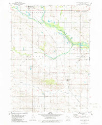
1979 Map of Dumont South
USGS Topo · Published 1980About this map
The Chicago and North Western railroad cuts a diagonal path through this rural landscape, connecting the town of Dumont in the northwest to Kesley in the southeast. This corridor follows the gentle topography defined by the West Fork Cedar River and its numerous tributaries, including Hartgrave Creek and Maynes Creek. The mapping of townships like Pittsford, Madison, and Ripley reveals a well-established grid of section lines and secondary roads punctuated by community landmarks.
Find a feature on this map
26 named features on this map. Tap any name to fly to it.
Don’t see what you’re looking for? This feature index may not catch every label — zoom into the map to look around manually.
Map Details
Editions of this 1979 Dumont South Map
2 editions found
Other maps of this area

1954 · Waterloo
USGS Topo · 1:250,000

1955 · Waterloo
USGS Topo · 1:250,000

1972 · Dumont North
USGS Topo · 1:24,000

1972 · Hansell
USGS Topo · 1:24,000

1972 · Allison
USGS Topo · 1:24,000

1979 · Ackley NE
USGS Topo · 1:24,000

1979 · Ackley
USGS Topo · 1:24,000

1979 · Butler Center
USGS Topo · 1:24,000

1980 · Aplington
USGS Topo · 1:24,000
1980 · Parkersburg
USGS Topo · 1:24,000