Old Maps of Taylor County, Iowa
Explore 130 old maps of Taylor County, spanning from 1940 to today. These high-resolution historic maps reveal how streets, neighborhoods, landmarks, and natural features evolved over time — perfect for genealogy, metal detecting, research, and local history exploration.
What you can do with these maps:
- See how Taylor County changed over time: Compare historical maps to modern-day views to trace roads, homesites, rail lines & more.
- View detailed metadata: Each map includes creators, publishers, year, scale, and archive source.
- Overlay maps with satellite & LiDAR: Visualize the past alongside modern tools to explore terrain & human change.
- Trusted historical sources: Maps sourced from the USGS, Library of Congress, and other archives.
- Access maps your way: View online, download high-res files, or order prints for personal or research use.
Start exploring old maps of Taylor County to uncover forgotten places, hidden landmarks, and the deep history beneath your feet.
Taylor County, IA maps
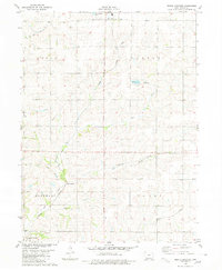
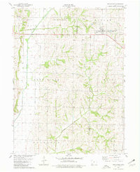
(130)- 1940 Map of Blockton, 1954 Print
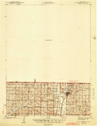
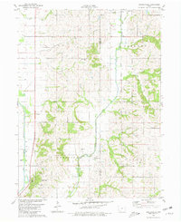
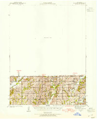 1940 Blockton1954 Print · USGSLife along the Iowa and Missouri border in the early 1940s was centered on small rural school districts and family farms. Researchers can trace the exact locations of vanished community hubs like Irena, Jackson Ch, and Victory Sch before the consolidation of rural landmarks.2 unique versions available
 - 1940 Map of Bedford, 1954 Print
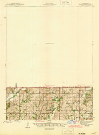
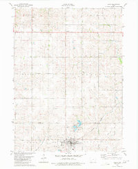
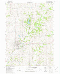
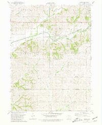
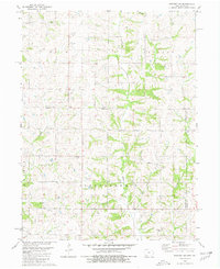
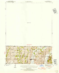 1940 Bedford1954 Print · USGSThe Iowa-Missouri borderlands come alive in this mid-century survey of Taylor, Worth, and Nodaway counties. Researchers can trace the Chicago Great Western rail line and locate vanished rural hubs like Luteston Sch and Isadora.2 unique versions available
 - 1940 Map of New Market, 1954 Print
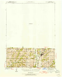 1940 New Market1954 Print · USGSThe borderlands of Iowa and Missouri come into focus during the early 1940s, centered on the rail-and-river hub of Hopkins. Genealogists can trace a wealth of rural landmarks including Burch Cem, Prairie Star Sch, and Good Hope Ch.
 - 1943 Map of Bedford
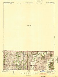 1943 Bedford1943 Print · USGSThe borderlands of Iowa and Missouri are captured here in the early 1940s, showing a landscape defined by small-town life and the railroad. Genealogists can trace family footprints through numerous rural landmarks like New Hope Cem, Star of the West Ch, and the Platte Dell Sch.2 unique versions available
 - 1943 Map of New Market
 1943 New Market1943 Print · USGSThe Iowa-Missouri border was a landscape of river-valley agriculture and scattered rural schoolhouses in the early 1940s. Genealogists can trace family footprints through sites like Washburn Cem or schools such as Independence Sch and Hazel Dell Sch.2 unique versions available
 - 1943 Map of Blockton
 1943 Blockton1943 Print · USGSThe Iowa-Missouri borderlands are captured here in the early 1940s, showing a landscape of small townships and rural school districts. Genealogists can locate specific local landmarks such as Lone Star Sch, Irena, and the Middle Fork Lotts Creek.3 unique versions available
 - 1955 Map of Nebraska City, 1967 Print
 1955 Nebraska City1967 Print · USGSThe four-state region surrounding the Missouri River valley appears here in the mid-1950s, a landscape of rail-dependent market towns and rural school districts. Genealogists can locate family landmarks like the Rock Bluff School, St Oswald Church, and the Clarinda State Hospital.3 unique versions available
 - 1957 Map of Nebraska City
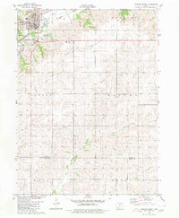
 1957 Nebraska City1957 Print · USGSThe four-state junction of Nebraska, Iowa, Missouri, and Kansas comes alive in this mid-fifties survey of the Missouri River valley. Genealogists and historians can trace the rail-and-road networks connecting Nebraska City, Maryville, and the Squaw Creek National Wildlife Refuge.
 - 1958 Map of Nebraska City
 1958 Nebraska City1958 Print · USGSThe Missouri River Valley and its fertile four-state borderlands are captured here during the mid-century expansion of the regional highway and rail networks. Genealogists can trace family roots through numerous rural landmarks like Moulton School, Shady Grove Church, and the Clarinda State Hospital.
 - 1980 Map of Corning South
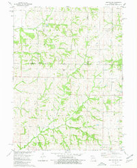
 1980 Corning South1980 Print · USGSThe hill country south of Corning is captured here in the late seventies, showing a landscape defined by the Burlington Northern line and the East Nodaway River. Genealogists can locate Walnut Grove Cemetery and Oak Hill Cem, or trace the One Hundred and Two River through the southern townships.
 - 1980 Map of Gravity
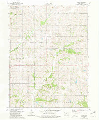
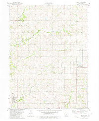 1980 Gravity1980 Print · USGSTaylor County farmland is captured here in the late 1970s, organized around the many branches of the One Hundred and Two River. Genealogists and local historians can locate Washington Cem, the Old Railroad Grade, and small centers like Gravity and Bushville.
 - 1980 Map of Merle Junction
 1980 Merle Junction1980 Print · USGSTaylor County farmland in the late seventies is centered on the rail crossroads at Merle Junction. Family researchers and local historians can trace the paths of the Mid Fork One Hundred and Two River, locate the Conway Cem, and see the footprint of Wilson County Park.
 - 1980 Map of Hopkins SW
 1980 Hopkins SW1980 Print · USGSThe Missouri-Iowa border comes into focus in the late 1970s, showing a rural landscape defined by township lines and family heritage. Genealogists and historians can trace local roots through numerous burial sites like Burch Cem, Siam Cem, and Hazel Dell Cem.
 - 1980 Map of Lenox
 1980 Lenox1980 Print · USGSTaylor and Adams counties are shown here as they appeared in the late seventies, centered on the rail-fed town of Lenox. Researchers can find family roots at the trio of North Fairview, East Fairview, and West Fairview cemeteries, or trace the legacy of Stringtown and Salem Ch.
 - 1980 Map of Guss, 1981 Print
 1980 Guss1981 Print · USGSTaylor County farmland in the early eighties is meticulously detailed here, showing the rural townships of Nodaway and Dallas. Family researchers can locate historic burial sites like Guss Cem and Holt Cem or trace the winding One Hundred and Two River.
 - 1980 Map of Bedford, 1981 Print
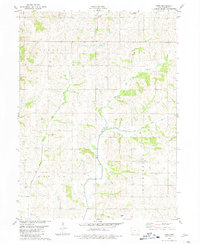
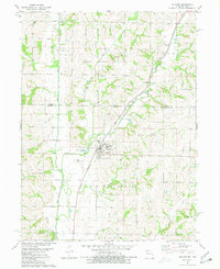
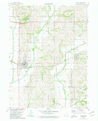
 1980 Bedford1981 Print · USGSBedford and the surrounding Taylor County countryside are captured here in the early eighties, showcasing a landscape of small-town industry and rural recreation. Researchers can trace family history through sites like Lexington Cem or follow the Burlington Northern line past the Lake of Three Fires.
 - 1980 Map of Conway, 1981 Print
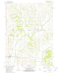
 1980 Conway1981 Print · USGSTaylor County farmland in the late seventies is captured here, showing the rural structure of townships from Marshall to Jefferson. Genealogists can locate family farmsteads and burial sites like Platteville Cem near the settlements of Conway and Platteville.
 - 1980 Map of Hopkins, 1981 Print
 1980 Hopkins1981 Print · USGSNodaway County and the Missouri-Iowa border are captured in the early eighties as rural life centered on the town of Hopkins. Genealogists can locate family landmarks like Washburn Cem and Willard Cem or trace the Burlington Northern rail line.
 - 1980 Map of Sheridan, 1981 Print
 1980 Sheridan1981 Print · USGSThe Missouri-Iowa borderlands are captured here in the late seventies, showing the rural landscape around Sheridan and Isadora. Researchers can trace the Chicago and North Western rail corridor and locate family sites at Sheridan Cem or Athelstan Cem.
 - 1980 Map of Hawleyville, 1981 Print
 1980 Hawleyville1981 Print · USGSPage and Taylor counties are captured in the early eighties as the Nodaway River forks converge near established rural townships. Genealogists can trace family sites at Hawleyville Cem or Valley Cem, while outdoor historians can locate the original Campground at Nodaway Valley County Park.
 - 1980 Map of Brooks, 1981 Print
 1980 Brooks1981 Print · USGSSouthwestern Iowa in the early eighties remains a landscape defined by its river valleys and rail lines. Genealogists can locate family landmarks like Methodist Grove Cem, the settlement of Brooks, and the headwaters of the uniquely named One Hundred and Two River.
 - 1980 Map of Villisca, 1981 Print
 1980 Villisca1981 Print · USGSVillisca and the surrounding Iowa farmland are captured here in the early eighties, showcasing a landscape defined by the three branches of the Nodaway River. Genealogists can locate several local burial sites including Nodaway Cem and Findley Cem, while following the path of the Burlington Northern rail line.
 - 1980 Map of Ladoga, 1981 Print
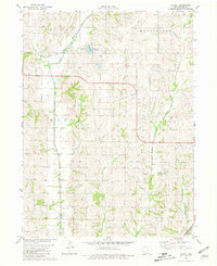 1980 Ladoga1981 Print · USGSTaylor County in the early eighties is captured here as a network of river forks and rural townships. Researchers can trace family history at Graceland Cem or follow the legacy of local transport along the Old Railroad Grade and the One Hundred and Two River.
 - 1980 Map of New Market, 1981 Print
 1980 New Market1981 Print · USGSTaylor and Page counties come together at the town of New Market during the late 1970s. Genealogists can trace family footprints at Memory Cem or Vase Cem and locate the small community of Siam near the southern border.
 - 1980 Map of Bedford SW, 1981 Print
 1980 Bedford SW1981 Print · USGSThis rural borderland between Iowa and Missouri was mapped in the late 1970s, showing a landscape of traditional farmsteads and township boundaries. Genealogists can locate several remote burial sites and community centers, including Berea Ch, New Hope Cem, and Brethren Cem.
Showing maps 1-25 of 130
Top cities of Taylor County
- Bedford historical maps
- Lenox historical maps
- New Market historical maps
- Clearfield historical maps
- Gravity historical maps
- Blockton historical maps
See more
Frequently asked questions
- What are the different types of historical maps available for Taylor County?
- What is the oldest map of Taylor County?
- Where can I purchase historical maps of Taylor County for my home or office?
- Where can I download high-res historical maps of Taylor County?
- Are there historical topographic maps available for Taylor County?
- Is there historical aerial imagery available for Taylor County?
- Where are historical maps of Taylor County sourced from?