2020s Maps of Taylor County, Iowa
Explore 20 historic maps of Taylor County from the 2020s. These maps offer a rare glimpse into what life looked like during the 2020s — showing old roads, neighborhoods, homes, and landmarks that have changed or disappeared over time.
Whether you're researching your family's past, planning a metal detecting trip, or studying how Taylor County's landscape evolved across the 2020s, these high-resolution maps are a powerful tool for exploring the history of this region.
- Focus on a specific era: All maps on this page are from the 2020s, giving you a focused view of this time period.
- See what’s changed: Compare century-old streets, trails, and buildings to today's modern landscape using overlays and satellite layers.
- Research with precision: Use these maps for genealogy, historical research, land use analysis, or educational projects.
- View, download, or print: Maps are fully viewable online in high resolution, and can be downloaded or printed for your own records.
Start exploring Taylor County's history through authentic maps from the 2020s. This is your window into the past.
Taylor County, IA maps
(20)- 2021 Map of Hopkins, 2021 Print
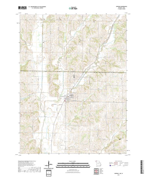 2021 Hopkins2021 Print · USGSThe northern edge of Nodaway County at the turn of the 2020s is defined by the three forks of the One Hundred and Two River converging near the town of Hopkins. Researchers can trace rural cemetery sites such as Williams Cem and Washburn Cem or locate the distinctive local rise of The Mound.
 - 2021 Map of Sheridan, 2021 Print
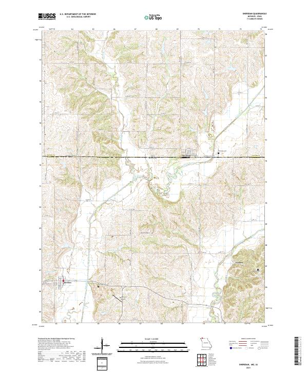 2021 Sheridan2021 Print · USGSThe Missouri-Iowa border comes into focus in this recent study of Worth County and Taylor County. Researchers can trace family roots at Sheridan Cem and Isadora Cem, or locate the specific grid of Athelstan near the Platte River.
 - 2021 Map of Hopkins SW, 2021 Print
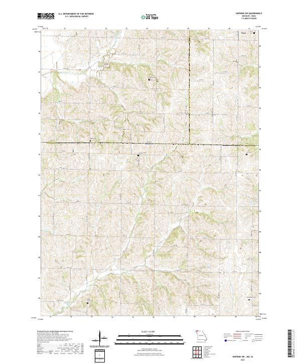 2021 Hopkins SW2021 Print · USGSThe Iowa-Missouri borderlands come into focus in this recent survey of the rural landscape where Page, Taylor, and Nodaway counties meet. Genealogists can locate several family burial sites including Siam Cemetery, Johnson Cemetery, and Morehouse Cemetery.
 - 2021 Map of Bedford SW, 2021 Print
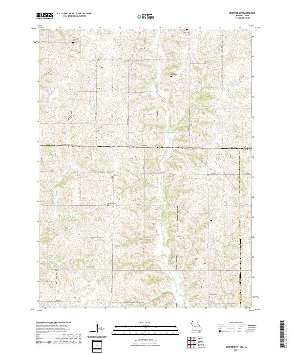 2021 Bedford SW2021 Print · USGSThe borderlands of Nodaway County and Taylor County are captured here in the early twenty-first century as a landscape of grid roads and family burial grounds. Researchers can locate several rural cemeteries including Brethren Cem, New Hope Cem, and Ross Township Cem.
 - 2022 Map of Clearfield, 2022 Print
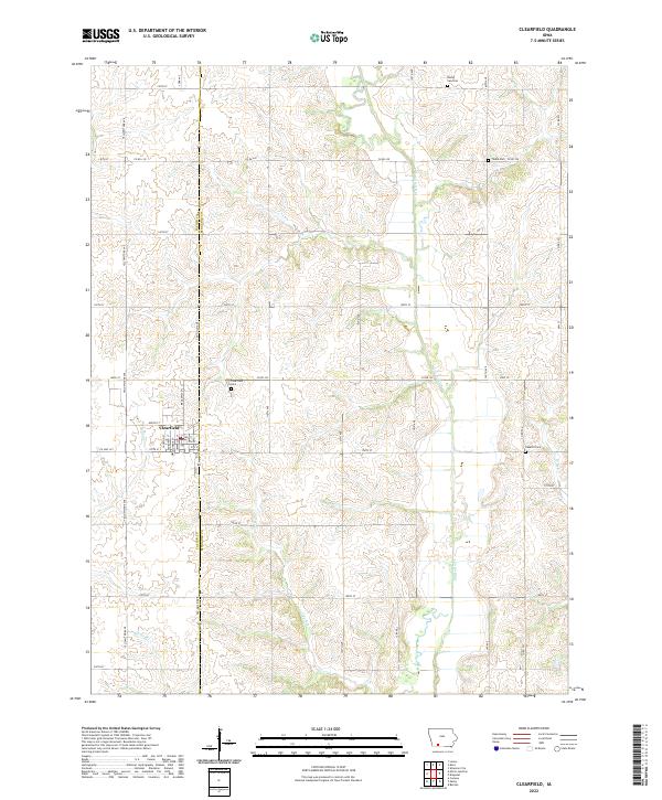 2022 Clearfield2022 Print · USGSClearfield and the surrounding farm country are mapped here at the Taylor and Ringgold county line in recent years. Researchers can pinpoint early family burial sites like Tindie Cem and Rising Sun Cem or trace the path of the Platte River.
 - 2022 Map of Brooks, 2022 Print
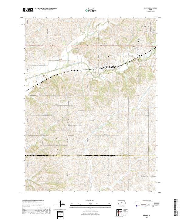 2022 Brooks2022 Print · USGSThe Adams and Taylor County line comes into focus in this recent survey of southwest Iowa. Genealogists can trace family heritage at Old Brooks Cem and Baldwin Cem while following the path of the East Nodaway River.
 - 2022 Map of Guss, 2022 Print
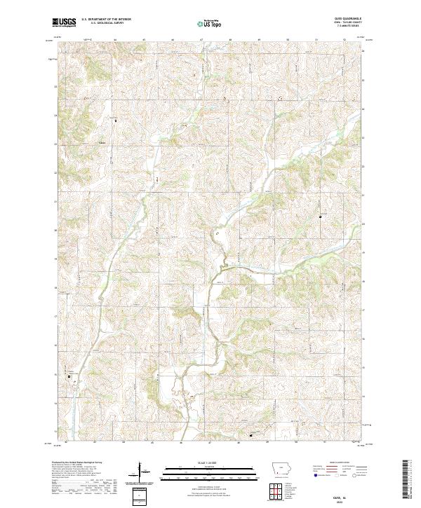 2022 Guss2022 Print · USGSTaylor County agriculture remains the heart of this region in the 2020s, centered on the settlement of Guss. Genealogists and local historians can trace family ties at the Dallas Center Cem, Ladoga Cem, and several river forks that have defined these farmsteads for generations.
 - 2022 Map of Blockton, 2022 Print
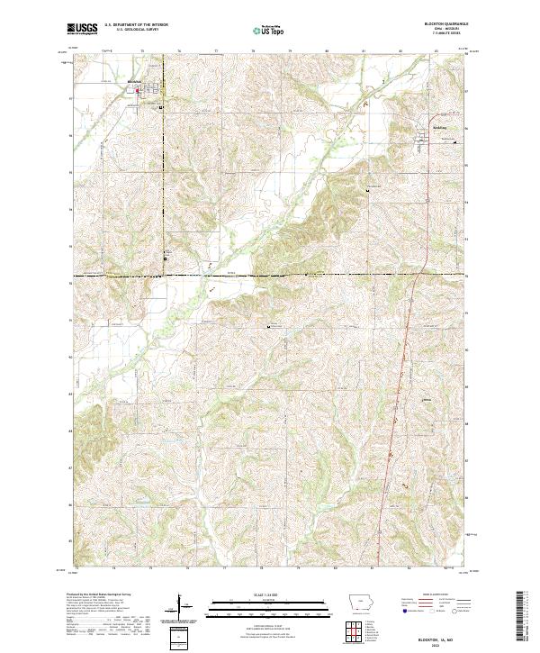 2022 Blockton2022 Print · USGSThe Iowa-Missouri borderlands near Blockton and Redding are shown in detail during the early 2020s. Genealogists and local historians can trace rural roots across five distinct burial sites, including Fairview Cem and Honey Grove Cem, along the Grand River.
 - 2022 Map of Corning South, 2022 Print
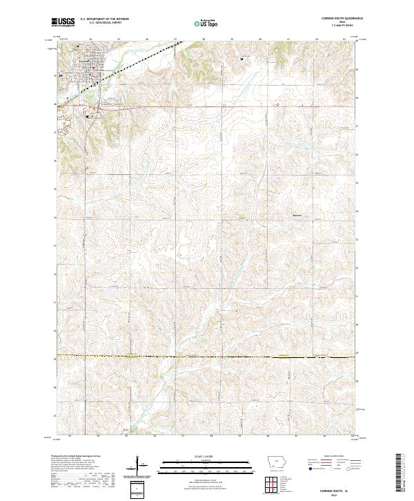 2022 Corning South2022 Print · USGSSouth of the Adams County seat in the early twenty-first century, this landscape shows the intersection of Iowa's river valleys and rural homesteads. Genealogists can locate family landmarks at the Icarian Cem, Calvary Cem, or trace the heritage of Corning.
 - 2022 Map of Kent, 2022 Print
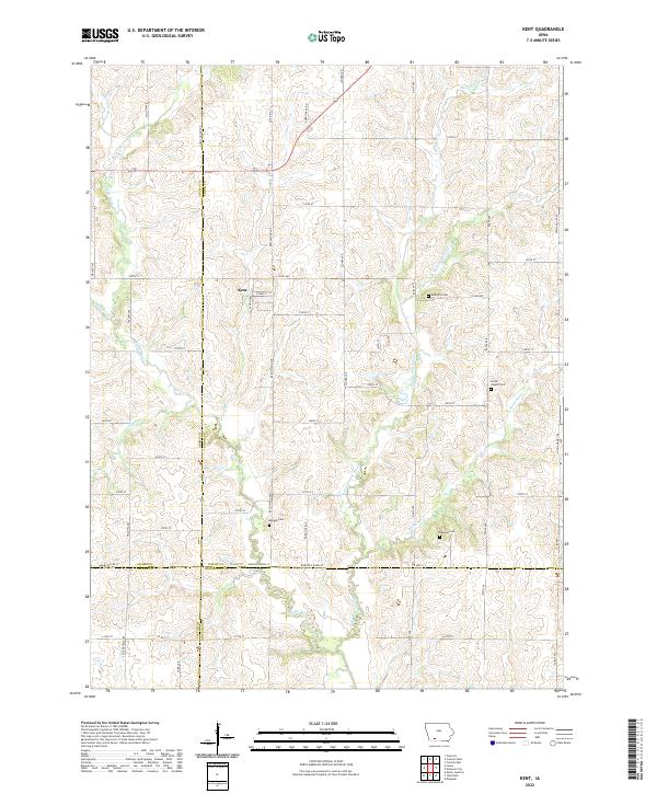 2022 Kent2022 Print · USGSThe rural town of Kent is documented here in the early twenty-first century, surrounded by the headwaters of the Platte River system. Family historians can locate several local burial sites, including McDuffie Cem, Morgan Cem, and the Grove Chapel Cem.
 - 2022 Map of Ladoga, 2022 Print
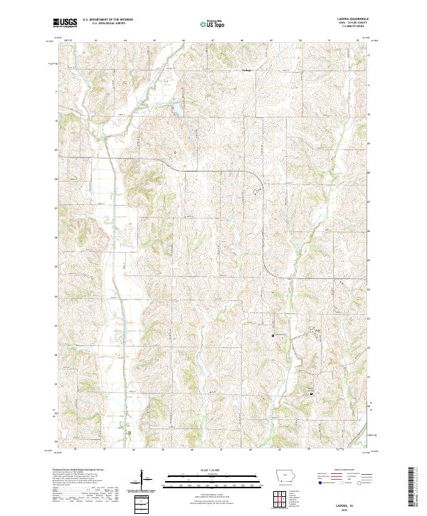 2022 Ladoga2022 Print · USGSTaylor County farmland is captured here in the early twenty-first century, defined by the winding forks of the One Hundred and Two River. Genealogists can locate rural landmarks like Graceland Cem, Ferrell-Ross Cem, and the small settlement of Ladoga.
 - 2022 Map of Bedford, 2022 Print
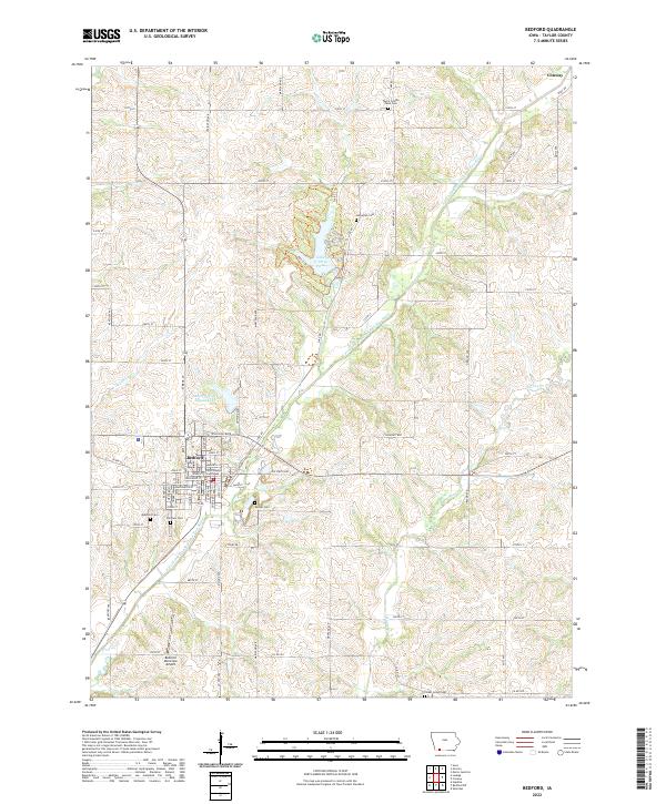 2022 Bedford2022 Print · USGSBedford serves as a focal point for Taylor County in the early twenty-first century, anchored by its traditional town square and water supply lakes. Genealogists and local historians can trace family locations through numerous sites like Lexington Cem, Mohler Cem, and the Bedford town center.
 - 2022 Map of Hawleyville, 2022 Print
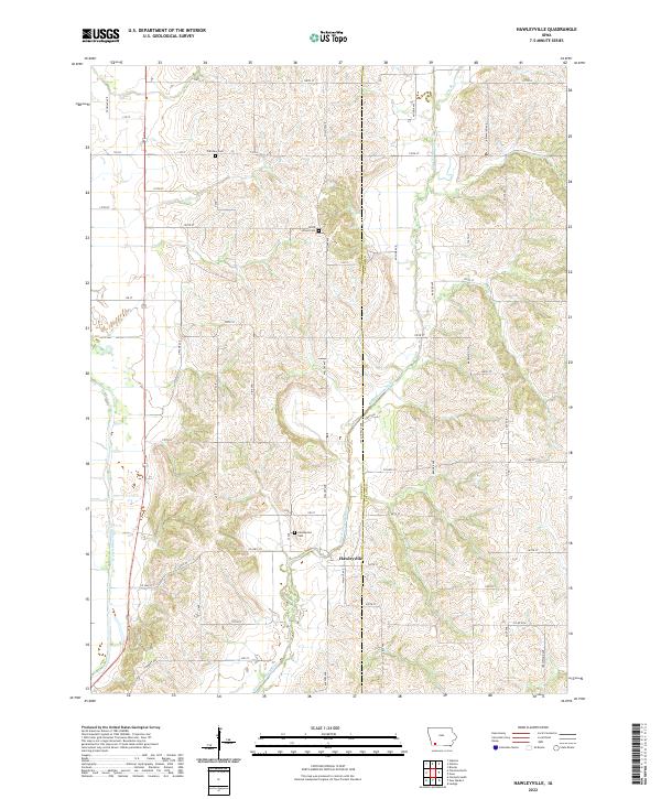 2022 Hawleyville2022 Print · USGSThe rolling river valleys of southwest Iowa are captured here in the early twenty-first century. Researchers can trace the heritage of Hawleyville and locate the nearby Hawleyville Cem, North Grove Cem, and Fairview Cem.
 - 2022 Map of Merle Junction, 2022 Print
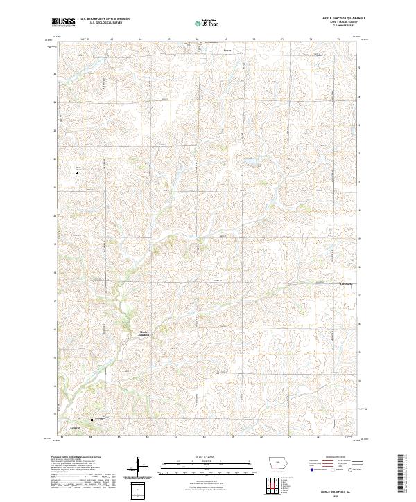 2022 Merle Junction2022 Print · USGSTaylor County, Iowa, is shown in the early 2020s as a landscape of grid-patterned township roads and branching river headwaters. Family historians can locate rural landmarks like Winslow Cem or trace the drainage of the E Fork One Hundred and Two River past Merle Junction.
 - 2022 Map of Gravity, 2022 Print
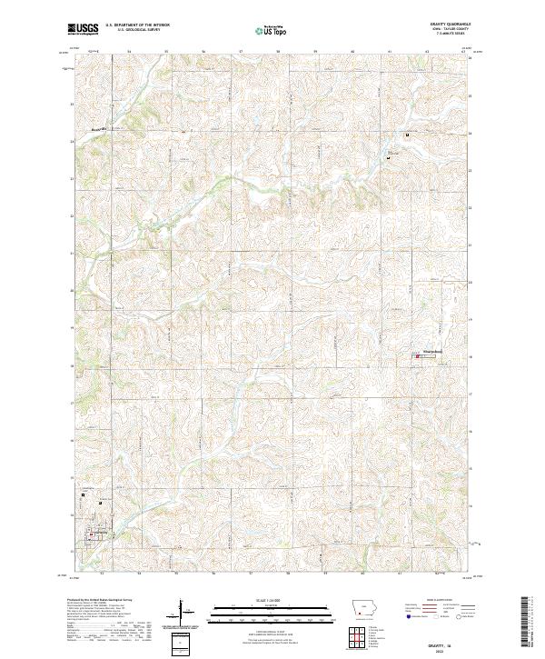 2022 Gravity2022 Print · USGSSouthern Iowa's rural Taylor County is mapped here in the early twenty-first century, showing the established farm sections and river forks. Genealogists can locate family sites at Blue Grove Cem, Gravity Cem, and the small community of Sharpsburg.
 - 2022 Map of Lenox, 2022 Print
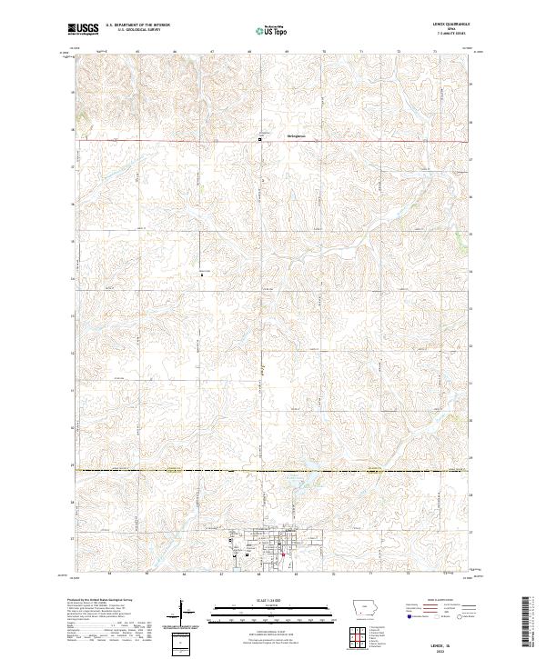 2022 Lenox2022 Print · USGSThis part of Taylor and Adams Counties is documented in the 2020s, centered on the well-defined town of Lenox and the surrounding rural townships. Genealogists and local historians can locate several family burial grounds, including Salem Cem and West Fairview Cem, alongside the small settlement of Stringtown.
 - 2022 Map of Maloy, 2022 Print
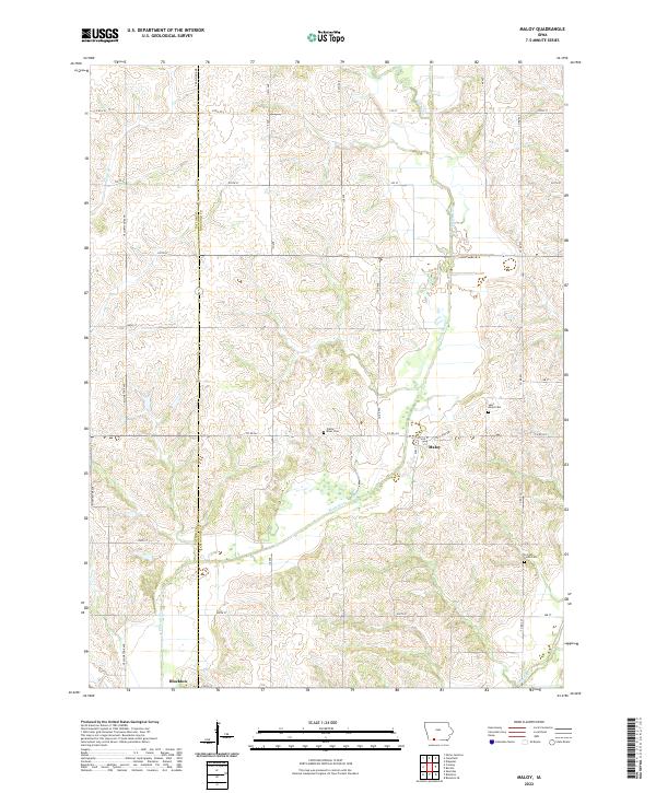 2022 Maloy2022 Print · USGSThe rural borderlands of Taylor and Ringgold counties come into focus in this contemporary Iowa survey. Genealogists can locate family burial plots at Saint Marys Cemetery or Forrest Home Cemetery and trace the paths of the Platte River and Grand River.
 - 2022 Map of Villisca, 2022 Print
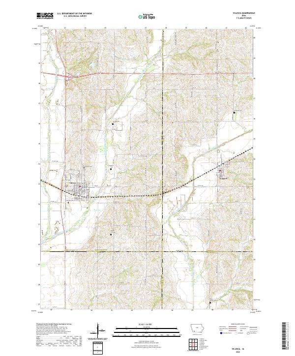 2022 Villisca2022 Print · USGSIn the southwestern Iowa countryside, the towns of Villisca and Nodaway anchor a landscape shaped by three branches of the Nodaway River. Researchers can trace ancestral roots through several distinct burial grounds, including Villisca Cem, Findley Cem, and the Pierce Family Cem.
 - 2022 Map of New Market, 2022 Print
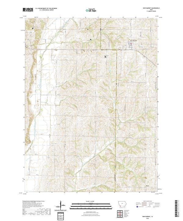 2022 New Market2022 Print · USGSTaylor and Page Counties are documented here in recent years as the agricultural landscape maintains its traditional settlement patterns. Researchers can trace family roots at several local burial grounds, including Aron View Cem and Memory Cem, or locate the rural communities of New Market and Siam.
 - 2022 Map of Conway, 2022 Print
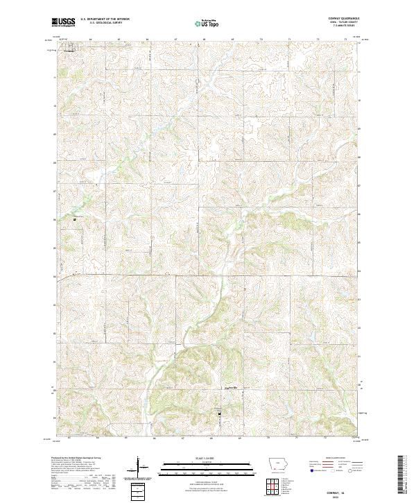 2022 Conway2022 Print · USGSTaylor County agriculture and rural settlement are preserved here in the early twenty-first century. Genealogists and local historians can trace family roots through the grids of Conway and Platteville, or locate historic burials at Bowers Cem and Platteville Cem.
End of results
Showing maps 1-20 of 20
Top cities of Taylor County
- Bedford historical maps
- Lenox historical maps
- New Market historical maps
- Clearfield historical maps
- Gravity historical maps
- Blockton historical maps
See more
Frequently asked questions
- What are the different types of historical maps available for Taylor County?
- What is the oldest map of Taylor County?
- Where can I purchase historical maps of Taylor County for my home or office?
- Where can I download high-res historical maps of Taylor County?
- Are there historical topographic maps available for Taylor County?
- Is there historical aerial imagery available for Taylor County?
- Where are historical maps of Taylor County sourced from?