1940s Maps of Taylor County, Iowa
Explore 6 historic maps of Taylor County from the 1940s. These maps offer a rare glimpse into what life looked like during the 1940s — showing old roads, neighborhoods, homes, and landmarks that have changed or disappeared over time.
Whether you're researching your family's past, planning a metal detecting trip, or studying how Taylor County's landscape evolved across the 1940s, these high-resolution maps are a powerful tool for exploring the history of this region.
- Focus on a specific era: All maps on this page are from the 1940s, giving you a focused view of this time period.
- See what’s changed: Compare century-old streets, trails, and buildings to today's modern landscape using overlays and satellite layers.
- Research with precision: Use these maps for genealogy, historical research, land use analysis, or educational projects.
- View, download, or print: Maps are fully viewable online in high resolution, and can be downloaded or printed for your own records.
Start exploring Taylor County's history through authentic maps from the 1940s. This is your window into the past.
Taylor County, IA maps
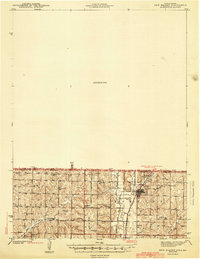
(6)- 1940 Map of Blockton, 1954 Print
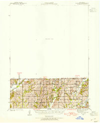 1940 Blockton1954 Print · USGSLife along the Iowa and Missouri border in the early 1940s was centered on small rural school districts and family farms. Researchers can trace the exact locations of vanished community hubs like Irena, Jackson Ch, and Victory Sch before the consolidation of rural landmarks.2 unique versions available
 - 1940 Map of Bedford, 1954 Print
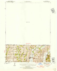 1940 Bedford1954 Print · USGSThe Iowa-Missouri borderlands come alive in this mid-century survey of Taylor, Worth, and Nodaway counties. Researchers can trace the Chicago Great Western rail line and locate vanished rural hubs like Luteston Sch and Isadora.2 unique versions available
 - 1940 Map of New Market, 1954 Print
 1940 New Market1954 Print · USGSThe borderlands of Iowa and Missouri come into focus during the early 1940s, centered on the rail-and-river hub of Hopkins. Genealogists can trace a wealth of rural landmarks including Burch Cem, Prairie Star Sch, and Good Hope Ch.
 - 1943 Map of Bedford
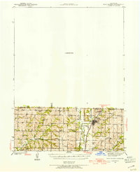
 1943 Bedford1943 Print · USGSThe borderlands of Iowa and Missouri are captured here in the early 1940s, showing a landscape defined by small-town life and the railroad. Genealogists can trace family footprints through numerous rural landmarks like New Hope Cem, Star of the West Ch, and the Platte Dell Sch.2 unique versions available
 - 1943 Map of New Market
 1943 New Market1943 Print · USGSThe Iowa-Missouri border was a landscape of river-valley agriculture and scattered rural schoolhouses in the early 1940s. Genealogists can trace family footprints through sites like Washburn Cem or schools such as Independence Sch and Hazel Dell Sch.2 unique versions available
 - 1943 Map of Blockton
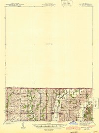
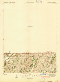 1943 Blockton1943 Print · USGSThe Iowa-Missouri borderlands are captured here in the early 1940s, showing a landscape of small townships and rural school districts. Genealogists can locate specific local landmarks such as Lone Star Sch, Irena, and the Middle Fork Lotts Creek.3 unique versions available
End of results
Showing maps 1-6 of 6
Top cities of Taylor County
- Bedford historical maps
- Lenox historical maps
- New Market historical maps
- Clearfield historical maps
- Gravity historical maps
- Blockton historical maps
See more
Frequently asked questions
- What are the different types of historical maps available for Taylor County?
- What is the oldest map of Taylor County?
- Where can I purchase historical maps of Taylor County for my home or office?
- Where can I download high-res historical maps of Taylor County?
- Are there historical topographic maps available for Taylor County?
- Is there historical aerial imagery available for Taylor County?
- Where are historical maps of Taylor County sourced from?