1980s Maps of Taylor County, Iowa
Explore 21 historic maps of Taylor County from the 1980s. These maps offer a rare glimpse into what life looked like during the 1980s — showing old roads, neighborhoods, homes, and landmarks that have changed or disappeared over time.
Whether you're researching your family's past, planning a metal detecting trip, or studying how Taylor County's landscape evolved across the 1980s, these high-resolution maps are a powerful tool for exploring the history of this region.
- Focus on a specific era: All maps on this page are from the 1980s, giving you a focused view of this time period.
- See what’s changed: Compare century-old streets, trails, and buildings to today's modern landscape using overlays and satellite layers.
- Research with precision: Use these maps for genealogy, historical research, land use analysis, or educational projects.
- View, download, or print: Maps are fully viewable online in high resolution, and can be downloaded or printed for your own records.
Start exploring Taylor County's history through authentic maps from the 1980s. This is your window into the past.
Taylor County, IA maps
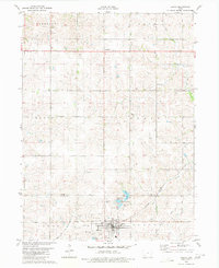
(21)- 1980 Map of Corning South
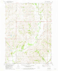
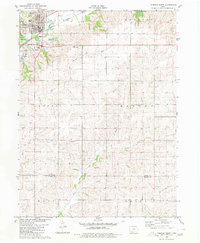 1980 Corning South1980 Print · USGSThe hill country south of Corning is captured here in the late seventies, showing a landscape defined by the Burlington Northern line and the East Nodaway River. Genealogists can locate Walnut Grove Cemetery and Oak Hill Cem, or trace the One Hundred and Two River through the southern townships.
 - 1980 Map of Gravity
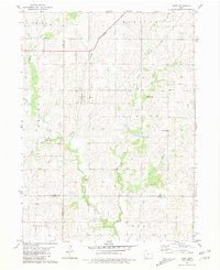
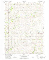 1980 Gravity1980 Print · USGSTaylor County farmland is captured here in the late 1970s, organized around the many branches of the One Hundred and Two River. Genealogists and local historians can locate Washington Cem, the Old Railroad Grade, and small centers like Gravity and Bushville.
 - 1980 Map of Merle Junction
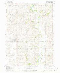
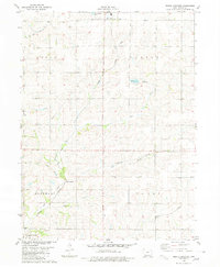 1980 Merle Junction1980 Print · USGSTaylor County farmland in the late seventies is centered on the rail crossroads at Merle Junction. Family researchers and local historians can trace the paths of the Mid Fork One Hundred and Two River, locate the Conway Cem, and see the footprint of Wilson County Park.
 - 1980 Map of Hopkins SW
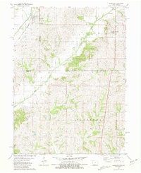
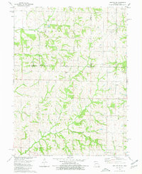 1980 Hopkins SW1980 Print · USGSThe Missouri-Iowa border comes into focus in the late 1970s, showing a rural landscape defined by township lines and family heritage. Genealogists and historians can trace local roots through numerous burial sites like Burch Cem, Siam Cem, and Hazel Dell Cem.
 - 1980 Map of Lenox
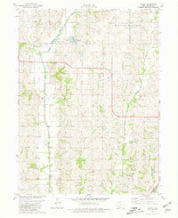
 1980 Lenox1980 Print · USGSTaylor and Adams counties are shown here as they appeared in the late seventies, centered on the rail-fed town of Lenox. Researchers can find family roots at the trio of North Fairview, East Fairview, and West Fairview cemeteries, or trace the legacy of Stringtown and Salem Ch.
 - 1980 Map of Guss, 1981 Print
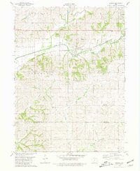
 1980 Guss1981 Print · USGSTaylor County farmland in the early eighties is meticulously detailed here, showing the rural townships of Nodaway and Dallas. Family researchers can locate historic burial sites like Guss Cem and Holt Cem or trace the winding One Hundred and Two River.
 - 1980 Map of Bedford, 1981 Print
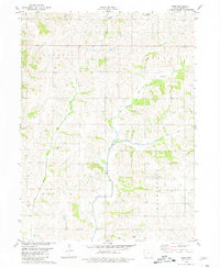
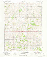
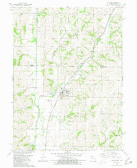
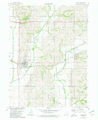
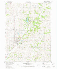 1980 Bedford1981 Print · USGSBedford and the surrounding Taylor County countryside are captured here in the early eighties, showcasing a landscape of small-town industry and rural recreation. Researchers can trace family history through sites like Lexington Cem or follow the Burlington Northern line past the Lake of Three Fires.
 - 1980 Map of Conway, 1981 Print
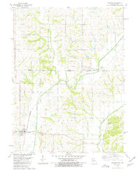
 1980 Conway1981 Print · USGSTaylor County farmland in the late seventies is captured here, showing the rural structure of townships from Marshall to Jefferson. Genealogists can locate family farmsteads and burial sites like Platteville Cem near the settlements of Conway and Platteville.
 - 1980 Map of Hopkins, 1981 Print
 1980 Hopkins1981 Print · USGSNodaway County and the Missouri-Iowa border are captured in the early eighties as rural life centered on the town of Hopkins. Genealogists can locate family landmarks like Washburn Cem and Willard Cem or trace the Burlington Northern rail line.
 - 1980 Map of Sheridan, 1981 Print
 1980 Sheridan1981 Print · USGSThe Missouri-Iowa borderlands are captured here in the late seventies, showing the rural landscape around Sheridan and Isadora. Researchers can trace the Chicago and North Western rail corridor and locate family sites at Sheridan Cem or Athelstan Cem.
 - 1980 Map of Hawleyville, 1981 Print
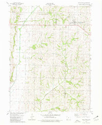
 1980 Hawleyville1981 Print · USGSPage and Taylor counties are captured in the early eighties as the Nodaway River forks converge near established rural townships. Genealogists can trace family sites at Hawleyville Cem or Valley Cem, while outdoor historians can locate the original Campground at Nodaway Valley County Park.
 - 1980 Map of Brooks, 1981 Print
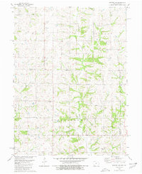
 1980 Brooks1981 Print · USGSSouthwestern Iowa in the early eighties remains a landscape defined by its river valleys and rail lines. Genealogists can locate family landmarks like Methodist Grove Cem, the settlement of Brooks, and the headwaters of the uniquely named One Hundred and Two River.
 - 1980 Map of Villisca, 1981 Print
 1980 Villisca1981 Print · USGSVillisca and the surrounding Iowa farmland are captured here in the early eighties, showcasing a landscape defined by the three branches of the Nodaway River. Genealogists can locate several local burial sites including Nodaway Cem and Findley Cem, while following the path of the Burlington Northern rail line.
 - 1980 Map of Ladoga, 1981 Print
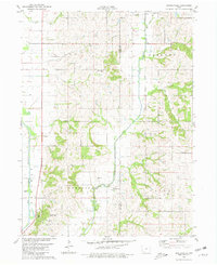
 1980 Ladoga1981 Print · USGSTaylor County in the early eighties is captured here as a network of river forks and rural townships. Researchers can trace family history at Graceland Cem or follow the legacy of local transport along the Old Railroad Grade and the One Hundred and Two River.
 - 1980 Map of New Market, 1981 Print
 1980 New Market1981 Print · USGSTaylor and Page counties come together at the town of New Market during the late 1970s. Genealogists can trace family footprints at Memory Cem or Vase Cem and locate the small community of Siam near the southern border.
 - 1980 Map of Bedford SW, 1981 Print
 1980 Bedford SW1981 Print · USGSThis rural borderland between Iowa and Missouri was mapped in the late 1970s, showing a landscape of traditional farmsteads and township boundaries. Genealogists can locate several remote burial sites and community centers, including Berea Ch, New Hope Cem, and Brethren Cem.
 - 1981 Map of Maloy
 1981 Maloy1981 Print · USGSRinggold County farmland remains centered on the rail-side village of Maloy during the early eighties. Genealogists and local historians can locate several rural burial sites, including Forest Home Cem and St Marys Cem, near the Platte River.
 - 1981 Map of Kent
 1981 Kent1981 Print · USGSSouthwest Iowa's agricultural heartland is documented here in the early 1980s, centered on the railroad town of Kent. Researchers can trace old family burial sites at McDuthies Cemetery and Morgan Cemetery or follow the Burlington Northern tracks.
 - 1981 Map of Clearfield
 1981 Clearfield1981 Print · USGSThe borderlands of Taylor and Ringgold Counties are captured here during the early 1980s, centered on the railroad town of Clearfield. Genealogists can trace several local burial sites, including Rising Sun Cem and Cabaret Cem, while mapping the BURLINGTON NORTHERN rail line.
 - 1981 Map of Blockton
 1981 Blockton1981 Print · USGSThe Iowa-Missouri borderlands come into focus in the early 1980s, showcasing the agricultural communities of Taylor and Ringgold counties. Trace the paths of the Chicago and North Western and an Old Railroad Grade past landmarks like Tent Chapel and Rosehill Cem.
 - 1985 Map of Mount Ayr
 1985 Mount Ayr1985 Print · USGSThe Iowa-Missouri borderlands are captured here in the mid-eighties, showing a landscape defined by the branching forks of the Platte River and Grand River. Researchers can trace the heritage of rural communities and conservation sites like Lake of Three Fires State Park and Rose Hill Cemetery.2 unique versions available
End of results
Showing maps 1-21 of 21
Top cities of Taylor County
- Bedford historical maps
- Lenox historical maps
- New Market historical maps
- Clearfield historical maps
- Gravity historical maps
- Blockton historical maps
See more
Frequently asked questions
- What are the different types of historical maps available for Taylor County?
- What is the oldest map of Taylor County?
- Where can I purchase historical maps of Taylor County for my home or office?
- Where can I download high-res historical maps of Taylor County?
- Are there historical topographic maps available for Taylor County?
- Is there historical aerial imagery available for Taylor County?
- Where are historical maps of Taylor County sourced from?