Old Maps of Bedford, Iowa for Academic Research
Study the evolution of Bedford with 12 high-resolution historic maps. Whether you're teaching, researching, or modeling changes in land use, these maps provide essential visual documentation of urban, environmental, and geographic change.
- Analyze long-term change: Track patterns in development, transportation, and natural features.
- Ideal for environmental or urban studies: Support academic projects with primary historical map data.
- Use in the classroom or lab: Educators and researchers rely on these maps to bring historical context to life.
These maps are a powerful tool for teaching, research, and visualizing how Bedford has changed over the decades.
Bedford, IA maps
(12)- 1940 Map of Bedford, 1954 Print
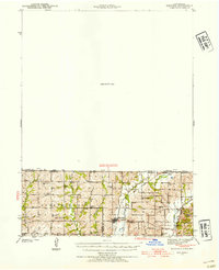 1940 Bedford1954 Print · USGSThe Iowa-Missouri borderlands come alive in this mid-century survey of Taylor, Worth, and Nodaway counties. Researchers can trace the Chicago Great Western rail line and locate vanished rural hubs like Luteston Sch and Isadora.2 unique versions available
 - 1943 Map of Bedford
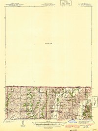 1943 Bedford1943 Print · USGSThe borderlands of Iowa and Missouri are captured here in the early 1940s, showing a landscape defined by small-town life and the railroad. Genealogists can trace family footprints through numerous rural landmarks like New Hope Cem, Star of the West Ch, and the Platte Dell Sch.2 unique versions available
 - 1955 Map of Nebraska City, 1967 Print
 1955 Nebraska City1967 Print · USGSThe four-state region surrounding the Missouri River valley appears here in the mid-1950s, a landscape of rail-dependent market towns and rural school districts. Genealogists can locate family landmarks like the Rock Bluff School, St Oswald Church, and the Clarinda State Hospital.3 unique versions available
 - 1957 Map of Nebraska City
 1957 Nebraska City1957 Print · USGSThe four-state junction of Nebraska, Iowa, Missouri, and Kansas comes alive in this mid-fifties survey of the Missouri River valley. Genealogists and historians can trace the rail-and-road networks connecting Nebraska City, Maryville, and the Squaw Creek National Wildlife Refuge.
 - 1958 Map of Nebraska City
 1958 Nebraska City1958 Print · USGSThe Missouri River Valley and its fertile four-state borderlands are captured here during the mid-century expansion of the regional highway and rail networks. Genealogists can trace family roots through numerous rural landmarks like Moulton School, Shady Grove Church, and the Clarinda State Hospital.
 - 1980 Map of Bedford, 1981 Print
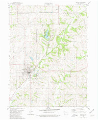 1980 Bedford1981 Print · USGSBedford and the surrounding Taylor County countryside are captured here in the early eighties, showcasing a landscape of small-town industry and rural recreation. Researchers can trace family history through sites like Lexington Cem or follow the Burlington Northern line past the Lake of Three Fires.
 - 1985 Map of Mount Ayr
 1985 Mount Ayr1985 Print · USGSThe Iowa-Missouri borderlands are captured here in the mid-eighties, showing a landscape defined by the branching forks of the Platte River and Grand River. Researchers can trace the heritage of rural communities and conservation sites like Lake of Three Fires State Park and Rose Hill Cemetery.2 unique versions available
 - 2010 Map of Bedford, 2010 Print
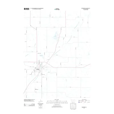
 2010 Bedford2010 Print · USGSCovers Bedford, including Conway, Taylor County, and other nearby areas
 - 2013 Map of Bedford, 2013 Print
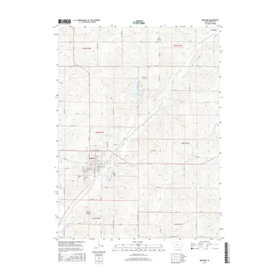
 2013 Bedford2013 Print · USGSCovers Bedford, including Conway, Taylor County, and other nearby areas
 - 2015 Map of Bedford, 2015 Print
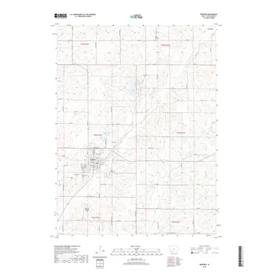
 2015 Bedford2015 Print · USGSCovers Bedford, including Conway, Taylor County, and other nearby areas
 - 2018 Map of Bedford, 2018 Print
 2018 Bedford2018 Print · USGSCovers Bedford, including Conway, Taylor County, and other nearby areas
 - 2022 Map of Bedford, 2022 Print
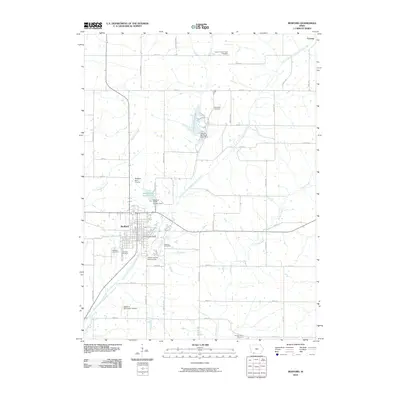
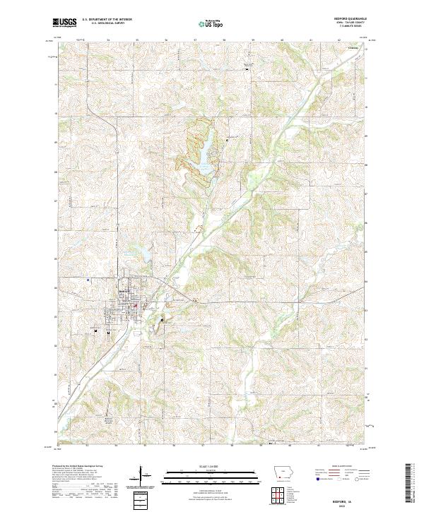 2022 Bedford2022 Print · USGSBedford serves as a focal point for Taylor County in the early twenty-first century, anchored by its traditional town square and water supply lakes. Genealogists and local historians can trace family locations through numerous sites like Lexington Cem, Mohler Cem, and the Bedford town center.
End of results
Showing maps 1-12 of 12
Top cities near Bedford
- Lenox historical maps
- Hopkins historical maps
- New Market historical maps
- Clearfield historical maps
- Sheridan historical maps
- Gravity historical maps
See more
Frequently asked questions
- What are the different types of historical maps available for Bedford?
- What is the oldest map of Bedford?
- Where can I purchase historical maps of Bedford for my home or office?
- Where can I download high-res historical maps of Bedford?
- Are there historical topographic maps available for Bedford?
- Is there historical aerial imagery available for Bedford?
- Where are historical maps of Bedford sourced from?