
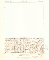
1940 Map of Bedford
USGS Topo · Published 1954About this map
Sheridan and Athelstan anchor this rural landscape along the state line in the early 1940s, where small-town life was defined by a dense network of one-room schoolhouses and country churches. The Chicago Great Western railroad cuts across the terrain, serving these remote agricultural communities and linking them to wider markets. The map reveals the intricate drainage patterns of the Platte River and Grand River, with numerous small tributaries like Honey Creek and Fox Branch winding through the rolling hills of Taylor, Nodaway, and Worth counties.
Find a feature on this map
33 named features on this map. Tap any name to fly to it.
Don’t see what you’re looking for? This feature index may not catch every label — zoom into the map to look around manually.
Map Details
Editions of this 1940 Bedford Map
2 editions found
Other maps of this area

1940 · Blockton
USGS Topo · 1:62,500

1940 · New Market
USGS Topo · 1:62,500

1940 · Parnell
USGS Topo · 1:62,500

1942 · Grant City
USGS Topo · 1:62,500

1943 · Bedford
USGS Topo · 1:62,500

1943 · Parnell
USGS Topo · 1:62,500

1943 · Maryville
USGS Topo · 1:62,500

1943 · New Market
USGS Topo · 1:62,500

1943 · Grant City
USGS Topo · 1:62,500

1943 · Blockton
USGS Topo · 1:62,500