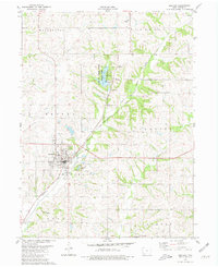
1980 Map of Bedford
USGS Topo · Published 1981About this map
Bedford serves as the central hub of this Iowa landscape, where the local economy and social life converge near the Fairground and Golf Course. The town's layout is meticulously detailed, including civic infrastructure such as the Bedford Municipal Airport and a Radio Tower. North of the town center, the Lake of Three Fires State Park offers a distinct recreational geography, featuring a Boat Ramp and Fish Hatchery along the waters of Lake of Three Fires.
Find a feature on this map
34 named features on this map. Tap any name to fly to it.
Don’t see what you’re looking for? This feature index may not catch every label — zoom into the map to look around manually.
Map Details
Editions of this 1980 Bedford Map
This is the sole edition of this map. No revisions or reprints were ever made.
Other maps of this area

1940 · Bedford
USGS Topo · 1:62,500

1940 · New Market
USGS Topo · 1:62,500

1943 · Bedford
USGS Topo · 1:62,500

1943 · New Market
USGS Topo · 1:62,500

1955 · Nebraska City
USGS Topo · 1:250,000

1957 · Nebraska City
USGS Topo · 1:250,000

1958 · Nebraska City
USGS Topo · 1:250,000

1980 · Gravity
USGS Topo · 1:24,000

1980 · Merle Junction
USGS Topo · 1:24,000

1980 · Guss
USGS Topo · 1:24,000