2020s Maps of Blockton, Iowa
Explore 2 historic maps of Blockton from the 2020s. These maps offer a rare glimpse into what life looked like during the 2020s — showing old roads, neighborhoods, homes, and landmarks that have changed or disappeared over time.
Whether you're researching your family's past, planning a metal detecting trip, or studying how Blockton's landscape evolved across the 2020s, these high-resolution maps are a powerful tool for exploring the history of this region.
- Focus on a specific era: All maps on this page are from the 2020s, giving you a focused view of this time period.
- See what’s changed: Compare century-old streets, trails, and buildings to today's modern landscape using overlays and satellite layers.
- Research with precision: Use these maps for genealogy, historical research, land use analysis, or educational projects.
- View, download, or print: Maps are fully viewable online in high resolution, and can be downloaded or printed for your own records.
Start exploring Blockton's history through authentic maps from the 2020s. This is your window into the past.
Blockton, IA maps
(2)- 2022 Map of Blockton, 2022 Print
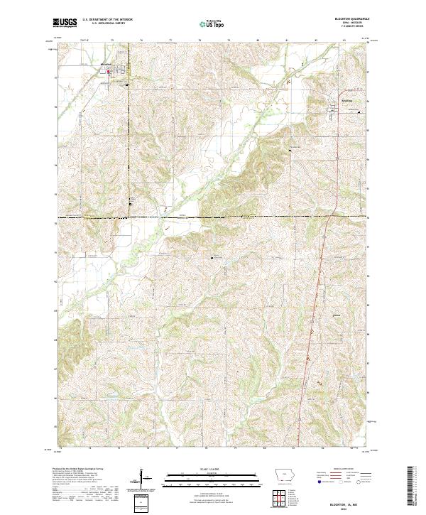 2022 Blockton2022 Print · USGSThe Iowa-Missouri borderlands near Blockton and Redding are shown in detail during the early 2020s. Genealogists and local historians can trace rural roots across five distinct burial sites, including Fairview Cem and Honey Grove Cem, along the Grand River.
 - 2022 Map of Maloy, 2022 Print
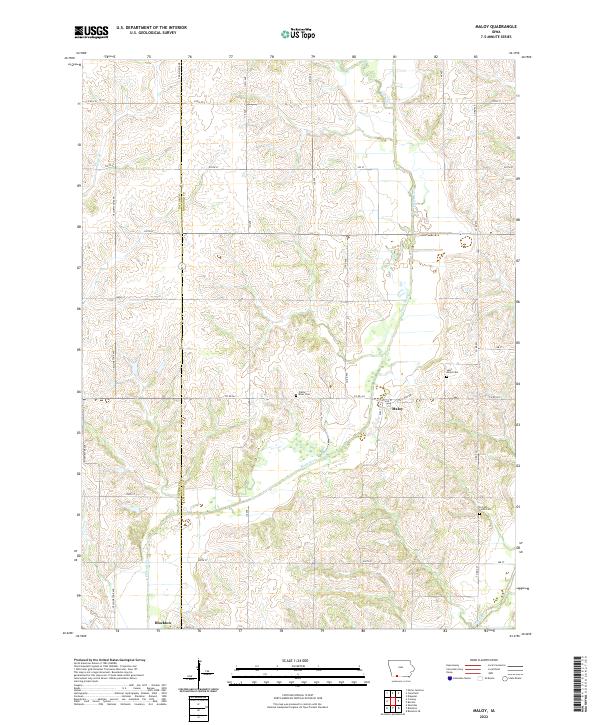 2022 Maloy2022 Print · USGSThe rural borderlands of Taylor and Ringgold counties come into focus in this contemporary Iowa survey. Genealogists can locate family burial plots at Saint Marys Cemetery or Forrest Home Cemetery and trace the paths of the Platte River and Grand River.
End of results
Showing maps 1-2 of 2
Top cities near Blockton
- Mount Ayr historical maps
- Grant City historical maps
- Diagonal historical maps
- Clearfield historical maps
- Parnell historical maps
- Sheridan historical maps
See more
Frequently asked questions
- What are the different types of historical maps available for Blockton?
- What is the oldest map of Blockton?
- Where can I purchase historical maps of Blockton for my home or office?
- Where can I download high-res historical maps of Blockton?
- Are there historical topographic maps available for Blockton?
- Is there historical aerial imagery available for Blockton?
- Where are historical maps of Blockton sourced from?