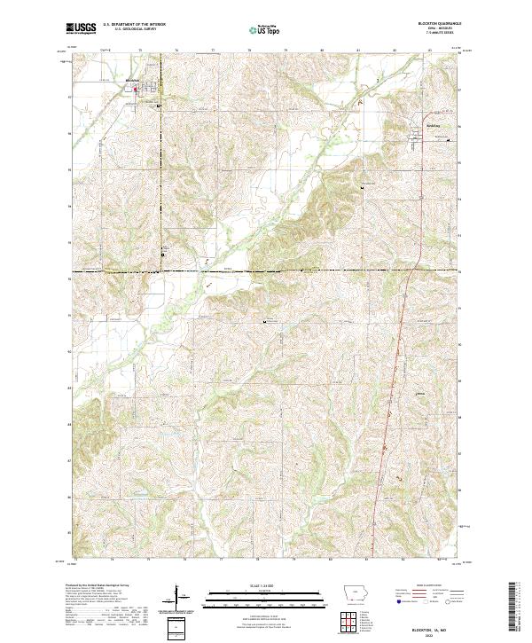
2022 Map of Blockton
USGS Topo · Published 2022About this map
Blockton and Redding serve as the primary northern hubs in this rural landscape, which spans the state line between Iowa and Missouri. The terrain is defined by the winding course of the Grand River, which flows southward through a network of small creeks and drainages like Marlowe Cr and Jay Cr. This area is characterized by its agricultural layout, where established county roads such as Co RD j55 and State HWY K connect isolated farmsteads and small communities like Irena just across the border in Worth County.
Find a feature on this map
71 named features on this map. Tap any name to fly to it.
Don’t see what you’re looking for? This feature index may not catch every label — zoom into the map to look around manually.
Map Details
Editions of this 2022 Blockton Map
This is the sole edition of this map. No revisions or reprints were ever made.
Other maps of this area

1940 · Blockton
USGS Topo · 1:62,500

1940 · Bedford
USGS Topo · 1:62,500

1940 · Parnell
USGS Topo · 1:62,500

1942 · Grant City
USGS Topo · 1:62,500

1943 · Bedford
USGS Topo · 1:62,500

1943 · Parnell
USGS Topo · 1:62,500

1943 · Grant City
USGS Topo · 1:62,500

1943 · Blockton
USGS Topo · 1:62,500

1955 · Nebraska City
USGS Topo · 1:250,000

1957 · Nebraska City
USGS Topo · 1:250,000