
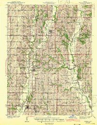
1943 Map of Parnell
USGS Topo · Published 1943About this map
Parnell and Ravenwood serve as central hubs in this early 1940s landscape, where the rural topography of northwest Missouri is defined by a dense network of country school districts and small river valley settlements. The convergence of the Chicago Great Western and Wabash railroads at Conception Junction and Clyde highlights the era's rail-dependent economy, while the St Benedict Convent stands as a prominent landmark in the southern reaches.
Find a feature on this map
69 named features on this map. Tap any name to fly to it.
Don’t see what you’re looking for? This feature index may not catch every label — zoom into the map to look around manually.
Map Details
Editions of this 1943 Parnell Map
2 editions found
Other maps of this area

1925 · Stanberry
USGS Topo · 1:62,500

1925 · Darlington
USGS Topo · 1:62,500

1927 · Bolckow
USGS Topo · 1:62,500

1939 · Stanberry
USGS Topo · 1:62,500

1940 · Blockton
USGS Topo · 1:62,500

1940 · Bedford
USGS Topo · 1:62,500

1940 · New Market
USGS Topo · 1:62,500

1940 · Parnell
USGS Topo · 1:62,500

1942 · Grant City
USGS Topo · 1:62,500

1943 · Bedford
USGS Topo · 1:62,500