Old Maps of Union County, Iowa for Academic Research
Study the evolution of Union County with 82 high-resolution historic maps. Whether you're teaching, researching, or modeling changes in land use, these maps provide essential visual documentation of urban, environmental, and geographic change.
- Analyze long-term change: Track patterns in development, transportation, and natural features.
- Ideal for environmental or urban studies: Support academic projects with primary historical map data.
- Use in the classroom or lab: Educators and researchers rely on these maps to bring historical context to life.
These maps are a powerful tool for teaching, research, and visualizing how Union County has changed over the decades.
Union County, IA maps
(82)- 1951 Map of Afton, 1953 Print
 1951 Afton1953 Print · USGSSouthern Iowa's rural landscape is captured here in the early fifties, showing a region defined by its rail-and-river economy and dense network of country schools. Researchers can trace family history through dozens of landmarks like Mt Pisgah Cem, Macksburg, and Green Lawn Cem.2 unique versions available
 - 1954 Map of Omaha, 1967 Print
 1954 Omaha1967 Print · USGSMid-century development radiates from the river bluffs into the agricultural heartland during this period of post-war growth. Genealogists and historians can trace rail-connected towns like Atlantic and Red Oak or locate the sprawling grounds of Offutt Air Force Base and Manawa Lake.3 unique versions available
 - 1955 Map of Nebraska City, 1967 Print
 1955 Nebraska City1967 Print · USGSThe four-state region surrounding the Missouri River valley appears here in the mid-1950s, a landscape of rail-dependent market towns and rural school districts. Genealogists can locate family landmarks like the Rock Bluff School, St Oswald Church, and the Clarinda State Hospital.3 unique versions available
 - 1957 Map of Nebraska City
 1957 Nebraska City1957 Print · USGSThe four-state junction of Nebraska, Iowa, Missouri, and Kansas comes alive in this mid-fifties survey of the Missouri River valley. Genealogists and historians can trace the rail-and-road networks connecting Nebraska City, Maryville, and the Squaw Creek National Wildlife Refuge.
 - 1957 Map of Omaha
 1957 Omaha1957 Print · USGSWestern Iowa and the Missouri River valley are seen here in the mid-fifties during the height of the rail-and-road era. Researchers can trace the sprawling rail lines of the Chicago And North Western or locate Cold War landmarks like Offutt Air Force Base.
 - 1958 Map of Omaha
 1958 Omaha1958 Print · USGSOmaha and Council Bluffs stand at the center of this mid-fifties landscape, where the Missouri River splits the urban plains of Nebraska from the rolling hills of western Iowa. Genealogists can trace the rail lines of the Wabash RR and Illinois Central RR to rural settlements like Missouri Valley and Red Oak.2 unique versions available
 - 1958 Map of Nebraska City
 1958 Nebraska City1958 Print · USGSThe Missouri River Valley and its fertile four-state borderlands are captured here during the mid-century expansion of the regional highway and rail networks. Genealogists can trace family roots through numerous rural landmarks like Moulton School, Shady Grove Church, and the Clarinda State Hospital.
 - 1980 Map of Creston East, 1981 Print
 1980 Creston East1981 Print · USGSCreston thrived as a regional center in the early 1980s, shaped by the Burlington Northern rail line and a dense network of local schools and churches. Genealogists and historians can trace landmarks like Jerusalem Cem, St Malachys Sch, and the small community of Graves.
 - 1981 Map of Zion
 1981 Zion1981 Print · USGSSouthern Iowa's rural landscape is captured here in the early eighties, showing a network of agricultural townships and family homesteads. Genealogists and historians can trace the local landmarks of Zion, find quiet burial grounds like Wilson Cem, and follow the Burlington Northern rail line.
 - 1981 Map of Orient
 1981 Orient1981 Print · USGSAdair County farm country is captured here in the early eighties, centered on the railroad hub of Orient. Genealogists and local historians can trace legacy sites like the Prairie Lawn Cemetery or the rural settlements of Nevinville and Spaulding.
 - 1981 Map of Creston West
 1981 Creston West1981 Print · USGSUnion County during the early 1980s reveals a landscape of growing towns and established rail lines. Genealogists and historians can trace family locations near Cromwell, locate Spaulding Center Cem, or explore the development around Green Valley Lake.
 - 1981 Map of Arispe
 1981 Arispe1981 Print · USGSArispe and the surrounding Iowa countryside are captured here in the early eighties as the rail-and-river economy persisted. You can trace the Chicago and North Western line, locate family sites near Abel Cem, or follow the Grand River and its many tributaries.
 - 1981 Map of Shannon City
 1981 Shannon City1981 Print · USGSShannon City and its surrounding townships appear here in the early eighties, highlighting a landscape defined by the Grand River and the Chicago and North Western rail line. Researchers can trace rural lineages through sites like Harmony Cem, Mortimer Cem, and Oakland Cem.
 - 1981 Map of Tingley NE
 1981 Tingley NE1981 Print · USGSSouthern Iowa farm country at the dawn of the eighties reveals a landscape defined by the Thompson River and its numbered creeks. Researchers can locate remote rural landmarks like Otterbein Cem, Spring Valley Lake, and Oak Hill Ch among the rolling fields.
 - 1981 Map of Kent
 1981 Kent1981 Print · USGSSouthwest Iowa's agricultural heartland is documented here in the early 1980s, centered on the railroad town of Kent. Researchers can trace old family burial sites at McDuthies Cemetery and Morgan Cemetery or follow the Burlington Northern tracks.
 - 1983 Map of Afton, 1984 Print
 1983 Afton1984 Print · USGSAfton was a vital rail crossroads in the early 1980s, where the Burlington Northern met the Chicago and North Western. Trace local family history at Green Lawn Cem or follow the path of the Old Star Railroad Grade Branch.
 - 1983 Map of Lorimor South, 1984 Print
 1983 Lorimor South1984 Print · USGSUnion County agricultural lands are captured here in the early 1980s as the rail era continued to shape the local landscape. Researchers can trace the path of the CHICAGO AND NORTH WESTERN railroad as it connects Lorimor to the small siding at Monette.
 - 1983 Map of Macksburg, 1984 Print
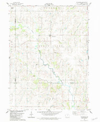 1983 Macksburg1984 Print · USGSMadison County farmland in the early eighties centers on the village of Macksburg and the meandering Grand River. Researchers can locate family roots at several rural burial grounds, including Kivett Cem, West Branch Cem, and Moon Cem.
 - 1983 Map of Lorimor North, 1984 Print
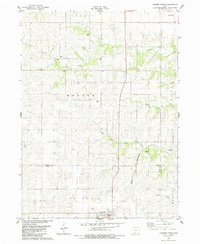 1983 Lorimor North1984 Print · USGSMadison and Union counties in the early 1980s show a quintessential Iowa agricultural landscape defined by rail lines and small-town centers. Genealogists can trace family footprints across Clark Cem and Barney Cem, or locate the historic Chicago and North Western corridor.
 - 1985 Map of Creston
 1985 Creston1985 Print · USGSSouthwest Iowa in the mid-eighties shows a landscape of established farm towns and growing regional hubs connected by vital rail lines. Genealogists and local historians can trace landmarks like Graceland Cem, the Southwestern Community College campus, and the Burlington Northern railroad route.
 - 1985 Map of Mount Ayr
 1985 Mount Ayr1985 Print · USGSThe Iowa-Missouri borderlands are captured here in the mid-eighties, showing a landscape defined by the branching forks of the Platte River and Grand River. Researchers can trace the heritage of rural communities and conservation sites like Lake of Three Fires State Park and Rose Hill Cemetery.2 unique versions available
 - 1993 Map of Creston
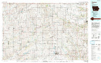 1993 Creston1993 Print · USGSSouthwestern Iowa in the early nineties shows a landscape of established farm towns and modern water reservoirs. Genealogists and local historians can trace the streets of Creston and Winterset, or find rural landmarks like Graceland Cem and Arbor Hill.
 - 2010 Map of Zion, 2010 Print
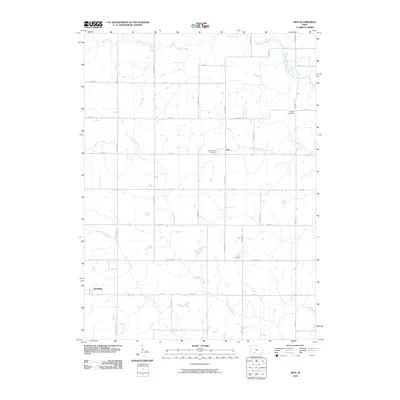 2010 Zion2010 Print · USGSAdair County farm country and the headwaters of the Thompson River are captured here in the early 2000s. Genealogists and local historians can trace family locations near the settlements of Zion and Spaulding, or locate burial sites at Hill of Zion Cemetery and Liberty Cemetery.
 - 2010 Map of Kent, 2010 Print
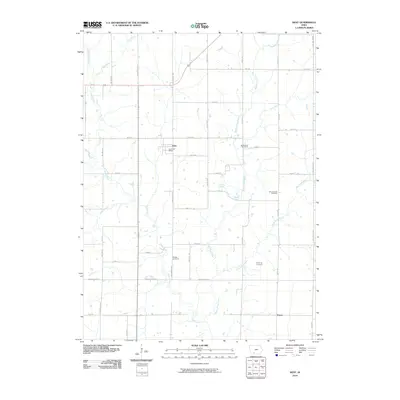 2010 Kent2010 Print · USGSAgricultural life in Union County continued its steady pace during the early 21st century, centered on the village of Kent. Researchers can locate several historic burial grounds like McDuthies Cemetery and Grove Chapel Cemetery tucked between the branches of the Platte River.
 - 2010 Map of Shannon City, 2010 Print
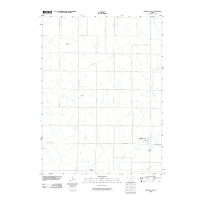 2010 Shannon City2010 Print · USGSThe rural borders of Ringgold and Union counties are captured in this early 21st-century study of southwestern Iowa. Researchers can locate family heritage sites like the Ide Family Cemetery, Mortimor Cemetery, and the Shannon City Post Office along the Grand River.
Showing maps 1-25 of 82
Top cities of Union County
- Creston historical maps
- Afton historical maps
- Lorimor historical maps
- Cromwell historical maps
- Arispe historical maps
- Thayer historical maps
See more
Frequently asked questions
- What are the different types of historical maps available for Union County?
- What is the oldest map of Union County?
- Where can I purchase historical maps of Union County for my home or office?
- Where can I download high-res historical maps of Union County?
- Are there historical topographic maps available for Union County?
- Is there historical aerial imagery available for Union County?
- Where are historical maps of Union County sourced from?