1960s Maps of Washington County, Iowa
Explore 8 historic maps of Washington County from the 1960s. These maps offer a rare glimpse into what life looked like during the 1960s — showing old roads, neighborhoods, homes, and landmarks that have changed or disappeared over time.
Whether you're researching your family's past, planning a metal detecting trip, or studying how Washington County's landscape evolved across the 1960s, these high-resolution maps are a powerful tool for exploring the history of this region.
- Focus on a specific era: All maps on this page are from the 1960s, giving you a focused view of this time period.
- See what’s changed: Compare century-old streets, trails, and buildings to today's modern landscape using overlays and satellite layers.
- Research with precision: Use these maps for genealogy, historical research, land use analysis, or educational projects.
- View, download, or print: Maps are fully viewable online in high resolution, and can be downloaded or printed for your own records.
Start exploring Washington County's history through authentic maps from the 1960s. This is your window into the past.
Washington County, IA maps
(8)- 1961 Map of Davenport
 1961 Davenport1961 Print · USGSThe Quad Cities and the eastern Iowa riverlands are captured here in the early sixties, showing the region's transition into a modern industrial and transit hub. Genealogists and historians can trace the paths of major railroads and find river landmarks like Rock Island Arsenal, Huron Island, and the Coralville Reservoir.
 - 1962 Map of Davenport
 1962 Davenport1962 Print · USGSThe Quad Cities and the Mississippi River corridor are shown at their industrial peak just before the interstate era fully transformed the region. Researchers can trace the sprawling rail networks of the Chicago Rock Island and Pacific and find landmarks like the Rock Island Arsenal and Wild Cat Den State Park.
 - 1965 Map of Williamstown, 1966 Print
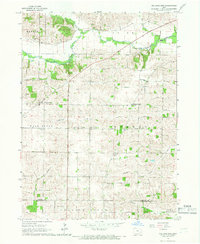 1965 Williamstown1966 Print · USGSThe rural borderlands of Johnson and Washington counties are captured here in the mid-1960s, showing a landscape defined by small farms and creek valleys. Researchers can locate numerous local landmarks including St Peters Cem, Hartsock Sch, and the community at Sharon Center.
 - 1965 Map of Hills, 1967 Print
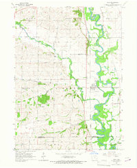 1965 Hills1967 Print · USGSJohnson County in the mid-sixties reveals a river-valley landscape defined by the winding Iowa River and the small-town hub of Hills. Genealogists and local historians can trace family locations near St Stanislaus Ch, Sandtown Cem, and several rural school sites.2 unique versions available
 - 1969 Map of Kalona, 1971 Print
 1969 Kalona1971 Print · USGSSoutheast Iowa farming life and rail transit converge in the late sixties along the winding English River. Local researchers can trace old schoolhouse locations like Snake Hollow Sch and family ties at Richmond Cem or Middleburg Cem.2 unique versions available
 - 1969 Map of Riverside, 1971 Print
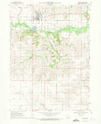
 1969 Riverside1971 Print · USGSThe northern edge of Washington County comes into focus in the late 1960s, centered on the riverfront town of Riverside. Genealogists and local historians can map out old family plots at St Vincent Cem or trace the rural path to Highland Sch.2 unique versions available
 - 1969 Map of Washington, 1971 Print
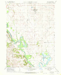
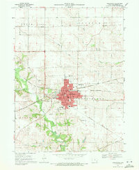 1969 Washington1971 Print · USGSWashington was a bustling Iowa rail center in the late sixties, where the Milwaukee Road and the Rock Island lines converged. Researchers can trace local landmarks like St James Sch, Elm Grove Cemetery, and the old County Farm.
 - 1969 Map of Lone Tree, 1972 Print
 1969 Lone Tree1972 Print · USGSLone Tree and the river bottomlands of Johnson and Louisa Counties are captured here in the late sixties. Genealogists can trace family landmarks like Evans Cem and Swank Ch, while the Old Railroad Grade marks a vanished rail corridor.
End of results
Showing maps 1-8 of 8
Top cities of Washington County
- Washington historical maps
- Kalona historical maps
- Wellman historical maps
- Riverside historical maps
- Brighton historical maps
- Ainsworth historical maps
See more
Frequently asked questions
- What are the different types of historical maps available for Washington County?
- What is the oldest map of Washington County?
- Where can I purchase historical maps of Washington County for my home or office?
- Where can I download high-res historical maps of Washington County?
- Are there historical topographic maps available for Washington County?
- Is there historical aerial imagery available for Washington County?
- Where are historical maps of Washington County sourced from?