Old Maps of Washington County, Iowa for Genealogy
Trace your family roots with 124 historic maps of Washington County. These high-res maps reveal old neighborhoods, homesites, landmarks, and streets — helping you uncover where your ancestors lived and how the area evolved over time.
- Explore historic neighborhoods: Identify where your relatives may have lived in the 1800s or 1900s.
- Compare maps over time: Trace the changes in streets, buildings, and landmarks for multi-generational research.
- Perfect for genealogy & ancestry research: Used by family historians and researchers to map out lineage and migration.
These maps are an incredible resource for exploring your personal connection to Washington County's past.
Washington County, IA maps
(124)- 1891 Map of Oxford
 1891 Oxford1891 Print · USGSEastern Iowa in the late nineteenth century was a landscape of burgeoning rail towns and fertile creek bottoms. Genealogists can trace the early township borders of Oxford and York while following the paths of the Chicago Rock Island and Pacific Railroad and Old Mans Creek.
 - 1891 Map of Iowa City
 1891 Iowa City1891 Print · USGSIowa City and its surrounding townships appear at the peak of the late 19th-century rail era. Researchers can trace early railroad alignments like the Chicago Rock Island and Pacific and locate established settlements including Tiffin, Coralville, and South Liberty.3 unique versions available
 - 1894 Map of Oxford
 1894 Oxford1894 Print · USGSNorthwestern Johnson County was a landscape of emerging rail towns and winding creek valleys in the late nineteenth century. Genealogists and local historians can trace the early footprints of Oxford and Windham alongside the Old Mans Creek drainage system.2 unique versions available
 - 1903 Map of Fairfax
 1903 Fairfax1903 Print · USGSEastern Iowa's rail-and-river corridor is captured here at the start of the twentieth century, showing the region's transition into an agricultural powerhouse. Genealogists can locate the seven original communal villages of the Amana colonies and old educational sites like Western College.2 unique versions available
 - 1938 Map of Iowa City
 1938 Iowa City1938 Print · USGSIowa City and its surrounding townships are captured in the mid-1930s, revealing a landscape of rural schoolhouses and the early University of Iowa campus. Trace vanished local landmarks like the State Sanatorium, Iowa City Landing Field, and dozens of named country schools.3 unique versions available
 - 1958 Map of Davenport, 1968 Print
 1958 Davenport1968 Print · USGSEastern Iowa and western Illinois thrive along the river during the late fifties, defined by the industrial Quad Cities and a robust rail network. Genealogists can trace family roots through settlements like Oasis and Stanwood or along the Cedar River.2 unique versions available
 - 1961 Map of Davenport
 1961 Davenport1961 Print · USGSThe Quad Cities and the eastern Iowa riverlands are captured here in the early sixties, showing the region's transition into a modern industrial and transit hub. Genealogists and historians can trace the paths of major railroads and find river landmarks like Rock Island Arsenal, Huron Island, and the Coralville Reservoir.
 - 1962 Map of Davenport
 1962 Davenport1962 Print · USGSThe Quad Cities and the Mississippi River corridor are shown at their industrial peak just before the interstate era fully transformed the region. Researchers can trace the sprawling rail networks of the Chicago Rock Island and Pacific and find landmarks like the Rock Island Arsenal and Wild Cat Den State Park.
 - 1965 Map of Williamstown, 1966 Print
 1965 Williamstown1966 Print · USGSThe rural borderlands of Johnson and Washington counties are captured here in the mid-1960s, showing a landscape defined by small farms and creek valleys. Researchers can locate numerous local landmarks including St Peters Cem, Hartsock Sch, and the community at Sharon Center.
 - 1965 Map of Hills, 1967 Print
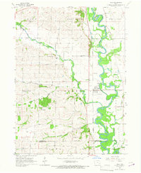 1965 Hills1967 Print · USGSJohnson County in the mid-sixties reveals a river-valley landscape defined by the winding Iowa River and the small-town hub of Hills. Genealogists and local historians can trace family locations near St Stanislaus Ch, Sandtown Cem, and several rural school sites.2 unique versions available
 - 1969 Map of Kalona, 1971 Print
 1969 Kalona1971 Print · USGSSoutheast Iowa farming life and rail transit converge in the late sixties along the winding English River. Local researchers can trace old schoolhouse locations like Snake Hollow Sch and family ties at Richmond Cem or Middleburg Cem.2 unique versions available
 - 1969 Map of Riverside, 1971 Print
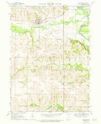 1969 Riverside1971 Print · USGSThe northern edge of Washington County comes into focus in the late 1960s, centered on the riverfront town of Riverside. Genealogists and local historians can map out old family plots at St Vincent Cem or trace the rural path to Highland Sch.2 unique versions available
 - 1969 Map of Washington, 1971 Print
 1969 Washington1971 Print · USGSWashington was a bustling Iowa rail center in the late sixties, where the Milwaukee Road and the Rock Island lines converged. Researchers can trace local landmarks like St James Sch, Elm Grove Cemetery, and the old County Farm.
 - 1969 Map of Lone Tree, 1972 Print
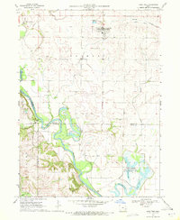 1969 Lone Tree1972 Print · USGSLone Tree and the river bottomlands of Johnson and Louisa Counties are captured here in the late sixties. Genealogists can trace family landmarks like Evans Cem and Swank Ch, while the Old Railroad Grade marks a vanished rail corridor.
 - 1970 Map of Cotter, 1972 Print
 1970 Cotter1972 Print · USGSLouisa County, Iowa, is captured in the early seventies, showing a landscape defined by the convergence of the Iowa River and major rail lines. Genealogists can locate several family burial sites like Bethel Cem and Boston Cem or trace the early town layouts of Cotter and Columbus City.
 - 1970 Map of Ainsworth, 1972 Print
 1970 Ainsworth1972 Print · USGSSoutheast Iowa's rail-and-river network is frozen in time during the early seventies, showing a landscape defined by industrial transport and small-town roots. Researchers can locate family landmarks like Bethel Ch, trace the old Chicago Rock Island and Pacific line, or find Campground Cem.
 - 1973 Map of Wellman, 1975 Print
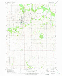 1973 Wellman1975 Print · USGSEastern Iowa's agricultural heartland is documented here in the early seventies, centered on the river-fed plains of Washington County. Researchers can trace rural genealogy and land use through specific sites like Wassonville Cem, the village of Lexington, and the Wellman Municipal Airport.
 - 1973 Map of Amish, 1975 Print
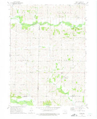 1973 Amish1975 Print · USGSIowa's rural heritage is preserved in this mid-1970s survey of the Johnson and Washington county borders. Genealogists and local historians can trace the foundations of this community through the Mennonite Sch, Windham cemetery, and Amish settlement.
 - 1973 Map of Keota, 1975 Print
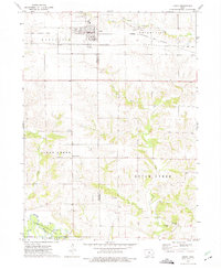 1973 Keota1975 Print · USGSMid-century Iowa life is centered around the railroad town of Keota and the surrounding agricultural townships in the 1970s. Genealogists can trace several rural burial grounds like St Marys Cem and old settlements such as Talleyrand or the riverside Valley.
 - 1973 Map of West Chester, 1975 Print
 1973 West Chester1975 Print · USGSSoutheast Iowa farm country is captured here during the mid-seventies, showing the intersection of rail lines and rural townships. Researchers can locate several country cemeteries like Roberts Chapel Cem or trace the Old Railroad Grade near Grace Hill.
 - 1973 Map of Kinross, 1975 Print
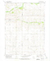 1973 Kinross1975 Print · USGSKinross and the surrounding Iowa farmsteads are shown in the 1970s, a period when local rail lines like the Central Iowa Transportation Coop still shaped the landscape. Researchers can locate family sites and rural landmarks, from St Patricks Cem to the small community of Nira.
 - 1973 Map of Holbrook, 1975 Print
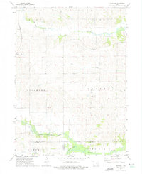 1973 Holbrook1975 Print · USGSIowa County farmland in the early 1970s reveals a quiet landscape shaped by the North English River and the legacy of local settlements. Genealogists can trace family roots through several rural burial grounds, including St Josephs Cem, Piersol Cem, and the community of Holbrook.
 - 1980 Map of Richland, 1981 Print
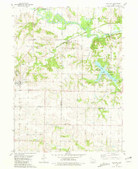 1980 Richland1981 Print · USGSSoutheast Iowa in the early 1980s reveals a landscape of quiet agricultural towns and significant state park land. Researchers can trace family history through several rural burial grounds like Evergreen Cem or follow the rails of the Chicago Milwaukee St Paul and Pacific.
 - 1980 Map of Brighton, 1981 Print
 1980 Brighton1981 Print · USGSThe Skunk River valley at the start of the 1980s reveals a deeply rooted rural landscape straddling the Washington and Jefferson county line. Genealogists can trace family footprints through numerous local burial sites like Hillcrest Cem and Friends Cem or locate the Quarry and Old Railroad Grade that shaped the local economy.
 - 1980 Map of Wayland, 1981 Print
 1980 Wayland1981 Print · USGSLife in the 1970s across the Washington and Henry county lines centered on the agricultural hubs of Wayland and Coppock during this era of field mapping. Researchers can trace family roots through several rural landmarks, including Schrock Cem, Eicher Emmanuel Ch, and the winding path of the Skunk River.
Showing maps 1-25 of 124
Top cities of Washington County
- Washington historical maps
- Kalona historical maps
- Wellman historical maps
- Riverside historical maps
- Brighton historical maps
- Ainsworth historical maps
See more
Frequently asked questions
- What are the different types of historical maps available for Washington County?
- What is the oldest map of Washington County?
- Where can I purchase historical maps of Washington County for my home or office?
- Where can I download high-res historical maps of Washington County?
- Are there historical topographic maps available for Washington County?
- Is there historical aerial imagery available for Washington County?
- Where are historical maps of Washington County sourced from?