2020s Maps of Wayne County, Iowa
Explore 20 historic maps of Wayne County from the 2020s. These maps offer a rare glimpse into what life looked like during the 2020s — showing old roads, neighborhoods, homes, and landmarks that have changed or disappeared over time.
Whether you're researching your family's past, planning a metal detecting trip, or studying how Wayne County's landscape evolved across the 2020s, these high-resolution maps are a powerful tool for exploring the history of this region.
- Focus on a specific era: All maps on this page are from the 2020s, giving you a focused view of this time period.
- See what’s changed: Compare century-old streets, trails, and buildings to today's modern landscape using overlays and satellite layers.
- Research with precision: Use these maps for genealogy, historical research, land use analysis, or educational projects.
- View, download, or print: Maps are fully viewable online in high resolution, and can be downloaded or printed for your own records.
Start exploring Wayne County's history through authentic maps from the 2020s. This is your window into the past.
Wayne County, IA maps
(20)- 2021 Map of Powersville, 2021 Print
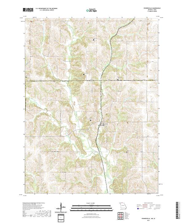 2021 Powersville2021 Print · USGSThe Missouri-Iowa borderlands near the start of the 2020s remain a landscape of quiet rural townships and winding creek forks. Local historians can trace family roots through numerous burial sites like Powersville Cemetery, Greer Cemetery, and the remote Wyreka Cemetery.
 - 2021 Map of Saint John, 2021 Print
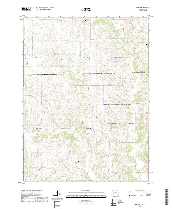 2021 Saint John2021 Print · USGSThe Missouri-Iowa borderlands come into focus in this recent survey of the Saint John area. Genealogists can locate family burial sites at Harris Cem, Genoa Cem, or Torrey Cem and trace the early road network near Locust Cr.
 - 2021 Map of Cleopatra, 2021 Print
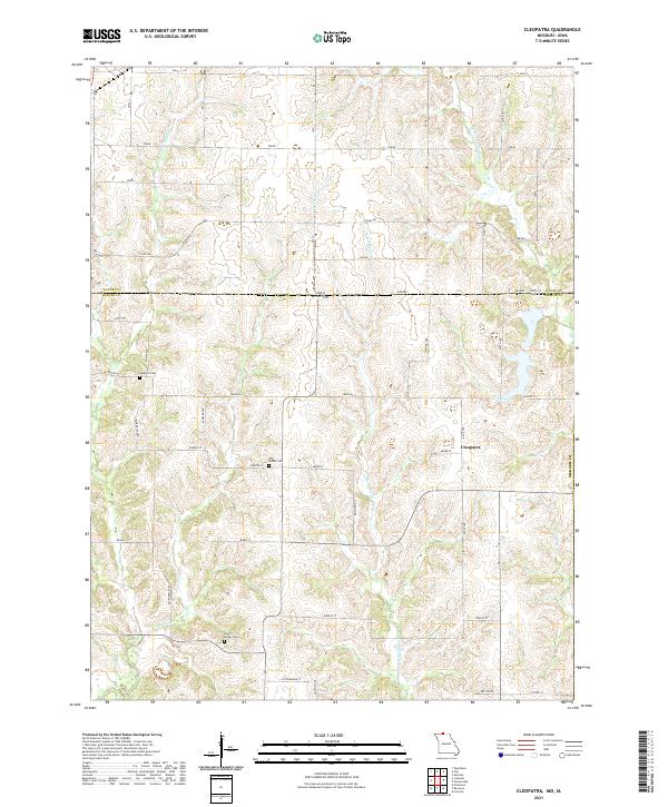 2021 Cleopatra2021 Print · USGSThe Missouri-Iowa border comes into focus in this recent survey of the rural landscape surrounding the settlement of Cleopatra. Genealogists and historians can locate family landmarks like Laughlin Cem and trace the winding course of Little Medicine Cr.
 - 2021 Map of Lake Thunderhead, 2021 Print
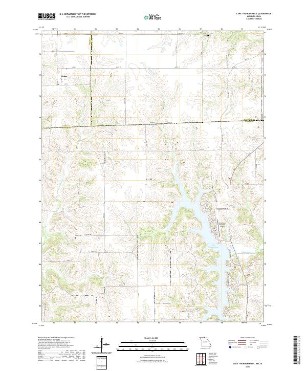 2021 Lake Thunderhead2021 Print · USGSThe Missouri-Iowa state line comes into focus in this recent survey of the lands around Lake Thunderhead and the village of Genoa. Genealogists and local historians can trace burial sites at Union Cem and Livingston Cem or locate the Unionville Municipal Airport.
 - 2022 Map of Clio, 2022 Print
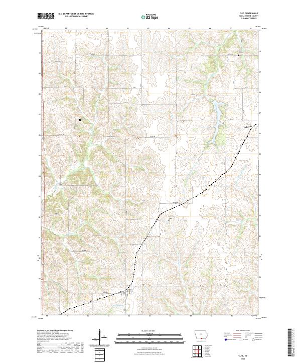 2022 Clio2022 Print · USGSWayne County's rural landscape is surveyed here in the modern era, centering on the township of Allerton. Researchers can trace local lineage and land use through well-marked sites like Clio Cem and the waters of the South Fork Chariton River.
 - 2022 Map of Garden Grove, 2022 Print
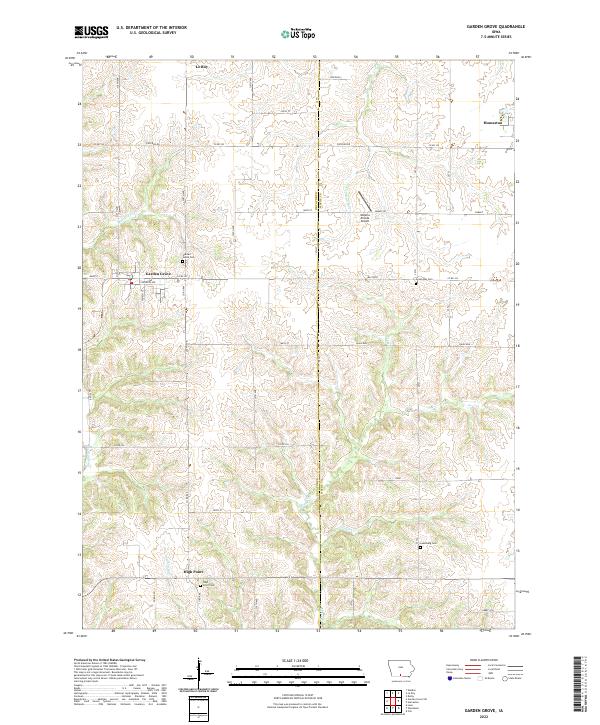 2022 Garden Grove2022 Print · USGSGarden Grove and the surrounding townships are captured in this modern survey of Southern Iowa's rolling farmland. Genealogists can locate family landmarks like Lewisburg Cem and High Point Cem or trace the winding paths of the Chariton River.
 - 2022 Map of Corydon, 2022 Print
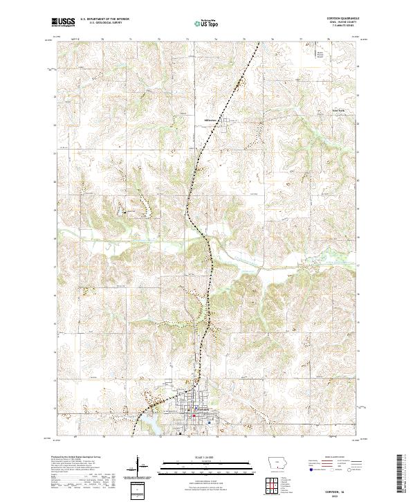 2022 Corydon2022 Print · USGSCorydon and the surrounding Wayne County prairie are documented here in the early twenty-first century, centered on the historic county seat. Researchers can locate family sites near Hogue Cem, the small community of Millerton, or the courthouse square in Corydon.
 - 2022 Map of Derby, 2022 Print
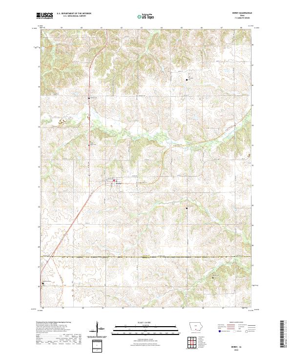 2022 Derby2022 Print · USGSThe Lucas County countryside around Derby is documented here during the early twenty-first century. Genealogists and historians can trace family locations through several rural cemeteries like Murray Cem and follow the route of the Cinder Path Trl.
 - 2022 Map of Seymour East, 2022 Print
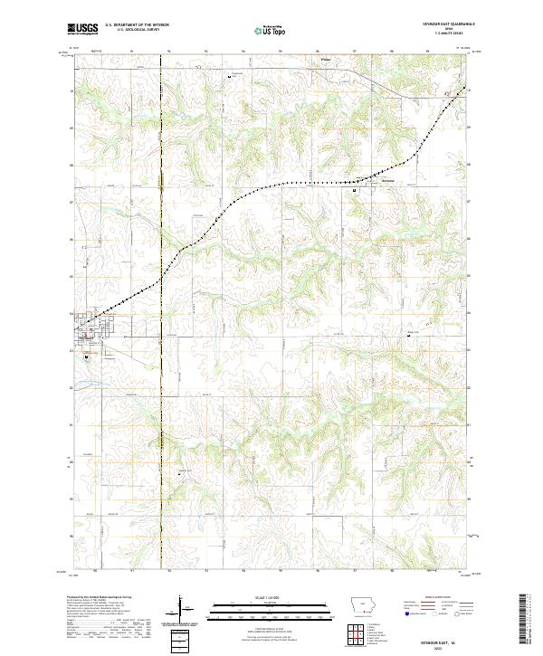 2022 Seymour East2022 Print · USGSSouthern Iowa's rural landscape is captured here during the 2020s, showing the settled farmsteads and small communities along the Appanoose and Wayne county line. Researchers can locate several burial sites including Jerome Cem and Shoultz Cem, or trace the path of Shoal Cr.
 - 2022 Map of Melrose, 2022 Print
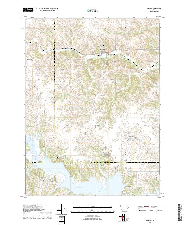 2022 Melrose2022 Print · USGSThe southern Iowa countryside near Melrose is captured here as it appeared in the early 2020s, dominated by the waters of Rathbun Lake. Genealogists and local historians can trace numerous family and community burial grounds, from Melrose Methodist Cem to the secluded Evans Cem near the Chariton River.
 - 2022 Map of Allerton, 2022 Print
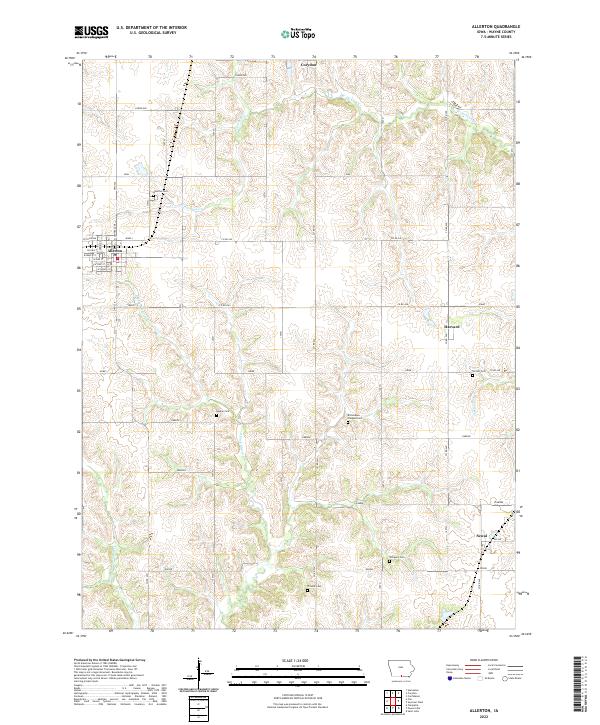 2022 Allerton2022 Print · USGSWayne County, Iowa, is documented here in the early twenty-first century, showing a landscape of traditional agriculture and rural townships. Family historians can trace local roots through numerous sites like Allerton Cem, Sewal, and Richardson Chappel Cem.
 - 2022 Map of Plano, 2022 Print
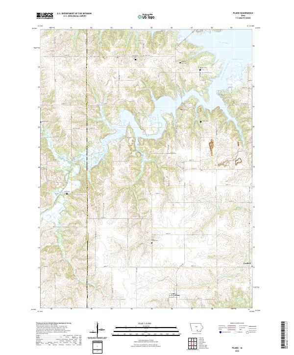 2022 Plano2022 Print · USGSThe Appanoose County countryside appears in detail here, showing the confluence of the South Fork Chariton River and the waters of Rathbun Lake. Researchers can locate several rural burial grounds, including the Lyon Family Cem and Cozad Cem, along with the small town of Plano.
 - 2022 Map of Confidence, 2022 Print
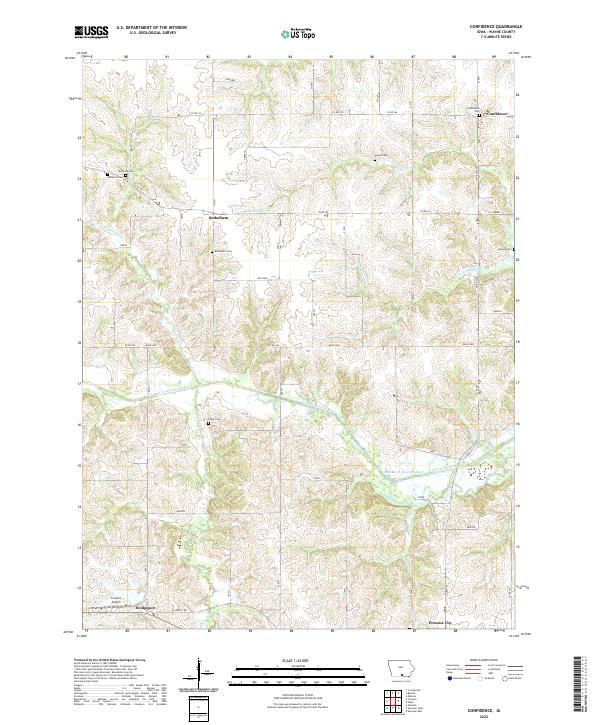 2022 Confidence2022 Print · USGSWayne County, Iowa, is shown here in the 2020s, featuring the quiet agricultural landscapes surrounding Promise City and Confidence. Researchers can trace old family sites and rural landmarks like Bethlehem Cem, Adcock Cem, and the path of the South Fork Chariton River.
 - 2022 Map of Russell, 2022 Print
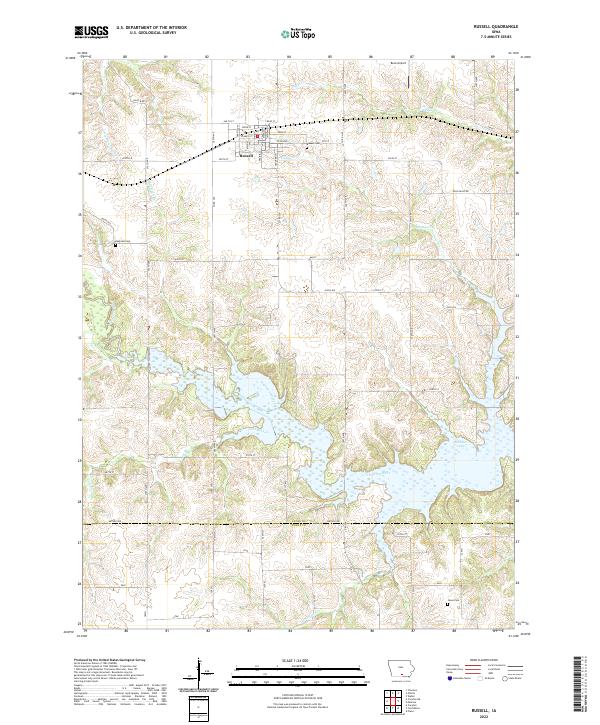 2022 Russell2022 Print · USGSThe Lucas County town of Russell and its surrounding farmsteads are shown here as they appeared in 2022. Trace family roots and local landmarks at Ragtown Cem, follow the flow of the Chariton River into Rathbun Lake, or locate the rural Beck Airport.
 - 2022 Map of Humeston, 2022 Print
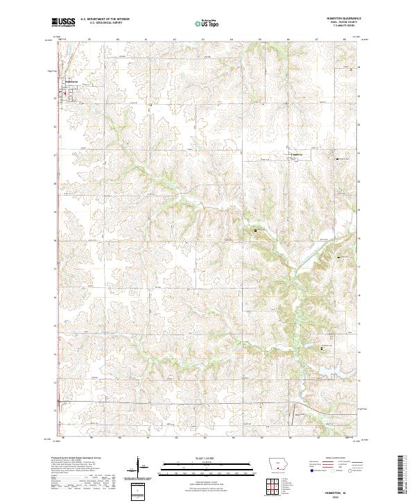 2022 Humeston2022 Print · USGSWayne County's agricultural heartland is documented here in the early twenty-first century, centered on the grid of Humeston. Local historians can trace family ties at Cambria Cem, Rush Cem, or Greenlee Cem along the S Fork Chariton River.
 - 2022 Map of Corydon NE, 2022 Print
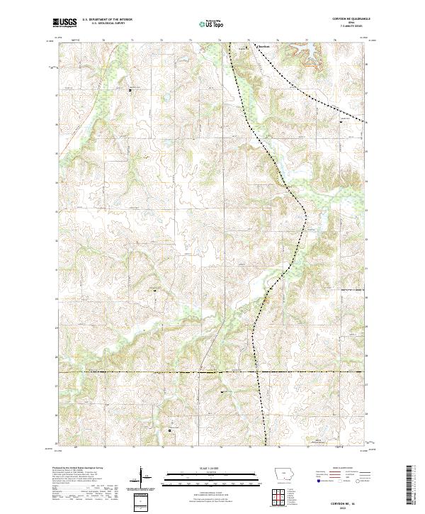 2022 Corydon NE2022 Print · USGSSouthern Iowa's rural landscape is documented here in the early twenty-first century as it spans the border of Lucas and Wayne Counties. Researchers can trace historic local burial grounds like Salem Cem and Freedom Cem or follow the Cinder Path Trl along the Chariton River.
 - 2022 Map of Woodland, 2022 Print
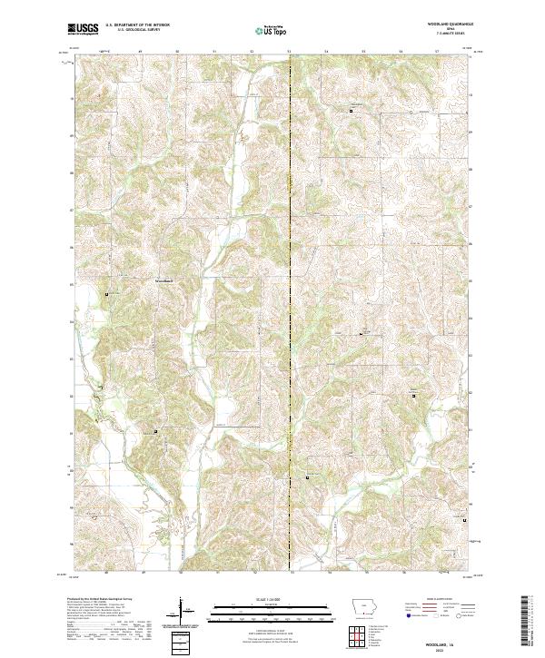 2022 Woodland2022 Print · USGSDecatur County in the 2020s remains a landscape of deep river valleys and quiet rural crossroads. Researchers can trace family history through numerous local burial sites like Shields Cem and Big Springs Cem while exploring the banks of the Weldon River.
 - 2022 Map of Le Roy, 2022 Print
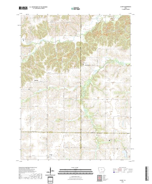 2022 Le Roy2022 Print · USGSSouthern Iowa’s multi-county borderlands are documented here, where early migration paths intersect with quiet rural settlements. Researchers can locate family burial grounds like Smyrna Cem and Gwinn Cem alongside the historic Morman Trl.
 - 2022 Map of Seymour West, 2022 Print
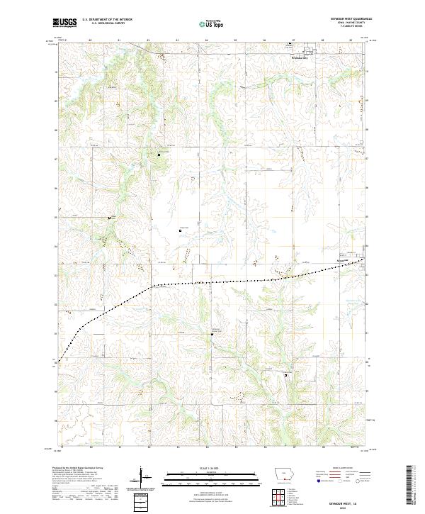 2022 Seymour West2022 Print · USGSWayne County, Iowa, is captured here in its modern agricultural form, showing the enduring rural layout of the southern prairie. Genealogists can locate several family burial sites including the Bollman Cem, Sharp Cem, and Tharp Cem.
 - 2022 Map of Lineville, 2022 Print
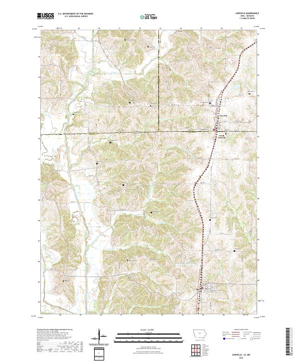 2022 Lineville2022 Print · USGSThe interstate border region of Iowa and Missouri comes to life in this survey of the area surrounding Lineville and Mercer. Genealogists can trace family heritage through over a dozen burial sites, including Evergreen Cem, Hollars Cem, and Middle Point Cem.
End of results
Showing maps 1-20 of 20
Top cities of Wayne County
- Corydon historical maps
- Seymour historical maps
- Humeston historical maps
- Allerton historical maps
- Lineville historical maps
- Promise City historical maps
See more
Frequently asked questions
- What are the different types of historical maps available for Wayne County?
- What is the oldest map of Wayne County?
- Where can I purchase historical maps of Wayne County for my home or office?
- Where can I download high-res historical maps of Wayne County?
- Are there historical topographic maps available for Wayne County?
- Is there historical aerial imagery available for Wayne County?
- Where are historical maps of Wayne County sourced from?