1980s Maps of Webster County, Iowa
Explore 8 historic maps of Webster County from the 1980s. These maps offer a rare glimpse into what life looked like during the 1980s — showing old roads, neighborhoods, homes, and landmarks that have changed or disappeared over time.
Whether you're researching your family's past, planning a metal detecting trip, or studying how Webster County's landscape evolved across the 1980s, these high-resolution maps are a powerful tool for exploring the history of this region.
- Focus on a specific era: All maps on this page are from the 1980s, giving you a focused view of this time period.
- See what’s changed: Compare century-old streets, trails, and buildings to today's modern landscape using overlays and satellite layers.
- Research with precision: Use these maps for genealogy, historical research, land use analysis, or educational projects.
- View, download, or print: Maps are fully viewable online in high resolution, and can be downloaded or printed for your own records.
Start exploring Webster County's history through authentic maps from the 1980s. This is your window into the past.
Webster County, IA maps
(8)- 1982 Map of Lanyon, 1983 Print
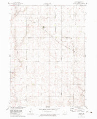 1982 Lanyon1983 Print · USGSGreene and Webster counties are captured here in the early eighties, showing a landscape of precise section grids and prairie streams. Genealogists can locate Township Cem and Renner Cem, or trace the rail sidings in Lanyon and Hope.
 - 1982 Map of Boxholm, 1983 Print
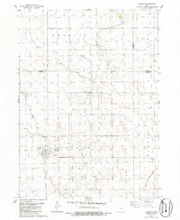
 1982 Boxholm1983 Print · USGSBoone and Webster County farmland is captured here in the early eighties, centered on the railroad towns of Boxholm and Pilot Mound. Genealogists and local historians can locate specific sites including Pioneer Graves, Grand Sch, and Union Cem.
 - 1984 Map of Humboldt, 1985 Print
 1984 Humboldt1985 Print · USGSNorth Central Iowa in the mid-eighties shows a deeply integrated landscape of agricultural drainage and rail-connected settlements. Trace the rural layout of the era via the Chicago and North Western line, Rush Lake, and Lizard Lake County Park.2 unique versions available
 - 1984 Map of Iowa Falls, 1985 Print
 1984 Iowa Falls1985 Print · USGSNorth-central Iowa is documented here during the mid-eighties, showing a landscape of traditional rail towns and extensive wildlife management areas. Researchers can trace family history through settlements like Belmond, Dows, and Ackley, or locate landmarks like Beeds Lake State Park.2 unique versions available
 - 1985 Map of Carroll
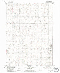
 1985 Carroll1985 Print · USGSWest-Central Iowa in the mid-eighties shows a landscape of highly engineered farmland and river-valley conservation. Researchers can trace the drainage patterns of Purgatory Creek or locate local landmarks like Dolliver Memorial State Park and the rail-junction town of Gowrie.
 - 1985 Map of Churdan
 1985 Churdan1985 Print · USGSThis Greene County community is captured in the mid-1980s as its rail-dependent past began to shift into the modern era. Genealogists and local historians can trace the Old Railroad Grade near Adaza or locate family plots at Highland Cem.
 - 1985 Map of Ames
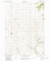
 1985 Ames1985 Print · USGSCentral Iowa's prairie landscape in the mid-eighties shows a well-established network of rail towns and conservation areas. Genealogists and historians can trace the paths of the Lincoln Highway and the Chicago and North Western line connecting Ames, Boone, and Webster City.
 - 1986 Map of Paton
 1986 Paton1986 Print · USGSMid-century Greene County comes into focus in this Iowa farm country survey where the Chicago and North Western rail line still serves the prairie. Genealogists and local historians can trace the Dawson Cem and the small siding at Lena.
End of results
Showing maps 1-8 of 8
Top cities of Webster County
Frequently asked questions
- What are the different types of historical maps available for Webster County?
- What is the oldest map of Webster County?
- Where can I purchase historical maps of Webster County for my home or office?
- Where can I download high-res historical maps of Webster County?
- Are there historical topographic maps available for Webster County?
- Is there historical aerial imagery available for Webster County?
- Where are historical maps of Webster County sourced from?