1970s Maps of Webster County, Iowa
Explore 12 historic maps of Webster County from the 1970s. These maps offer a rare glimpse into what life looked like during the 1970s — showing old roads, neighborhoods, homes, and landmarks that have changed or disappeared over time.
Whether you're researching your family's past, planning a metal detecting trip, or studying how Webster County's landscape evolved across the 1970s, these high-resolution maps are a powerful tool for exploring the history of this region.
- Focus on a specific era: All maps on this page are from the 1970s, giving you a focused view of this time period.
- See what’s changed: Compare century-old streets, trails, and buildings to today's modern landscape using overlays and satellite layers.
- Research with precision: Use these maps for genealogy, historical research, land use analysis, or educational projects.
- View, download, or print: Maps are fully viewable online in high resolution, and can be downloaded or printed for your own records.
Start exploring Webster County's history through authentic maps from the 1970s. This is your window into the past.
Webster County, IA maps
(12)- 1978 Map of Eagle Grove SW, 1979 Print
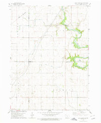 1978 Eagle Grove SW1979 Print · USGSThe rural borders of Webster, Wright, and Hamilton counties are captured here in the late 1970s, showing a landscape defined by industrial agriculture and the Boone River. Genealogists and researchers can locate family sites near Troy Cem or trace the path of the Chicago and North Western railroad.
 - 1978 Map of Duncombe, 1979 Print
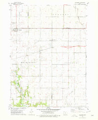 1978 Duncombe1979 Print · USGSIowa's agricultural heartland is documented here in the late seventies, showing the rail-dependent growth of Webster County. Genealogists and local researchers can locate St Josephs Cem and Blanchard Cem or trace the early paths of the Illinois Central Gulf through Duncombe.
 - 1978 Map of Eagle Grove, 1979 Print
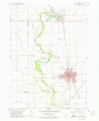 1978 Eagle Grove1979 Print · USGSWright County as the rail-and-river economy matured in the late seventies. Genealogists and researchers can trace the growth of Eagle Grove through its schools and cemeteries like Rose Hill Cem or locate the junction of the Rock Island and Pacific and Chicago and North Western lines.
 - 1978 Map of Stratford, 1979 Print
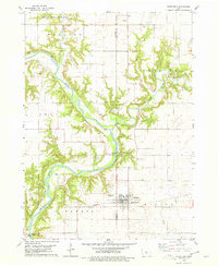 1978 Stratford1979 Print · USGSStratford and the surrounding river bluffs are documented in the late 1970s as the railroad and river define the local economy. Researchers can locate several family and pioneer burial sites like Vegors Cem and Homer Cem, or trace the rail path of the Chicago and North Western.
 - 1979 Map of Fort Dodge North
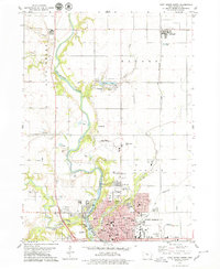 1979 Fort Dodge North1979 Print · USGSFort Dodge and the township of Badger are seen here in the late seventies as the river valley's industrial and residential corridors matured. Genealogists can locate several burial grounds like Corpus Christi Cem and St Paul Cem, while historians can trace the paths of the Illinois Central and North Western railroads.
 - 1979 Map of Thor
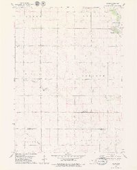
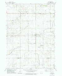 1979 Thor1979 Print · USGSHumboldt and Webster counties are captured in the late 1970s, showcasing the agricultural grid surrounding the rail town of Thor. Genealogists can locate several burial sites including East Ullensvang Cem, Norway Lake Cem, and Blossom Hill Cem.2 unique versions available
 - 1979 Map of Humboldt
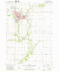 1979 Humboldt1979 Print · USGSHumboldt and Dakota City sit at the junction of the Des Moines River forks during the late seventies, a period of established civic and rail infrastructure. Researchers can trace family roots through several rural burial grounds like Union Cem and Indian Mound Cem or locate vanished local schools such as Meuse Sch.
 - 1979 Map of Clare
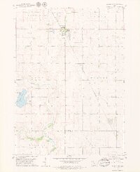
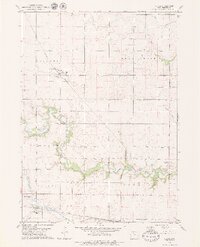 1979 Clare1979 Print · USGSMid-century Iowa agriculture and rail networks converge here during the late seventies, centered on the settlements of Clare and Barnum. Researchers can locate several family burial sites like Trinity Cem or trace the Illinois Central Gulf rail line.2 unique versions available
 - 1979 Map of Gilmore City SW
 1979 Gilmore City SW1979 Print · USGSThe rural intersection of Pocahontas, Webster, and Calhoun Counties is captured here in the late seventies. Genealogists and local historians can trace family roots at Lizard Cem and St Josephs Cem, or follow the Illinois Central Gulf rail line.
 - 1979 Map of Unique
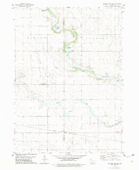
 1979 Unique1979 Print · USGSHumboldt and Webster counties come into focus during the late 1970s, showing a rural Iowa landscape shaped by the Des Moines River. Genealogists and local historians can trace the settlement at Unique, locate Township Cem, and explore the grounds of Joe Sheldon County Park.
 - 1979 Map of Gilmore City
 1979 Gilmore City1979 Print · USGSGilmore City sits at the intersection of Pocahontas and Humboldt counties during the late seventies, a hub for rail and local quarrying. Trace the diagonal path of the Chicago and North Western railroad to Pioneer or find family history at St Johns Cem and Marble Valley Cem.2 unique versions available
 - 1979 Map of Vincent
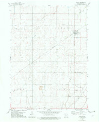 1979 Vincent1979 Print · USGSVincent and the surrounding Webster County townships are shown here in the late seventies as a structured agricultural landscape. Genealogists and researchers can pinpoint historical sites including St Johns Ch, Colfax Cem, and the railroad settlement of Industry.
End of results
Showing maps 1-12 of 12
Top cities of Webster County
Frequently asked questions
- What are the different types of historical maps available for Webster County?
- What is the oldest map of Webster County?
- Where can I purchase historical maps of Webster County for my home or office?
- Where can I download high-res historical maps of Webster County?
- Are there historical topographic maps available for Webster County?
- Is there historical aerial imagery available for Webster County?
- Where are historical maps of Webster County sourced from?