Old Maps of Webster County, Iowa for Academic Research
Study the evolution of Webster County with 166 high-resolution historic maps. Whether you're teaching, researching, or modeling changes in land use, these maps provide essential visual documentation of urban, environmental, and geographic change.
- Analyze long-term change: Track patterns in development, transportation, and natural features.
- Ideal for environmental or urban studies: Support academic projects with primary historical map data.
- Use in the classroom or lab: Educators and researchers rely on these maps to bring historical context to life.
These maps are a powerful tool for teaching, research, and visualizing how Webster County has changed over the decades.
Webster County, IA maps
(166)- 1916 Map of Boone
 1916 Boone1916 Print · USGSBoone and the Des Moines River valley appear here in the decade before the Great War, showing a landscape defined by deep river bluffs and heavy rail traffic. Genealogists can locate dozens of named rural schools such as Incline School and Coal Valley School, or trace the riverside streets of Moingona and Fraser.3 unique versions available
 - 1923 Map of Lehigh
 1923 Lehigh1923 Print · USGSWebster County in the early twenties centers on the industrial and mining hubs along the Des Moines River. Trace the history of regional industries through Clayworks, Coalville, and Kalo, or locate rural landmarks like Coon Mound and Wildcat Cave.3 unique versions available
 - 1923 Map of Fort Dodge
 1923 Fort Dodge1923 Print · USGSThe river valleys and rail corridors of North Central Iowa are detailed here in the years following the Great War. Genealogists and local historians can locate dozens of rural schoolhouses and the early footprints of Humboldt, Badger, and Fort Dodge.3 unique versions available
 - 1951 Map of Ogden
 1951 Ogden1951 Print · USGSCentral Iowa's farming heartland is captured here in the early fifties, showing a landscape defined by the intersection of the Chicago North Western and the Fort Dodge Des Moines and Southern. Researchers can trace vanished rural schoolhouses like Kelly Sch and the family history tied to Union Cem or Boxholm.3 unique versions available
 - 1954 Map of Waterloo, 1968 Print
 1954 Waterloo1968 Print · USGSCentral Iowa at the height of its mid-century agricultural and rail boom features the growing hubs of Waterloo and Cedar Falls. Genealogists and researchers can trace the rail corridors of the Chicago Great Western and find local landmarks like Iowa State College and Brushy Ridge.4 unique versions available
 - 1954 Map of Fort Dodge, 1968 Print
 1954 Fort Dodge1968 Print · USGSNorthwest Iowa is shown here during a period of steady industrial and rail activity in the mid-fifties. Researchers can trace the extensive rail lines connecting Fort Dodge to mining and manufacturing sites like Gypsum and Industry Station.3 unique versions available
 - 1955 Map of Waterloo
 1955 Waterloo1955 Print · USGSCentral Iowa in the mid-fifties presents a dense landscape of rail-connected farming towns and growing river cities. Researchers can trace ancestral roots and old transport routes through Waterloo, Marshalltown, and Ames, while locating rural Cemeteries and local Quarries.2 unique versions available
 - 1957 Map of Fort Dodge
 1957 Fort Dodge1957 Print · USGSWest-central Iowa thrived as a network of rail-linked agricultural hubs and river towns during the mid-fifties. Researchers can trace the development of the Des Moines River valley and locate historic landmarks in Fort Dodge, Storm Lake, and Lehigh.
 - 1958 Map of Fort Dodge
 1958 Fort Dodge1958 Print · USGSWestern Iowa in the mid-1950s reveals a productive landscape of river-valley industry and prairie agricultural hubs. Researchers can trace the development of the Des Moines River corridor through Fort Dodge and locate vanished local landmarks near Coalville or Storm Lake.
 - 1962 Map of Jefferson, 1964 Print
 1962 Jefferson1964 Print · USGSGreene County agriculture and rail commerce are at their peak in the early sixties as steam gives way entirely to diesel. Genealogists can locate family plots at Golgotha Cem, trace the rural North Sch, or explore the wetland edges of Goose Lake State Preserve.
 - 1965 Map of Fraser, 1966 Print
 1965 Fraser1966 Print · USGSThe Des Moines River valley in the mid-1960s reveals a rural landscape transitioning toward major hydrological management. Researchers can trace ancestral locations at Hardin Cem or Mineral Ridge Cem and locate vanished landmarks near Ridgeport and Fraser.
 - 1965 Map of Moorland, 1966 Print
 1965 Moorland1966 Print · USGSMoorland was a vital rail crossroads in the mid-1960s, where three major lines intersected amidst the fertile Iowa prairie. Researchers can trace family history at Our Lady of Good Council Cem or locate the small settlement of Roelyn and the Nepler Landing Field.
 - 1965 Map of Farnhamville, 1966 Print
 1965 Farnhamville1966 Print · USGSCalhoun and Webster counties appear in the mid-1960s as a productive agricultural engine shaped by rail lines and drainage projects. Researchers can trace family sites near Cedar Cem, the small elevator town of Slifer, or the early Old Railroad Grade.
 - 1965 Map of Fort Dodge South, 1966 Print
 1965 Fort Dodge South1966 Print · USGSSouthern Webster County in the mid-sixties reveals a river-driven landscape where industry meets the prairie. Genealogists and historians can trace the foundations of Coalville and Kalo or locate family sites at Elkhorn Cem and Graceland Cem.
 - 1965 Map of Lehigh, 1966 Print
 1965 Lehigh1966 Print · USGSWebster County in the mid-1960s displays a landscape of river-bend settlements and deep ravines along the Des Moines River. Researchers can trace the rail corridor of the Chicago and North Western and locate family burial sites at West Lawn Cem or Township Cem.
 - 1965 Map of Knierim, 1966 Print
 1965 Knierim1966 Print · USGSCalhoun County was a bustling rail hub in the 1960s, where four major lines crossed paths near the grain elevators and farms. Genealogists and rail historians can trace the exact routes of the Illinois Central and find local landmarks like Township Cem and Trinity Ch.
 - 1965 Map of Gowrie, 1966 Print
 1965 Gowrie1966 Print · USGSGowrie and Callender are captured in the mid-1960s at the height of their importance as a tri-railroad junction. Genealogists and rail historians can trace the paths of the Chicago Rock Island and Pacific and locate local landmarks like Danish Cem and Peterson Airport.
 - 1965 Map of Harcourt, 1966 Print
 1965 Harcourt1966 Print · USGSWebster County agriculture and rail transport meet in the mid-1960s as these prairie townships expand their drainage and transit networks. Trace the intersections of the Chicago and North Western through Harcourt or locate the Lost Grove Cem and small sidings like Lundgren.2 unique versions available
 - 1965 Map of Evanston, 1966 Print
 1965 Evanston1966 Print · USGSWebster County's river valleys and rail lines are captured here in the mid-sixties, showing the rural landscape before modern development. Genealogists and historians can locate old settlements like Border Plains and Evanston, or trace the OLD RAILROAD GRADE near the river.
 - 1978 Map of Eagle Grove SW, 1979 Print
 1978 Eagle Grove SW1979 Print · USGSThe rural borders of Webster, Wright, and Hamilton counties are captured here in the late 1970s, showing a landscape defined by industrial agriculture and the Boone River. Genealogists and researchers can locate family sites near Troy Cem or trace the path of the Chicago and North Western railroad.
 - 1978 Map of Duncombe, 1979 Print
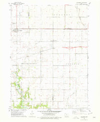 1978 Duncombe1979 Print · USGSIowa's agricultural heartland is documented here in the late seventies, showing the rail-dependent growth of Webster County. Genealogists and local researchers can locate St Josephs Cem and Blanchard Cem or trace the early paths of the Illinois Central Gulf through Duncombe.
 - 1978 Map of Eagle Grove, 1979 Print
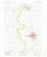 1978 Eagle Grove1979 Print · USGSWright County as the rail-and-river economy matured in the late seventies. Genealogists and researchers can trace the growth of Eagle Grove through its schools and cemeteries like Rose Hill Cem or locate the junction of the Rock Island and Pacific and Chicago and North Western lines.
 - 1978 Map of Stratford, 1979 Print
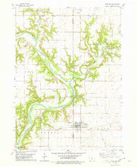 1978 Stratford1979 Print · USGSStratford and the surrounding river bluffs are documented in the late 1970s as the railroad and river define the local economy. Researchers can locate several family and pioneer burial sites like Vegors Cem and Homer Cem, or trace the rail path of the Chicago and North Western.
 - 1979 Map of Fort Dodge North
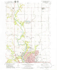 1979 Fort Dodge North1979 Print · USGSFort Dodge and the township of Badger are seen here in the late seventies as the river valley's industrial and residential corridors matured. Genealogists can locate several burial grounds like Corpus Christi Cem and St Paul Cem, while historians can trace the paths of the Illinois Central and North Western railroads.
 - 1979 Map of Thor
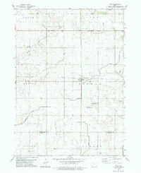 1979 Thor1979 Print · USGSHumboldt and Webster counties are captured in the late 1970s, showcasing the agricultural grid surrounding the rail town of Thor. Genealogists can locate several burial sites including East Ullensvang Cem, Norway Lake Cem, and Blossom Hill Cem.2 unique versions available
Showing maps 1-25 of 166
Top cities of Webster County
Frequently asked questions
- What are the different types of historical maps available for Webster County?
- What is the oldest map of Webster County?
- Where can I purchase historical maps of Webster County for my home or office?
- Where can I download high-res historical maps of Webster County?
- Are there historical topographic maps available for Webster County?
- Is there historical aerial imagery available for Webster County?
- Where are historical maps of Webster County sourced from?