2020s Maps of El Dorado, Kansas
Explore 2 historic maps of El Dorado from the 2020s. These maps offer a rare glimpse into what life looked like during the 2020s — showing old roads, neighborhoods, homes, and landmarks that have changed or disappeared over time.
Whether you're researching your family's past, planning a metal detecting trip, or studying how El Dorado's landscape evolved across the 2020s, these high-resolution maps are a powerful tool for exploring the history of this region.
- Focus on a specific era: All maps on this page are from the 2020s, giving you a focused view of this time period.
- See what’s changed: Compare century-old streets, trails, and buildings to today's modern landscape using overlays and satellite layers.
- Research with precision: Use these maps for genealogy, historical research, land use analysis, or educational projects.
- View, download, or print: Maps are fully viewable online in high resolution, and can be downloaded or printed for your own records.
Start exploring El Dorado's history through authentic maps from the 2020s. This is your window into the past.
El Dorado, KS maps
(2)- 2022 Map of El Dorado, 2022 Print
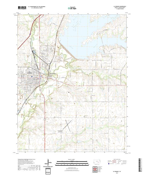 2022 El Dorado2022 Print · USGSEl Dorado and the Walnut River valley are shown here in the early twenty-first century as the regional hub of Butler County. Researchers can trace local history through markers like Belle Vista Cem, the Butler County Judicial Center, and Sherman Cem.
 - 2022 Map of El Dorado SW, 2022 Print
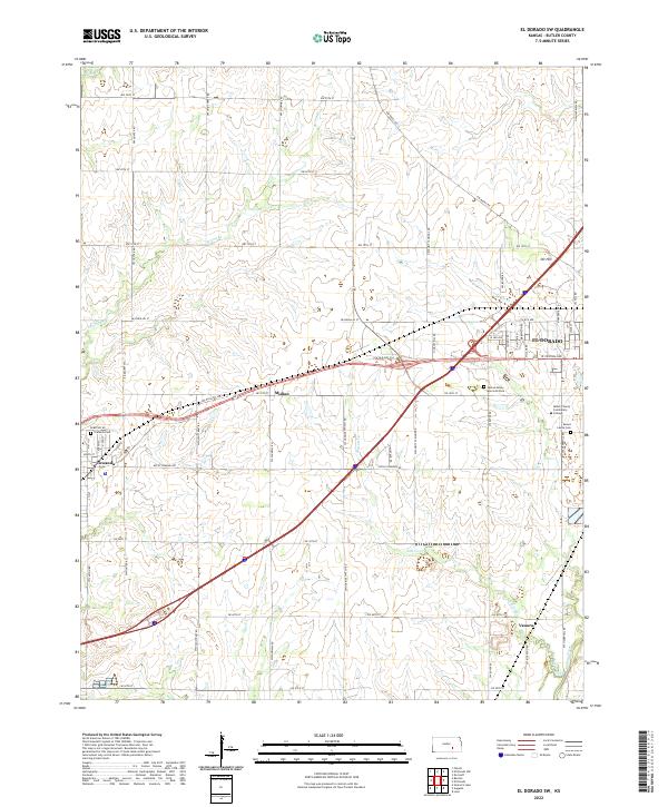 2022 El Dorado SW2022 Print · USGSButler County, Kansas, is shown in the modern era as a landscape defined by prairie creeks and growing suburban centers. Researchers can trace local history through the proximity of Midian and Oil Hill or find family sites at Towanda Cem and Sunset Lawns Cem.
End of results
Showing maps 1-2 of 2
Top cities near El Dorado
- Augusta historical maps
- Prospect historical maps
- Towanda historical maps
- Leon historical maps
- Potwin historical maps
- Chelsea historical maps
See more
Frequently asked questions
- What are the different types of historical maps available for El Dorado?
- What is the oldest map of El Dorado?
- Where can I purchase historical maps of El Dorado for my home or office?
- Where can I download high-res historical maps of El Dorado?
- Are there historical topographic maps available for El Dorado?
- Is there historical aerial imagery available for El Dorado?
- Where are historical maps of El Dorado sourced from?