1900s (20th Century) Maps of Chase County, Kansas
Explore 36 historic maps of Chase County from the 1900s (20th Century). These maps offer a rare glimpse into what life looked like during the 1900s — showing old roads, neighborhoods, homes, and landmarks that have changed or disappeared over time.
Whether you're researching your family's past, planning a metal detecting trip, or studying how Chase County's landscape evolved across the 1900s, these high-resolution maps are a powerful tool for exploring the history of this region.
- Focus on a specific era: All maps on this page are from the 1900s, giving you a focused view of this time period.
- See what’s changed: Compare century-old streets, trails, and buildings to today's modern landscape using overlays and satellite layers.
- Research with precision: Use these maps for genealogy, historical research, land use analysis, or educational projects.
- View, download, or print: Maps are fully viewable online in high resolution, and can be downloaded or printed for your own records.
Start exploring Chase County's history through authentic maps from the 1900s. This is your window into the past.
Chase County, KS maps
(36)- 1955 Map of Hutchinson, 1967 Print
 1955 Hutchinson1967 Print · USGSCentral Kansas in the mid-sixties reveals a landscape of growing reservoirs and evolving transportation corridors. Trace the development of towns like Hutchinson and Abilene alongside the Union Pacific Railroad and the expanding Interstate 70.3 unique versions available
 - 1957 Map of Elmdale, 1958 Print
 1957 Elmdale1958 Print · USGSThe Cottonwood River valley in the late fifties was a landscape of rail-driven commerce and small-town resilience. Trace the historic route of the Atchison Topeka and Santa Fe through Elmdale or locate the old Clements Sch near the riverbanks.
 - 1957 Map of Strong City, 1958 Print
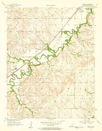
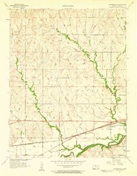
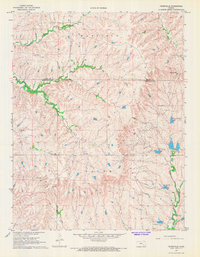
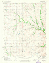
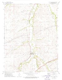
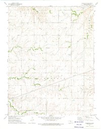
 1957 Strong City1958 Print · USGSChase County, Kansas, is shown here during the late fifties as the regional rail and river network shaped the prairie landscape. Genealogists and local historians can trace the foundations of Strong City, locating the Rodeo Grounds and family sites like Simmons Cem.2 unique versions available
 - 1957 Map of Wonsevu, 1958 Print
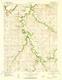 1957 Wonsevu1958 Print · USGSChase and Marion County farmland is captured here in the late fifties, showing the rural crossroads and creek-side settlements of the Kansas prairie. Genealogists and local historians can locate Wonsevu Cem, the Clothier Landing Field, and the winding Cedar Creek drainage.2 unique versions available
 - 1957 Map of Cedar Point, 1958 Print
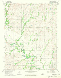
 1957 Cedar Point1958 Print · USGSCedar Point and the surrounding Kansas prairie are captured here in the late fifties as the regional rail-and-river economy flourished. Researchers can trace family history through sites like Drinkwater Cem, Montgomery Cem, and the Immanuel Ch.2 unique versions available
 - 1957 Map of Saffordville, 1958 Print
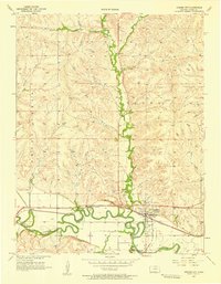
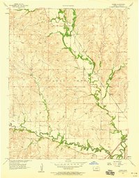
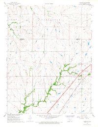
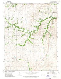
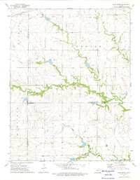
 1957 Saffordville1958 Print · USGSChase County agricultural life in the late fifties is centered here on the Cottonwood River valley and its vital rail links. Researchers can trace the rail sidings at Ellinor, the riverside streets of Saffordville, and local burials at Hillside Cem.3 unique versions available
 - 1957 Map of Hymer, 1958 Print
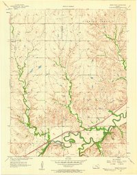
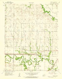
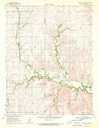
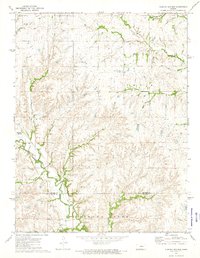
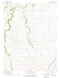
 1957 Hymer1958 Print · USGSChase County, Kansas, in the late fifties shows a rural landscape anchored by the Cottonwood River and its many tributaries. Genealogists and local historians can trace the paths of the Atchison Topeka and Santa Fe railroad and the small settlement of Hymer.2 unique versions available
 - 1957 Map of Plymouth, 1958 Print
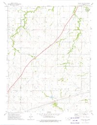
 1957 Plymouth1958 Print · USGSLyon and Chase County borders meet here in the late fifties, where the railroad and river define the local geography. Genealogists can trace family roots through sites like Hillside Cemetery and rural centers like Plymouth or the Cottonwood School.2 unique versions available
 - 1959 Map of Hutchinson
 1959 Hutchinson1959 Print · USGSCentral Kansas thrives at the intersection of rail and river in the mid-1950s, as post-war aviation infrastructure reshapes the prairie. Genealogists and historians can trace the paths of the AT&SF RR through Newton and Hutchinson, or locate military sites like Smoky Hill Air Force Base.2 unique versions available
 - 1962 Map of Florence SE, 1963 Print
 1962 Florence SE1963 Print · USGSThe Butler and Chase County borderlands come into focus in the early sixties as a landscape of prairie drainage and agricultural sectioning. Genealogists and historians can trace the Railroad Grade and locate features like an isolated Oil Well and the Walnut River.
 - 1967 Map of Thrall, 1968 Print
 1967 Thrall1968 Print · USGSIn the late 1960s, the Greenwood County landscape was a patchwork of agricultural townships and active petroleum production. Researchers can trace the legacy of the local oil industry through the Thrall Aagard Oil Field and find family sites like Andrew Cem or the Prairie Chapel Cem.
 - 1967 Map of Teterville, 1968 Print
 1967 Teterville1968 Print · USGSThe Flint Hills of Greenwood County come into focus during the late 1960s, showing a region where oil production meets traditional ranching. Researchers can trace the industrial footprint of Oil Wells near Teterville or locate family sites like High Prairie Cem.
 - 1967 Map of Cassoday, 1968 Print
 1967 Cassoday1968 Print · USGSThe tallgrass prairie of Butler County underwent significant changes in the late sixties as modern highways intersected old rail lines. Researchers can trace the path of the Atchison Topeka and Santa Fe through Cassoday, locate the Cassoday Cem, and follow the winding Walnut River.3 unique versions available
 - 1967 Map of Matfield Green SE, 1968 Print
 1967 Matfield Green SE1968 Print · USGSButler and Chase County history is revealed in the 1960s as major transit lines like the Kansas Turnpike cut through the Flint Hills. Genealogists and historians can trace the Old Indian Treaty Boundary and find local landmarks like Thurman and Fox Lake.
 - 1970 Map of Lincolnville NE, 1972 Print
 1970 Lincolnville NE1972 Print · USGSThe Flint Hills border of Marion and Chase counties is captured here in the early seventies, showing a landscape defined by deep creek valleys and open range. Researchers can trace family history at Elk Cem or locate early industrial sites like the local Quarry and Oil Well.
 - 1972 Map of Americus, 1974 Print
 1972 Americus1974 Print · USGSLyon and Morris counties in the early 1970s reveal a landscape of river-bottom farms and small-town rail connections. You can trace the Old Indian Treaty Boundary and locate family history at Dunlap Cem or the township of Toledo.
 - 1972 Map of Burdick, 1974 Print
 1972 Burdick1974 Print · USGSBurdick and the surrounding Flint Hills borderlands are captured here during the early seventies, centered on the Atchison Topeka and Santa Fe rail corridor. Genealogists and local historians can trace family land near Hebron Church or follow the winding courses of Sixmile Creek and Diamond Creek.
 - 1972 Map of Wilsey SE, 1974 Print
 1972 Wilsey SE1974 Print · USGSThe Flint Hills of Morris and Chase counties are captured here in the early 1970s, showcasing a landscape shaped by early surveyors and ranching. Trace the path of the Indian Treaty Boundary or locate landmarks like Fourmile Cem and the Missouri Pacific rail line.
 - 1972 Map of Diamond Springs, 1974 Print
 1972 Diamond Springs1974 Print · USGSThe Flint Hills region of central Kansas comes into focus in the early 1970s as railroads and winding creeks define the rural landscape. Genealogists and researchers can trace family roots near Diamond Creek Cem or follow the historic rail lines of the Atchison Topeka and Santa Fe.
 - 1972 Map of Lake Kahola, 1974 Print
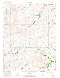
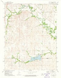 1972 Lake Kahola1974 Print · USGSThe Morris and Chase County borderlands come into focus during the early seventies, centered on the newly established Lake Kahola. Genealogists and local historians can trace the Old Indian Treaty Boundary and the path of the Missouri Pacific rail line.
 - 1973 Map of Matfield Green, 1975 Print
 1973 Matfield Green1975 Print · USGSChase County, Kansas, is documented here in the early 1970s as the modern toll road began to redefine the Flint Hills landscape. Researchers can trace the legacy of the Atchison Topeka and Santa Fe railroad, the Matfield Green Cem, and the Knute Rockne Memorial Monument.
 - 1973 Map of Shaw Creek, 1975 Print
 1973 Shaw Creek1975 Print · USGSThe Kansas Flint Hills of the early 1970s are captured here where the borders of Lyon, Chase, and Greenwood counties meet. Genealogists and researchers can locate the settlement of Kenbro and trace early petroleum activity through numerous Oil Wells and the winding Verdigris River.
 - 1973 Map of Gladstone, 1975 Print
 1973 Gladstone1975 Print · USGSThe Flint Hills of Chase County are captured in the early 1970s at a fascinating intersection of rail and road history. Genealogists and local historians can locate Gladstone, the Miller Cem, and the path of the Atchison Topeka and Santa Fe railway.
 - 1973 Map of Phenis Creek, 1975 Print
 1973 Phenis Creek1975 Print · USGSLyon and Chase Counties in the early 1970s reveal a landscape of prairie creeks and mid-century energy development. Researchers can locate the Ebenezer Ch, trace the Kansas Toll Road Turnpike, and identify sites within the local Oil Field.
 - 1973 Map of Homestead, 1975 Print
 1973 Homestead1975 Print · USGSChase County, Kansas, is captured in the early 1970s as a landscape of quiet prairie settlements and winding creek beds. Genealogists can locate the Homestead Cem and Community Hall, or trace rural life near Homestead and Ludwig.
Showing maps 1-25 of 36
Top cities of Chase County
- Cottonwood Falls historical maps
- Strong City historical maps
- Toledo historical maps
- Bazaar historical maps
- Matfield Green historical maps
- Cedar Point historical maps
See more
Frequently asked questions
- What are the different types of historical maps available for Chase County?
- What is the oldest map of Chase County?
- Where can I purchase historical maps of Chase County for my home or office?
- Where can I download high-res historical maps of Chase County?
- Are there historical topographic maps available for Chase County?
- Is there historical aerial imagery available for Chase County?
- Where are historical maps of Chase County sourced from?