Old Maps of Clifton, Kansas for Hiking & Exploration
Hike through history with 11 historic maps of Clifton. Explore old trails, ghost towns, and forgotten backroads — perfect for outdoor adventurers and local explorers.
- Rediscover forgotten places: Map out old mining camps, roads, and footpaths that no longer exist on modern maps.
- Layer with modern tools: Combine with LiDAR or satellite views to plan hikes through historical terrain.
- Made for exploration: Popular among hikers, overlanders, and local history lovers.
Use these maps to find adventure and explore the hidden past of Clifton.
Clifton, KS maps
(11)- 1893 Map of Washington
 1893 Washington1893 Print · USGSWashington County and its river valleys were being transformed by a massive expansion of rail lines in the 1890s. Researchers can trace the early footprints of settlements like Haddam, Clyde, and Linn along the Missouri Pacific Railway and the Republican River.4 unique versions available
 - 1955 Map of Manhattan, 1964 Print
 1955 Manhattan1964 Print · USGSNorth Central Kansas is captured here in the mid-fifties, just as major flood control projects began reshaping the river valleys. Genealogists can locate family sites near St. Joseph Church, Sunset Cemetery, or along the busy tracks of the Rock Island RR.4 unique versions available
 - 1956 Map of Manhattan
 1956 Manhattan1956 Print · USGSNorth-central Kansas in the mid-fifties reveals a landscape defined by the convergence of the Republican River and Smoky Hill River. Historians can trace the rail corridors of the Union Pacific RR and Missouri Pacific RR through towns like Manhattan and Clay Center.
 - 1957 Map of Manhattan
 1957 Manhattan1957 Print · USGSNortheast Kansas in the mid-1950s reveals a landscape of expanding military installations and new water projects. Genealogists and historians can trace the rail-to-river economy through the Union Pacific RR and old settlements like Clay Center or Marysville.
 - 1965 Map of Clifton, 1966 Print
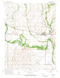 1965 Clifton1966 Print · USGSThe Republican River valley in the mid-1960s reveals a landscape where the Chicago Rock Island and Pacific railroad links the communities of Clifton and Vining. Local historians can trace cemetery locations like St Marys Cem and follow the winding courses of Dry Creek and Scribner Creek.
 - 1985 Map of Concordia
 1985 Concordia1985 Print · USGSNorth Central Kansas in the mid-eighties shows a robust agricultural and rail corridor centered on the Republican River. Genealogists and historians can trace rail lines and community centers like the St Joseph Ch, Belleville Cem, and Cloud County Comm College.2 unique versions available
 - 2009 Map of Clifton, 2009 Print
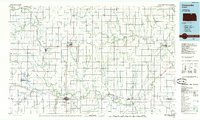
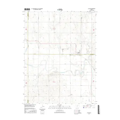
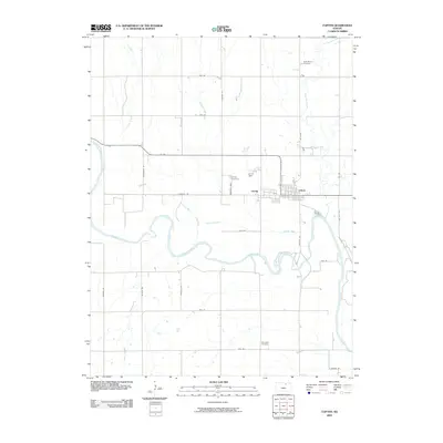 2009 Clifton2009 Print · USGSCovers Clifton, including Vining, Cloud County, and other nearby areas
 - 2012 Map of Clifton, 2012 Print
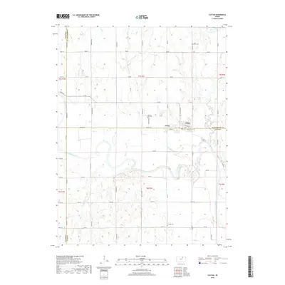
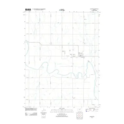 2012 Clifton2012 Print · USGSCovers Clifton, including Vining, Cloud County, and other nearby areas
 - 2016 Map of Clifton, 2016 Print
 2016 Clifton2016 Print · USGSCovers Clifton, including Vining, Cloud County, and other nearby areas
 - 2018 Map of Clifton, 2018 Print
 2018 Clifton2018 Print · USGSCovers Clifton, including Vining, Cloud County, and other nearby areas
 - 2022 Map of Clifton, 2022 Print
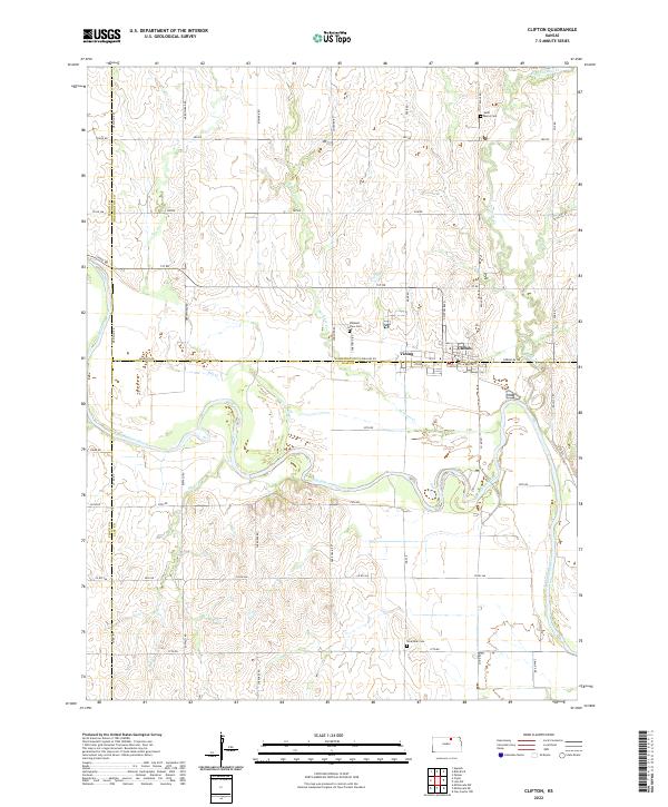 2022 Clifton2022 Print · USGSThe Republican River valley in the early 2020s shows the enduring agricultural grid of North Central Kansas. Trace family history and local boundaries through Clifton, Vining, and rural sites like Saint Marys Cem and Riverdale Cem.
End of results
Showing maps 1-11 of 11
Top cities near Clifton
- Clay Center historical maps
- Clyde historical maps
- Miltonvale historical maps
- Linn historical maps
- Morganville historical maps
- Palmer historical maps
See more
Frequently asked questions
- What are the different types of historical maps available for Clifton?
- What is the oldest map of Clifton?
- Where can I purchase historical maps of Clifton for my home or office?
- Where can I download high-res historical maps of Clifton?
- Are there historical topographic maps available for Clifton?
- Is there historical aerial imagery available for Clifton?
- Where are historical maps of Clifton sourced from?