Old Maps of Ford County, Kansas
Explore 194 old maps of Ford County, spanning from 1892 to today. These high-resolution historic maps reveal how streets, neighborhoods, landmarks, and natural features evolved over time — perfect for genealogy, metal detecting, research, and local history exploration.
What you can do with these maps:
- See how Ford County changed over time: Compare historical maps to modern-day views to trace roads, homesites, rail lines & more.
- View detailed metadata: Each map includes creators, publishers, year, scale, and archive source.
- Overlay maps with satellite & LiDAR: Visualize the past alongside modern tools to explore terrain & human change.
- Trusted historical sources: Maps sourced from the USGS, Library of Congress, and other archives.
- Access maps your way: View online, download high-res files, or order prints for personal or research use.
Start exploring old maps of Ford County to uncover forgotten places, hidden landmarks, and the deep history beneath your feet.
Ford County, KS maps
(194)- 1892 Map of Meade
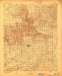
 1892 Meade1892 Print · USGSSouthwestern Kansas at the end of the nineteenth century centers on the growing rail hub of Meade. Genealogists and historians can trace early prairie settlements and rail stops like Fowler, Minneola, and the riverside site of Odee.5 unique versions available
 - 1892 Map of Dodge
 1892 Dodge1892 Print · USGSWestern Kansas at the close of the nineteenth century centers on the vital Arkansas River valley and its competing rail lines. Genealogists and historians can trace early prairie settlements like Montezuma, Ensign, and Cimarron alongside the namesake hub of Dodge.4 unique versions available
 - 1892 Map of Spearville
 1892 Spearville1892 Print · USGSWestern Kansas at the peak of the railroad boom comes to life in this late nineteenth-century survey of the high plains. Genealogists and researchers can trace early town sites like Ford, Spearville, and Bucklin along the Arkansas River and competing rail lines.
 - 1894 Map of Spearville
 1894 Spearville1894 Print · USGSWestern Kansas was undergoing a rail-driven boom during the late nineteenth century as new townships emerged along the prairie. Genealogists and historians can trace early trackside settlements like Spearville and Ford or follow the path of the Arkansas River and Coon Creek.4 unique versions available
 - 1896 Map of Ashland
 1896 Ashland1896 Print · USGSClark County at the close of the nineteenth century was a landscape of expanding railroads and emerging cattle-towns. Genealogists and researchers can trace the early footprints of Ashland, locate the remote Jacobs Well, and follow the original routes of the Atchison Topeka and Santa Fe R. R.3 unique versions available
 - 1955 Map of Pratt, 1968 Print
 1955 Pratt1968 Print · USGSSouth-central Kansas during the mid-fifties presents a landscape of sprawling oil fields and critical rail junctions. Researchers can trace the paths of the Atchison Topeka and Santa Fe railroad or locate local landmarks like the Blue Ridge Community House and Camp Carlisle.3 unique versions available
 - 1955 Map of Dodge City, 1968 Print
 1955 Dodge City1968 Print · USGSSouthwest Kansas in the mid-fifties reveals an expansive landscape of cattle towns, early gas fields, and prairie outposts. Researchers can trace rural school districts like Moundview and Good Luck or locate the Kansas State Game Farm near Lakin.3 unique versions available
 - 1958 Map of Dodge City
 1958 Dodge City1958 Print · USGSSouthwest Kansas in the late fifties shows a landscape of river-valley agriculture and burgeoning energy infrastructure. Genealogists can trace rural life through numerous landmarks like Fairview Cemetery, the Goodwell School, and Concord Church.
 - 1959 Map of Pratt
 1959 Pratt1959 Print · USGSSouth-central Kansas thrived as a rail and agricultural hub in the late fifties, where the Arkansas River meets a vast grid of section roads. Researchers can trace the path of the Missouri Pacific railroad through settlements like Turon and Stafford, or locate family landmarks like the Prairie Oak School.2 unique versions available
 - 1959 Map of Dodge City
 1959 Dodge City1959 Print · USGSSouthwest Kansas in the mid-fifties is captured at its agricultural height, centered on the vital rail and river hubs of Dodge City and Garden City. Genealogists and local historians can trace rural school districts like Shockey School and Hickok School or locate the Fairview Cemetery.
 - 1967 Map of Bloom, 1968 Print
 1967 Bloom1968 Print · USGSBloom and the surrounding Kansas plains were firmly defined by the rail and ranching economy in the late sixties. Researchers can trace the CHICAGO Rock Island and Pacific railroad and the historic Old Indian Treaty Boundary near Bloom Cem.
 - 1967 Map of Minneola, 1968 Print
 1967 Minneola1968 Print · USGSMinneola and the surrounding plains were a hub of rail and regional boundary lines in the late 1960s. Genealogists and researchers can trace the Old Indian Treaty Boundary across the county line and locate sites like the Kennedy Glider Port and Minneola Cem.
 - 1968 Map of Dodge City NE, 1969 Print
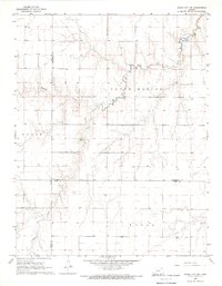
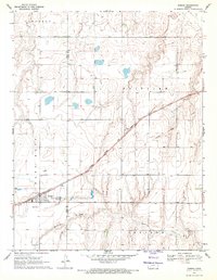
 1968 Dodge City NE1969 Print · USGSThe rural landscapes of Hodgeman and Ford counties are documented here in the late sixties, showing a period of agricultural stability and early industrial infrastructure. Researchers can trace the winding Saw Log Creek, identify local landmarks like St Michaels Cem, and explore the sprawling townships of South Roscoe and Grandview.
 - 1968 Map of Dodge City NW, 1969 Print
 1968 Dodge City NW1969 Print · USGSThe High Plains of Western Kansas appear in the late sixties at the intersection of Gray, Hodgeman, and Ford counties. Genealogists and researchers can trace the rural landscape across South Roscoe and Royal, following Buckner Creek and its South Fork.2 unique versions available
 - 1968 Map of Dodge City, 1969 Print
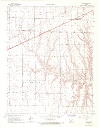
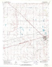
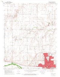 1968 Dodge City1969 Print · USGSDodge City thrived along the Arkansas River in the late sixties as a regional hub of education and transport. Researchers can locate Boot Hill, trace the Old Indian Treaty Boundary, and identify schools like Sacred Heart Sch.3 unique versions available
 - 1968 Map of Dodge City SW, 1969 Print
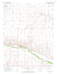 1968 Dodge City SW1969 Print · USGSThe Arkansas River valley west of Dodge City is shown here in the late sixties, where the Atchison Topeka and Santa Fe railroad defines the corridor. Researchers can locate the Ridenour Cem, the Townhall at Howell, and traces of an Abandoned Canal along the river bank.2 unique versions available
 - 1969 Map of Bucklin NE, 1971 Print
 1969 Bucklin NE1971 Print · USGSThe Kansas plains south of the Arkansas River come into focus in the late sixties, where agriculture and energy production intersect. Researchers can trace the layout of the Fralick West Oil Field and the rural reaches of Pleasant Valley and South Brown.
 - 1969 Map of Bucklin SE, 1971 Print
 1969 Bucklin SE1971 Print · USGSThe Kansas prairie south of the Arkansas River comes into focus in the late sixties, showing a landscape defined by rail and energy. Trace the path of the Chicago Rock Island and Pacific and locate scattered gas wells along Rattlesnake Creek.
 - 1969 Map of South Dodge, 1971 Print
 1969 South Dodge1971 Print · USGSFord County south of the Arkansas River in the late sixties shows a mix of industrial expansion and traditional farm life. Genealogists and historians can trace the Old Indian Treaty Boundary or find rural landmarks like Richland Valley Sch and Hope Ch.3 unique versions available
 - 1969 Map of Fort Dodge SW, 1971 Print
 1969 Fort Dodge SW1971 Print · USGSFord County and the High Plains are captured here in the late sixties, a period of transition for the Kansas ranching landscape. Researchers can trace the mid-century energy infrastructure through the Pipelines and Compressor Station that intersect with a rugged Jeep Trail.2 unique versions available
 - 1969 Map of Fowler, 1971 Print
 1969 Fowler1971 Print · USGSThe High Plains of Meade and Ford counties are captured here in the late sixties, centered on the Fowler settlement. Genealogists and historians can trace family locations near McCauley Cem, follow the Chicago Rock Island and Pacific rail line, or map the bends of Crooked Creek.2 unique versions available
 - 1969 Map of Fort Dodge, 1971 Print
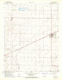
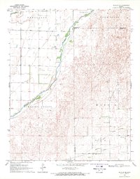
 1969 Fort Dodge1971 Print · USGSFort Dodge and the Arkansas River valley are captured in the late sixties as industrial transport and rural settlements defined the Ford County landscape. Researchers can trace the dual rail lines of the Atchison Topeka and Santa Fe and the Chicago Rock Island and Pacific near Wilroads Gardens.2 unique versions available
 - 1969 Map of Bucklin, 1971 Print
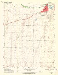
 1969 Bucklin1971 Print · USGSBucklin and the high plains of Ford County are captured in the late sixties at a critical rail intersection. Family historians and researchers can trace the town’s layout, including the Bucklin Cemetery, Bucklin Airfield, and the Chicago Rock Island and Pacific rail lines.
 - 1969 Map of Ensign, 1971 Print
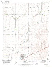
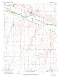
 1969 Ensign1971 Print · USGSThe community of Ensign and the surrounding High Plains are captured here during the late sixties. Genealogists and local researchers can trace the diagonal Atchison Topeka and Santa Fe Railroad Grade and locate the Johnson Cem and Ensign Cem.
 - 1969 Map of Ensign SE, 1971 Print
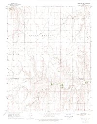
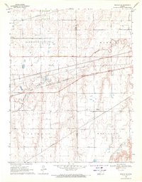
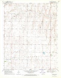 1969 Ensign SE1971 Print · USGSFord County in the late 1960s is captured here, marked by the diagonal path of the Old Indian Treaty Boundary. You can trace rural landmarks like the Concord Cem and the winding course of Mulberry Creek through the open prairie.
Showing maps 1-25 of 194
Top cities of Ford County
- Dodge City historical maps
- Spearville historical maps
- Bucklin historical maps
- Ford historical maps
- Bloom historical maps
Frequently asked questions
- What are the different types of historical maps available for Ford County?
- What is the oldest map of Ford County?
- Where can I purchase historical maps of Ford County for my home or office?
- Where can I download high-res historical maps of Ford County?
- Are there historical topographic maps available for Ford County?
- Is there historical aerial imagery available for Ford County?
- Where are historical maps of Ford County sourced from?