Old Maps of Newton, Kansas for Metal Detecting
Plan your next treasure hunt with 38 historic maps of Newton. Find old homesites, ghost towns, trails, and gathering spots that may be lost to time — perfect for identifying promising metal detecting locations.
- Locate forgotten sites: Uncover places like long-lost settlements, abandoned rail lines, or gathering spots.
- Plan better hunts: Use map overlays combined with LiDAR or satellite views to narrow in on historically rich areas.
- Made for detectorists: Thousands of hobbyists use these maps to discover relics, coins, and hidden history.
Use these historic maps to boost your research and find new opportunities beneath the surface of Newton.
Newton, KS maps
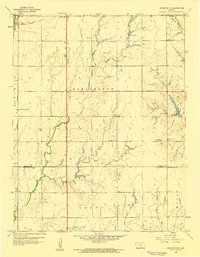
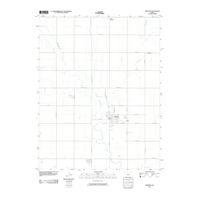
(38)- 1889 Map of Newton
 1889 Newton1889 Print · USGSRailroad expansion defines this Kansas landscape in the late 1880s, centered on the growing hubs of Newton and Marion. Genealogists and historians can trace the early grids of towns like Peabody, Hillsboro, and Lehigh as they appeared at their founding.
 - 1889 Map of Wichita
 1889 Wichita1889 Print · USGSWichita and its surrounding townships thrived as a rail-driven boomtown in the late nineteenth century. Genealogists can trace family footprints through early settlements like Oatville, Valley Center, and Douglass along the Arkansas River.
 - 1894 Map of Wichita
 1894 Wichita1894 Print · USGSWichita and the surrounding prairie are captured here during the height of the Victorian era's railroad boom. Genealogists and historians can trace the early development of Wichita and find vanished stations and rural townships like Indianola, Oatville, and Green Station.5 unique versions available
 - 1894 Map of Newton
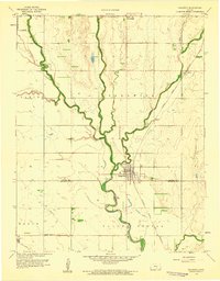
 1894 Newton1894 Print · USGSCentral Kansas was undergoing a rapid transformation into a rail-driven agricultural hub during the 1890s. Genealogists and historians can trace the early growth of Newton, Marion, and Peabody alongside branching rail lines and the winding COTTONWOOD RIVER.5 unique versions available
 - 1955 Map of Wichita, 1959 Print
 1955 Wichita1959 Print · USGSSouth-central Kansas comes alive in the mid-1950s as Wichita grows into its role as a regional industrial and military powerhouse. Trace the rail-and-river network connecting El Dorado and Arkansas City through the Atchison Topeka and Santa Fe lines.3 unique versions available
 - 1955 Map of Hutchinson, 1967 Print
 1955 Hutchinson1967 Print · USGSCentral Kansas in the mid-sixties reveals a landscape of growing reservoirs and evolving transportation corridors. Trace the development of towns like Hutchinson and Abilene alongside the Union Pacific Railroad and the expanding Interstate 70.3 unique versions available
 - 1957 Map of Newton, 1958 Print
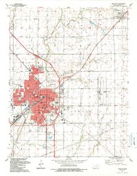
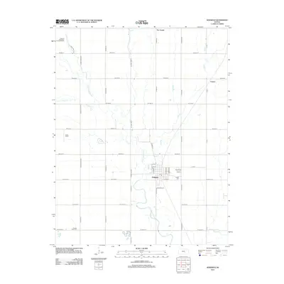
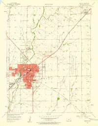 1957 Newton1958 Print · USGSNewton emerges as a bustling rail and educational hub in the late 1950s, defined by its historic college and intersecting rail lines. Researchers can locate family landmarks such as Greenwood Cemetery, Bethel College, and rural schools like Kellas Sch.2 unique versions available
 - 1958 Map of Wichita
 1958 Wichita1958 Print · USGSSouth Central Kansas in the late fifties was a landscape of aviation industry, oil exploration, and expanding turnpikes. Researchers can trace mid-century growth through McConnell Air Force Base, major facilities for Cessna Aircraft Company, and the active El Dorado Oil Field.
 - 1959 Map of Hutchinson
 1959 Hutchinson1959 Print · USGSCentral Kansas thrives at the intersection of rail and river in the mid-1950s, as post-war aviation infrastructure reshapes the prairie. Genealogists and historians can trace the paths of the AT&SF RR through Newton and Hutchinson, or locate military sites like Smoky Hill Air Force Base.2 unique versions available
 - 1959 Map of Sedgwick, 1960 Print
 1959 Sedgwick1960 Print · USGSThe Kansas plains meet the meandering Little Arkansas River in the late fifties as the town of Sedgwick continues its rail-and-river growth. Genealogists and local historians can trace legacy sites like Hillside Cemetery, the remote Putnam siding, and Pleasant Valley Church.2 unique versions available
 - 1959 Map of Sedgwick NE, 1960 Print
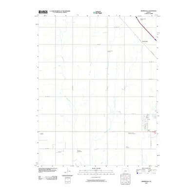
 1959 Sedgwick NE1960 Print · USGSHarvey and Sedgwick counties appear here at the close of the 1950s, when small rural school districts and oil extraction shaped the Kansas prairie. Genealogists can locate family-named landmarks like Dewey Sch, Norris Sch, and the Goodrich Oil Field.2 unique versions available
 - 1959 Map of Zimmerdale, 1960 Print
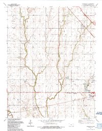
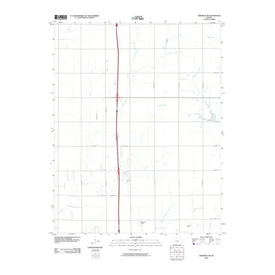
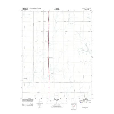
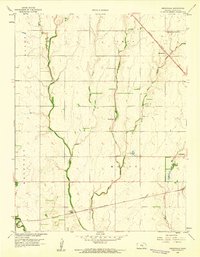 1959 Zimmerdale1960 Print · USGSHarvey County agricultural lands are captured here in the late fifties, showing the rural grid between Newton and Halstead. Researchers can locate the Pennsylvania Mennonite Ch, the Prouty School, and rail lines including the Missouri Pacific.4 unique versions available
 - 1985 Map of Wichita
 1985 Wichita1985 Print · USGSThe mid-1980s landscape of the Wichita metro area is captured here during a peak era for the local aviation industry. Researchers can trace the sprawling rail network of the Santa Fe and Frisco or locate family landmarks at White Chapel Cem and Cheney Reservoir.
 - 1985 Map of Hutchinson
 1985 Hutchinson1985 Print · USGSCentral Kansas in the mid-1980s is revealed here as a landscape of productive plains, rail corridors, and growing college towns. Genealogists and historians can trace family plots at McPherson Cemetery and follow the routes of the Missouri Pacific through settlements like Moundridge and Hesston.2 unique versions available
 - 1989 Map of Newton, 1990 Print
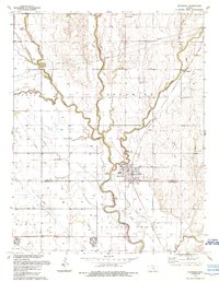
 1989 Newton1990 Print · USGSNewton and North Newton anchor this late-eighties survey of Harvey County during a period of steady prairie growth. Researchers can trace the legacy of rail and education through Bethel College, the Atchison Topeka and Santa Fe lines, and local landmarks like Greenwood Cemetery.
 - 1989 Map of Zimmerdale, 1990 Print
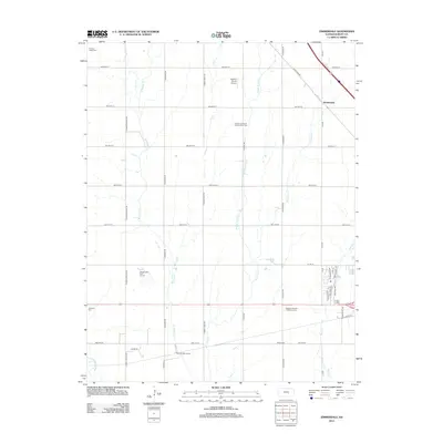
 1989 Zimmerdale1990 Print · USGSHarvey County’s agricultural heartland is documented here in the late eighties, showing the convergence of the Emma Creek system. Researchers can locate numerous local burial sites including Royer Cem and Church of God Cem, or trace the outskirts of Newton.
 - 1989 Map of Sedgwick, 1990 Print
 1989 Sedgwick1990 Print · USGSThe Harvey and Sedgwick county line area is detailed here in the late twentieth century as the Little Arkansas River winds past established town centers. Researchers can trace family roots at Pleasant Valley Ch or locate rural sites like Van Arsdale and Kemper Cem.
 - 1990 Map of Wichita
 1990 Wichita1990 Print · USGSThe Wichita metropolitan area and its surrounding agricultural plains are captured in the late twentieth century, showing a landscape defined by rapid suburban expansion and massive water projects. Genealogists can locate family landmarks in small towns like Garden Plain and Clonmel, or trace the development around Cheney Reservoir and McConnell Air Force Base.
 - 2009 Map of Newton, 2009 Print
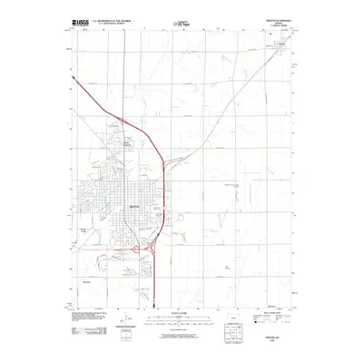 2009 Newton2009 Print · USGSCovers Newton, including North Newton, Walton, and other nearby areas
 - 2009 Map of Sedgwick, 2009 Print
 2009 Sedgwick2009 Print · USGSCovers Newton, including Sedgwick, Putnam, and other nearby areas
 - 2009 Map of Sedgwick NE, 2009 Print
 2009 Sedgwick NE2009 Print · USGSCovers Newton, including McLains, Kechi, and other nearby areas
 - 2009 Map of Zimmerdale, 2009 Print
 2009 Zimmerdale2009 Print · USGSCovers Newton, including Hesston, Halstead, and other nearby areas
 - 2012 Map of Sedgwick, 2012 Print
 2012 Sedgwick2012 Print · USGSCovers Newton, including Sedgwick, Putnam, and other nearby areas
 - 2012 Map of Sedgwick NE, 2012 Print
 2012 Sedgwick NE2012 Print · USGSCovers Newton, including McLains, Kechi, and other nearby areas
 - 2012 Map of Zimmerdale, 2012 Print
 2012 Zimmerdale2012 Print · USGSCovers Newton, including Hesston, Halstead, and other nearby areas
Showing maps 1-25 of 38
Top cities near Newton
- Wichita historical maps
- Park City historical maps
- Valley Center historical maps
- Hesston historical maps
- Halstead historical maps
- Sedgwick historical maps
See more
Top neighborhoods of Newton
Frequently asked questions
- What are the different types of historical maps available for Newton?
- What is the oldest map of Newton?
- Where can I purchase historical maps of Newton for my home or office?
- Where can I download high-res historical maps of Newton?
- Are there historical topographic maps available for Newton?
- Is there historical aerial imagery available for Newton?
- Where are historical maps of Newton sourced from?