Old Maps of Webber, Kansas for Genealogy
Trace your family roots with 10 historic maps of Webber. These high-res maps reveal old neighborhoods, homesites, landmarks, and streets — helping you uncover where your ancestors lived and how the area evolved over time.
- Explore historic neighborhoods: Identify where your relatives may have lived in the 1800s or 1900s.
- Compare maps over time: Trace the changes in streets, buildings, and landmarks for multi-generational research.
- Perfect for genealogy & ancestry research: Used by family historians and researchers to map out lineage and migration.
These maps are an incredible resource for exploring your personal connection to Webber's past.
Webber, KS maps
(10)- 1894 Map of Mankato
 1894 Mankato1894 Print · USGSJewell and Mitchell Counties come into focus during the late nineteenth-century expansion of the Kansas rail network. Genealogists and historians can trace the early development of Mankato, Burr Oak, and Cawker along the vital lines of the Missouri Pacific Railway.4 unique versions available
 - 1955 Map of Beloit, 1971 Print
 1955 Beloit1971 Print · USGSNorth Central Kansas in the mid-fifties shows a landscape of river-valley agriculture and expanding water infrastructure. Genealogists can trace the rail lines of the Union Pacific through towns like Nicodemus, Cawker City, and the State Sanatorium.3 unique versions available
 - 1959 Map of Beloit
 1959 Beloit1959 Print · USGSNorth Central Kansas at mid-century reveals a landscape shaped by river valleys and the expansion of massive water reservoirs. Genealogists and historians can trace the rail-town connections of Beloit and Norton or locate the site of the new Webster Dam.3 unique versions available
 - 1969 Map of Webber, 1971 Print
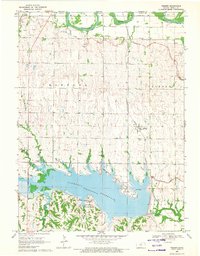 1969 Webber1971 Print · USGSThe northern reaches of Jewell County meet the Nebraska border here in the late sixties, where the recently completed Lovewell Reservoir reshaped the valley. Genealogists and local historians can trace the rail corridor of the Atchison Topeka and Santa Fe through Webber and locate rural landmarks like Montana Cem and Valley View Cem.
 - 1985 Map of Smith Center
 1985 Smith Center1985 Print · USGSNorth Central Kansas in the mid-eighties shows a landscape of small agricultural hubs like Smith Center and Mankato linked by the Missouri Pacific line. Researchers can locate the Geographic Center of 48 States and trace family roots near Fairview Cem or along Waconda Lake.2 unique versions available
 - 2009 Map of Webber, 2009 Print
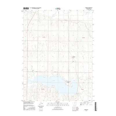
 2009 Webber2009 Print · USGSCovers Webber, including Jewell County, United States, and other nearby areas
 - 2012 Map of Webber, 2012 Print
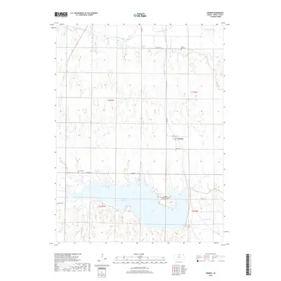
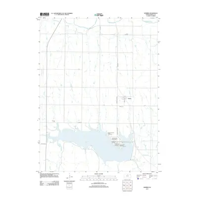 2012 Webber2012 Print · USGSCovers Webber, including Jewell County, United States, and other nearby areas
 - 2015 Map of Webber, 2015 Print
 2015 Webber2015 Print · USGSCovers Webber, including Jewell County, United States, and other nearby areas
 - 2018 Map of Webber, 2018 Print
 2018 Webber2018 Print · USGSCovers Webber, including Jewell County, United States, and other nearby areas
 - 2022 Map of Webber, 2022 Print
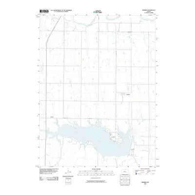
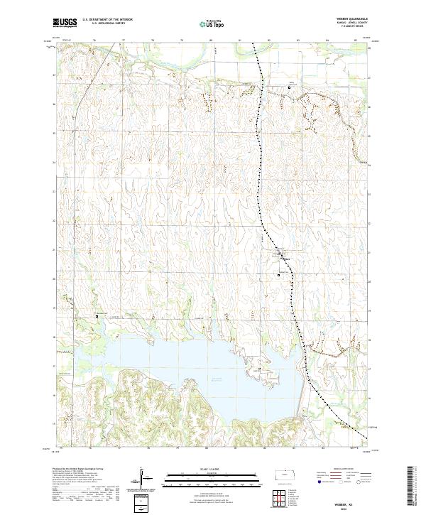 2022 Webber2022 Print · USGSIn the rural plains of northern Kansas, this contemporary survey shows the intersection of major water projects and small-town life. Genealogists can trace family landmarks like Webber Cem and Dahl Cem near the expansive waters of Lovewell Reservoir.
End of results
Showing maps 1-10 of 10
Top cities near Webber
- Superior historical maps
- Mankato historical maps
- Courtland historical maps
- Hardy historical maps
- Republic historical maps
- Ruskin historical maps
See more
Frequently asked questions
- What are the different types of historical maps available for Webber?
- What is the oldest map of Webber?
- Where can I purchase historical maps of Webber for my home or office?
- Where can I download high-res historical maps of Webber?
- Are there historical topographic maps available for Webber?
- Is there historical aerial imagery available for Webber?
- Where are historical maps of Webber sourced from?