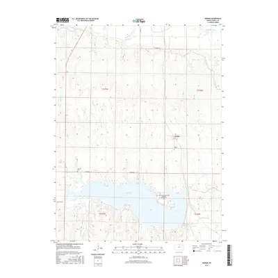
2015 Map of Webber
USGS Topo · Published 2015About this map
The Republican River and the extensive Lovewell Reservoir dominate this northern Kansas landscape along the border of Jewell County. The small community of Webber sits at a crossroads in the center of the map, serving as a hub for the surrounding agricultural sections. The area is marked by several significant burial sites that speak to the region's heritage, including the Webber Cem, Montana Cem, and the descriptively named White Rock Scandinavian Evangelical Lutheran Cem located near the reservoir's northern shore. Water management is a defining characteristic of this terrain, evidenced by the Courtland Canal in the northwest and various tributaries like White Rock Cr and Montana Cr that drain into the reservoir. The map illustrates a developed rural grid system connected by routes such as Webber Rd and N Shore Rd, highlighting the intersection of natural waterways and modern infrastructure.
Find a feature on this map
18 named features on this map. Tap any name to fly to it.
Don’t see what you’re looking for? This feature index may not catch every label — zoom into the map to look around manually.
Map Details
Editions of this 2015 Webber Map
This is the sole edition of this map. No revisions or reprints were ever made.
Other maps of this area

1892 · Concordia
USGS Topo · 1:125,000

1894 · Mankato
USGS Topo · 1:125,000

1898 · Superior
USGS Topo · 1:125,000

1898 · Hebron
USGS Topo · 1:125,000

1955 · Manhattan
USGS Topo · 1:250,000

1955 · Lincoln
USGS Topo · 1:250,000

1955 · Grand Island
USGS Topo · 1:250,000

1955 · Beloit
USGS Topo · 1:250,000

1956 · Manhattan
USGS Topo · 1:250,000

1957 · Manhattan
USGS Topo · 1:250,000