Old Maps of Kearny County, Kansas for Metal Detecting
Plan your next treasure hunt with 195 historic maps of Kearny County. Find old homesites, ghost towns, trails, and gathering spots that may be lost to time — perfect for identifying promising metal detecting locations.
- Locate forgotten sites: Uncover places like long-lost settlements, abandoned rail lines, or gathering spots.
- Plan better hunts: Use map overlays combined with LiDAR or satellite views to narrow in on historically rich areas.
- Made for detectorists: Thousands of hobbyists use these maps to discover relics, coins, and hidden history.
Use these historic maps to boost your research and find new opportunities beneath the surface of Kearny County.
Kearny County, KS maps
(195)- 1891 Map of Larned, 1921 Print
 1891 Larned1921 Print · USGSThe Arkansas River valley at the close of the nineteenth century shows a landscape being rapidly transformed by rail and irrigation. Genealogists and historians can trace early prairie life through rail stops like Rush Centre, Garfield, and the hub at Larned.
 - 1900 Map of Syracuse
 1900 Syracuse1900 Print · USGSWestern Kansas at the turn of the century shows a frontier landscape shaped by the Arkansas River and the arriving railroad. Genealogists and researchers can locate early settlements like Hatton, Edwin, and Gognac along with the path of the Atchison Topeka and Santa Fe.5 unique versions available
 - 1900 Map of Lakin
 1900 Lakin1900 Print · USGSSouthwestern Kansas at the close of the nineteenth century is defined by the rail corridor along the Arkansas River and the early grid of prairie townships. Genealogists can trace pioneer-era locations like Ulysses and Shockey, or the remote station at Conductor.5 unique versions available
 - 1920 Map of Syracuse
 1920 Syracuse1920 Print · USGSWestern Kansas at the close of the frontier era centers on the vital Arkansas River valley and the reach of the railroad. Genealogists and local historians can trace early prairie settlements like Gognac, Hatton, and Kendall along the Atchison Topeka and Santa Fe line.
 - 1941 Map of Modoc
 1941 Modoc1941 Print · USGSWichita and Scott counties are shown just before the war, when the rural school system and the Missouri Pacific railroad anchored the High Plains economy. Researchers can locate numerous local landmarks including St Marys Cem, Lydia Ch, and schools like Prairie Bell Sch.
 - 1951 Map of Modoc, 1952 Print
 1951 Modoc1952 Print · USGSWestern Kansas farming communities are captured in the early fifties as the rural school system and steam-era rail lines still defined the landscape. Genealogists can locate family landmarks like St Marys Cem, Lydia Ch, and several country schools including Grandview Sch.
 - 1955 Map of Dodge City, 1968 Print
 1955 Dodge City1968 Print · USGSSouthwest Kansas in the mid-fifties reveals an expansive landscape of cattle towns, early gas fields, and prairie outposts. Researchers can trace rural school districts like Moundview and Good Luck or locate the Kansas State Game Farm near Lakin.3 unique versions available
 - 1955 Map of Scott City, 1969 Print
 1955 Scott City1969 Print · USGSWestern Kansas in the mid-fifties is captured here as a landscape of rural schoolhouses and significant rail corridors. Family historians can trace the locations of Skyline and Beaver Creek Schools or follow the Union Pacific line through Oakley and Sharon Springs.4 unique versions available
 - 1958 Map of Dodge City
 1958 Dodge City1958 Print · USGSSouthwest Kansas in the late fifties shows a landscape of river-valley agriculture and burgeoning energy infrastructure. Genealogists can trace rural life through numerous landmarks like Fairview Cemetery, the Goodwell School, and Concord Church.
 - 1958 Map of Scott City
 1958 Scott City1958 Print · USGSWestern Kansas at the peak of the post-war era reveals a landscape of high-plains agriculture and vital rail junctions. Genealogists and historians can trace old country school sites like Prairie Bell School, the landmark Chalk Pyramids, and small stops along the Union Pacific and Missouri Pacific.
 - 1959 Map of Dodge City
 1959 Dodge City1959 Print · USGSSouthwest Kansas in the mid-fifties is captured at its agricultural height, centered on the vital rail and river hubs of Dodge City and Garden City. Genealogists and local historians can trace rural school districts like Shockey School and Hickok School or locate the Fairview Cemetery.
 - 1959 Map of Ulysses NW, 1960 Print
 1959 Ulysses NW1960 Print · USGSSouthwestern Kansas during the late fifties reveals a high plains landscape transitioning into a major energy corridor. Researchers can trace local heritage at Shockey Cem or follow the drainage of Bear Creek and Wolf Creek amidst dozens of early Gas Well sites.
 - 1959 Map of Big Bow NE, 1960 Print
 1959 Big Bow NE1960 Print · USGSSouthwest Kansas at the close of the 1950s shows a landscape transformed by the regional gas boom. Researchers can trace the drainage of Bear Creek through Big Bow and Sherman townships or locate numerous scattered Gas Well sites.
 - 1959 Map of Ulysses NE, 1960 Print
 1959 Ulysses NE1960 Print · USGSIn the late 1950s, this portion of Southwest Kansas became a busy landscape of energy production and rural schooling. Local researchers can trace the mid-century gas boom through dozens of Gas Wells scattered near Pleasant Valley Sch and Lakin Draw.
 - 1959 Map of Hickok NW, 1960 Print
 1959 Hickok NW1960 Print · USGSGrant County and Kearny County are captured here during the late 1950s oil and gas expansion. Local historians can trace dozens of individual Gas Wells alongside rural landmarks like Hillcrest Sch and Warrendale Sch.
 - 1959 Map of Hickok NE, 1961 Print
 1959 Hickok NE1961 Print · USGSHaskell County and its neighbors are seen here in the late fifties, during a period of significant growth for the regional energy industry. Genealogists and researchers can locate rural landmarks such as Pleasant Prairie Ch, Pleasant Prairie Sch, and scores of Gas Wells.2 unique versions available
 - 1960 Map of Deerfield SE, 1961 Print
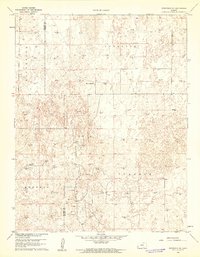 1960 Deerfield SE1961 Print · USGSFinney and Kearny Counties were entering a new era of petroleum production at the dawn of the sixties. Genealogists and historians can trace the intersection of ranching and industry through landmarks like Reeve Ranch and the many Gas Well sites across Ivanhoe.2 unique versions available
 - 1960 Map of Deerfield SW, 1961 Print
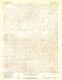 1960 Deerfield SW1961 Print · USGSWestern Kansas high plains are captured here in the early sixties as energy extraction began to reshape the rural landscape. Geologists and local historians can trace the distribution of the Gas Well network across the townships of South Side and Kendall.2 unique versions available
 - 1960 Map of Deerfield, 1961 Print
 1960 Deerfield1961 Print · USGSDeerfield and the Arkansas River valley are shown in the early 1960s during a period of significant irrigation and energy development. Genealogists and historians can trace the complex network of the Amazon Canal and Southside Ditch alongside the Lakin Cem and Pioneer Community Hall.2 unique versions available
 - 1960 Map of Deerfield NE, 1961 Print
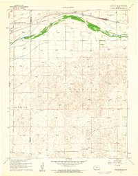 1960 Deerfield NE1961 Print · USGSThe Kansas High Plains meet the industrial age in the 1960s as irrigation and energy extraction transform the landscape. Trace the irrigation network of Great Eastern Ditch and the dozens of Gas Wells that dot the hills of Sherlock.2 unique versions available
 - 1965 Map of Wolf, 1967 Print
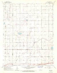 1965 Wolf1967 Print · USGSFinney County irrigation and rail networks are laid bare in the mid-sixties, showing the high-plains landscape before modern pivots. Genealogists can trace family connections to Wolf, Petersen, or Ritchal along the Garden City Western railroad line.
 - 1965 Map of Leoti 3 NW, 1967 Print
 1965 Leoti 3 NW1967 Print · USGSThe High Plains of Kearny County in the mid-sixties are defined by the winding paths of western Kansas drainage systems. Researchers can trace the local landscape through features like Fairview Cem, James Draw, and the township boundaries of West Hibbard.2 unique versions available
 - 1965 Map of Leoti 3 NE, 1967 Print
 1965 Leoti 3 NE1967 Print · USGSKearny County ranching country is captured here in the mid-1960s, showing a landscape defined by expansive draws and early energy development. Researchers can locate the Dienst Ranch, the North Kearny Sch, and topographic markers along James Draw.2 unique versions available
 - 1965 Map of Wolf NW, 1967 Print
 1965 Wolf NW1967 Print · USGSKearny County was undergoing a significant energy expansion in the mid-1960s as exploration moved across the High Plains. Researchers can pinpoint the exact locations of early industrial sites like a Pipeline and numerous Gas Wells along Campbell Draw.
 - 1965 Map of Wolf NE, 1967 Print
 1965 Wolf NE1967 Print · USGSWestern Kansas energy development is on full display in the mid-1960s as industrial exploration reaches across the High Plains. Researchers can trace the network of the East Hubbard Field and infrastructure like the Amazon Ditch.
Showing maps 1-25 of 195
Top cities of Kearny County
Frequently asked questions
- What are the different types of historical maps available for Kearny County?
- What is the oldest map of Kearny County?
- Where can I purchase historical maps of Kearny County for my home or office?
- Where can I download high-res historical maps of Kearny County?
- Are there historical topographic maps available for Kearny County?
- Is there historical aerial imagery available for Kearny County?
- Where are historical maps of Kearny County sourced from?