2020s Maps of Kiowa County, Kansas
Explore 15 historic maps of Kiowa County from the 2020s. These maps offer a rare glimpse into what life looked like during the 2020s — showing old roads, neighborhoods, homes, and landmarks that have changed or disappeared over time.
Whether you're researching your family's past, planning a metal detecting trip, or studying how Kiowa County's landscape evolved across the 2020s, these high-resolution maps are a powerful tool for exploring the history of this region.
- Focus on a specific era: All maps on this page are from the 2020s, giving you a focused view of this time period.
- See what’s changed: Compare century-old streets, trails, and buildings to today's modern landscape using overlays and satellite layers.
- Research with precision: Use these maps for genealogy, historical research, land use analysis, or educational projects.
- View, download, or print: Maps are fully viewable online in high resolution, and can be downloaded or printed for your own records.
Start exploring Kiowa County's history through authentic maps from the 2020s. This is your window into the past.
Kiowa County, KS maps
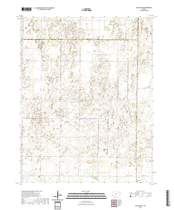
(15)- 2022 Map of Haviland, 2022 Print
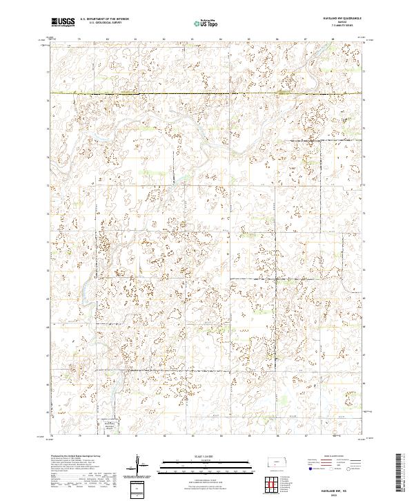
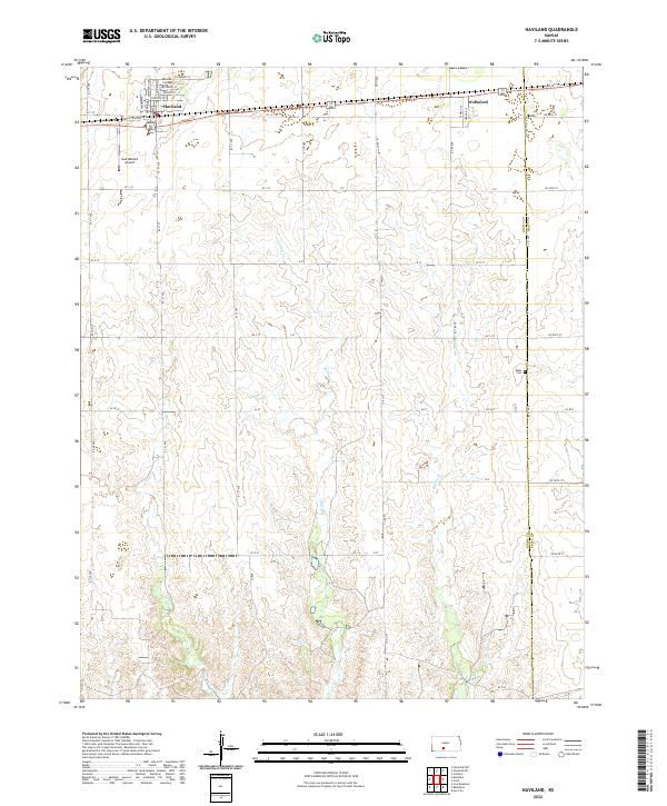 2022 Haviland2022 Print · USGSKiowa County communities like Haviland and Wellsford anchor this recent look at the agricultural plains of southern Kansas. Researchers can trace local landmarks such as Barclay College, the Gail Ballard Airport, and the rural Boles Cem.
 - 2022 Map of Bucklin NE, 2022 Print
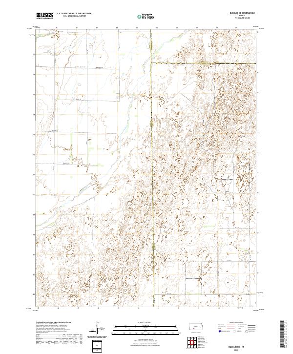 2022 Bucklin NE2022 Print · USGSThe Kansas prairie at the junction of Ford, Edwards, and Kiowa counties is captured here in the early 2020s. Researchers can trace the path of the Arkansas River and find family-named routes like Marshall Rd and the evocatively named Butter and Egg Rd.
 - 2022 Map of Greensburg NW, 2022 Print
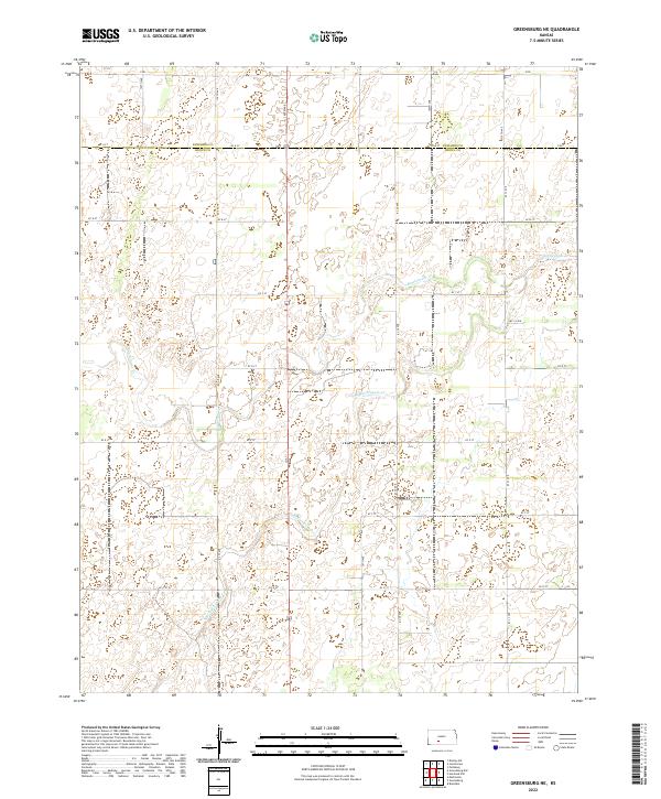
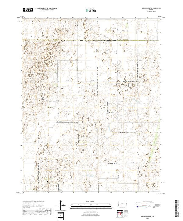 2022 Greensburg NW2022 Print · USGSThe rural borderlands of Edwards and Kiowa Counties are captured here in the early twenty-first century. Genealogists and local historians can locate burial sites at Bethel Cem and McKinley Cem along the winding course of Rattlesnake Cr.
 - 2022 Map of East Kiowa Creek North, 2022 Print
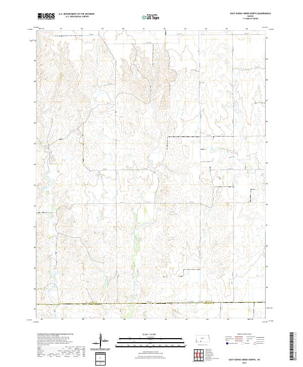 2022 East Kiowa Creek North2022 Print · USGSThe prairie landscape along the border of Kiowa and Comanche Counties is captured in this modern survey. Researchers can trace the drainage of Middle Kiowa Creek and the precise layout of rural routes like KC 12 Road and County Line Road.
 - 2022 Map of Greensburg, 2022 Print
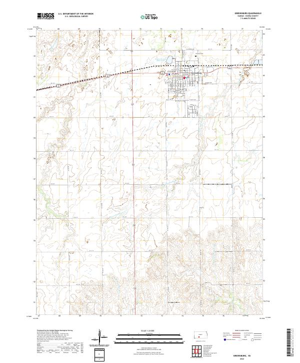 2022 Greensburg2022 Print · USGSGreensburg and the surrounding High Plains are captured here in the early twenty-first century as the community continues its legacy as a county seat. Genealogists and local historians can locate Fairview Cem, the Kiowa County Courthouse, and the headwaters of the Medicine Lodge River.
 - 2022 Map of Haviland NW, 2022 Print
 2022 Haviland NW2022 Print · USGSThe border of Kiowa and Edwards counties comes into focus in this recent survey of the Kansas prairie. Genealogists and local historians can trace the paths of Rattlesnake Cr and locate the Greensburg Municipal Airport amidst a grid of section roads like KC 37 Ave.
 - 2022 Map of Coldwater NE, 2022 Print
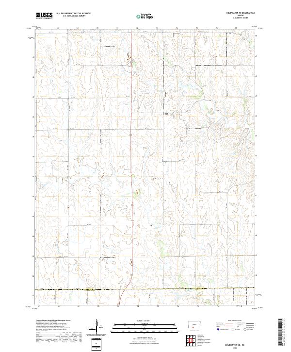 2022 Coldwater NE2022 Print · USGSKansas ranchlands and agricultural fields define the landscape at the Kiowa and Comanche county border in the early 2020s. Researchers can trace the upper reaches of the Medicine Lodge River and follow the route of 183 through the drainage basins of Mule Cr.
 - 2022 Map of Brenham, 2022 Print
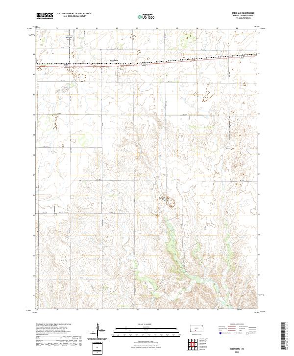 2022 Brenham2022 Print · USGSBrenham and the surrounding Kiowa County prairie are shown in high detail during the early 2020s. Researchers can trace the section-line roads and drainage of Thompson Cr or locate regional landmarks like the Greensburg Municipal Airport and Brenham.
 - 2022 Map of Mullinville, 2022 Print
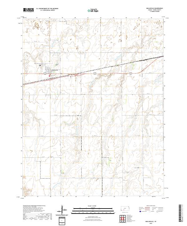 2022 Mullinville2022 Print · USGSThe Kiowa County prairie around Mullinville is captured here in the early 2020s, showing a landscape defined by ranching and small-town grit. Genealogists and local historians can trace the grid of Mullinville, locate Hillcrest Cem, and find the rural community of Joy.
 - 2022 Map of Iron Mountain, 2022 Print
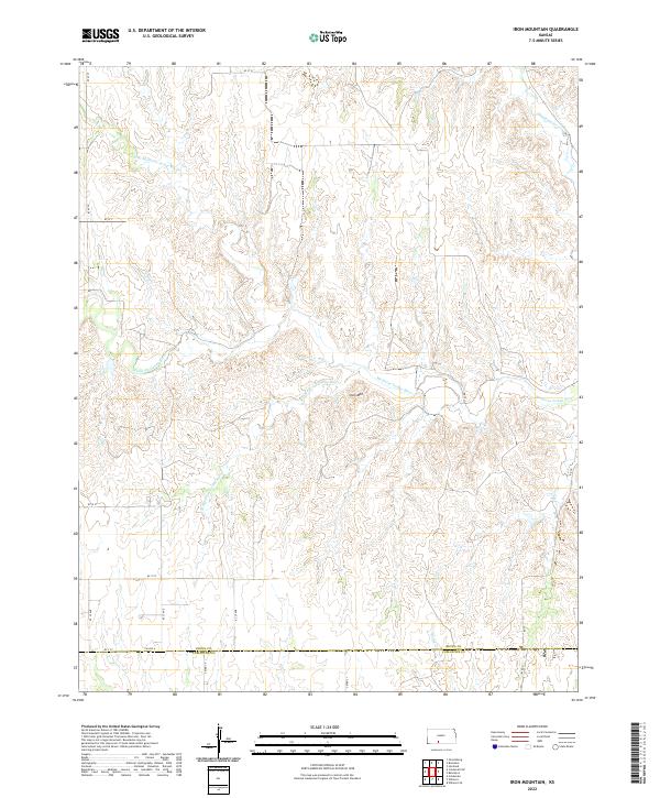 2022 Iron Mountain2022 Print · USGSKiowa and Comanche Counties at the start of the 2020s remain a landscape defined by the Medicine Lodge River and its many branches. Researchers can trace the rural road grid and find local landmarks like Iron Mtn and the headwaters of Thompson Cr.
 - 2022 Map of Turkey Creek, 2022 Print
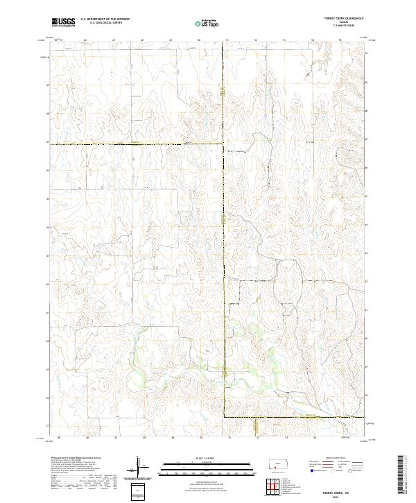 2022 Turkey Creek2022 Print · USGSSouthwestern Kansas ranching and farm country is captured here in the early twenty-first century as it spans the four-way meeting of Kiowa, Ford, Clark, and Comanche counties. Genealogists and historians can trace the paths of Turkey Cr and W Kiowa Cr as they navigate the section-line grids of Lane Rd and Zane Rd.
 - 2022 Map of Bucklin SE, 2022 Print
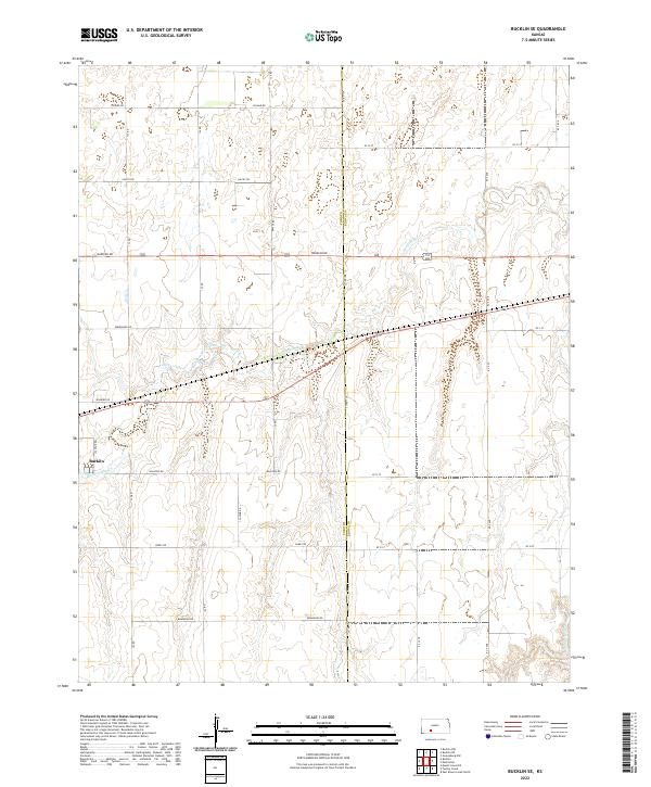 2022 Bucklin SE2022 Print · USGSThe rural landscape southeast of Bucklin comes to life in this recent survey of the Ford and Kiowa county line. Researchers can trace the drainage of Rattlesnake Cr and locate specific property blocks along named routes like Wrangler Rd and Wildfire Rd.
 - 2022 Map of Belvidere, 2022 Print
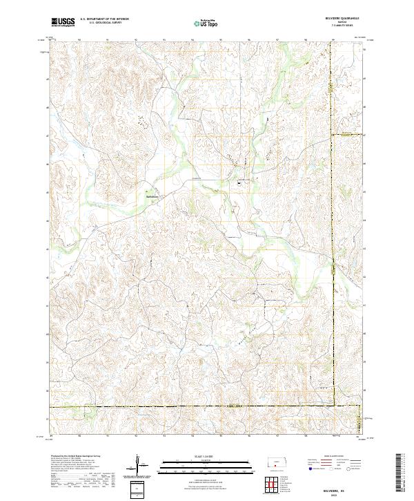 2022 Belvidere2022 Print · USGSBelvidere and the surrounding ranchlands of south-central Kansas are captured here in the early 2020s. Researchers can trace the winding Medicine Lodge River or locate family history at the Belvidere Cemetery and the central settlement of Belvidere.
 - 2022 Map of Greensburg NE, 2022 Print
 2022 Greensburg NE2022 Print · USGSThe Kansas high plains near the Edwards and Kiowa county line are shown in the early 2020s. Map collectors and researchers can trace the hydrology of Rattlesnake Cr and the grid of rural roads like KC A St and 140th Ave.
 - 2022 Map of Haviland NE, 2022 Print
 2022 Haviland NE2022 Print · USGSSouth-central Kansas prairie life is captured in this recent survey of the Kiowa and Edwards county lines. Genealogists and local historians can locate Providence Cem, Haviland Cem, and the natural waters of Lost Lake.
End of results
Showing maps 1-15 of 15
Frequently asked questions
- What are the different types of historical maps available for Kiowa County?
- What is the oldest map of Kiowa County?
- Where can I purchase historical maps of Kiowa County for my home or office?
- Where can I download high-res historical maps of Kiowa County?
- Are there historical topographic maps available for Kiowa County?
- Is there historical aerial imagery available for Kiowa County?
- Where are historical maps of Kiowa County sourced from?