1960s Maps of Leavenworth County, Kansas
Explore 9 historic maps of Leavenworth County from the 1960s. These maps offer a rare glimpse into what life looked like during the 1960s — showing old roads, neighborhoods, homes, and landmarks that have changed or disappeared over time.
Whether you're researching your family's past, planning a metal detecting trip, or studying how Leavenworth County's landscape evolved across the 1960s, these high-resolution maps are a powerful tool for exploring the history of this region.
- Focus on a specific era: All maps on this page are from the 1960s, giving you a focused view of this time period.
- See what’s changed: Compare century-old streets, trails, and buildings to today's modern landscape using overlays and satellite layers.
- Research with precision: Use these maps for genealogy, historical research, land use analysis, or educational projects.
- View, download, or print: Maps are fully viewable online in high resolution, and can be downloaded or printed for your own records.
Start exploring Leavenworth County's history through authentic maps from the 1960s. This is your window into the past.
Leavenworth County, KS maps
(9)- 1960 Map of Kansas City
 1960 Kansas City1960 Print · USGSMid-century Kansas and Missouri meet at the river forks, showing a sprawling rail-and-river economy during the 1950s growth era. Genealogists and researchers can trace tribal lands like the Kickapoo Indian Reservation or follow the early interstate corridors through Saint Joseph and Independence.3 unique versions available
 - 1960 Map of Potter, 1961 Print
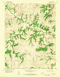 1960 Potter1961 Print · USGSNortheast Kansas at the start of the 1960s remains a landscape of rail-connected farming towns and deep, wooded creek valleys. Genealogists and historians can trace the foundations of local life through rural landmarks like St Johns Ch, Round Mound Cem, and the tracks of the Atchison Topeka and Santa Fe.4 unique versions available
 - 1961 Map of Lawrence
 1961 Lawrence1961 Print · USGSThe Kansas-Missouri borderland shows its mid-century transition from a rail-dependent agricultural region to a suburbanizing landscape. Genealogists can trace family footprints through numerous Cem sites and distinctive terrain landmarks like Graves Mound and Summers Mound.
 - 1961 Map of Weston, 1962 Print
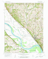 1961 Weston1962 Print · USGSThe Missouri River floodplain near the Kansas-Missouri border was a hive of rail and river activity in the early 1960s. Genealogists and historians can trace local landmarks like Graceland Cem, the Chicago Burlington and Quincy rail line, and the riverside community of Weston.3 unique versions available
 - 1961 Map of Oak Mills, 1962 Print
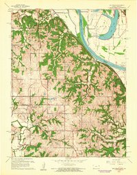 1961 Oak Mills1962 Print · USGSAcross the hills and river bottoms of the Kansas-Missouri border in the early 1960s, rural life followed the rails and riverbanks. Trace old school sites like St Patricks Sch and Lakeview Sch or the settlement at Oak Mills along the Missouri Pacific line.4 unique versions available
 - 1961 Map of Platte City, 1962 Print
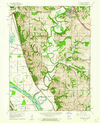 1961 Platte City1962 Print · USGSThe Missouri-Kansas borderlands in the early sixties reveal a landscape of river bends and railroad towns. Genealogists and historians can trace family-named sites like Jewett Cem or visit the rural Hickory Grove Ch and the Kansas State Penitentiary Farm.4 unique versions available
 - 1961 Map of Leavenworth, 1962 Print
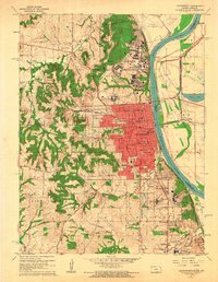 1961 Leavenworth1962 Print · USGSLeavenworth and its surrounding military and penal institutions are shown in detail during the early sixties. Genealogists can trace family footprints at Mount Muncie Cemetery or locate local landmarks like Bain City, Xavier, and St Marys College.4 unique versions available
 - 1961 Map of Easton, 1962 Print
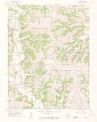 1961 Easton1962 Print · USGSLeavenworth County agriculture and community life are well-documented here in the early sixties. Researchers can pinpoint long-standing rural landmarks like St Thomas Cem, Wildwood Sch, and the quiet crossroads at Springdale.3 unique versions available
 - 1961 Map of Easton SW, 1962 Print
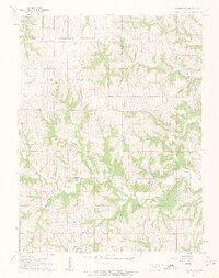 1961 Easton SW1962 Print · USGSJefferson County townships are mapped here in the early sixties, showing the rural structure of the Kansas landscape. Genealogists can locate family landmarks like St Lawrence Cem, Wise Cem, and the community gathering point at Hebron Ch.3 unique versions available
End of results
Showing maps 1-9 of 9
Top cities of Leavenworth County
- Leavenworth historical maps
- Lansing historical maps
- Fairmount historical maps
- Tonganoxie historical maps
- Basehor historical maps
- Kickapoo historical maps
See more
Frequently asked questions
- What are the different types of historical maps available for Leavenworth County?
- What is the oldest map of Leavenworth County?
- Where can I purchase historical maps of Leavenworth County for my home or office?
- Where can I download high-res historical maps of Leavenworth County?
- Are there historical topographic maps available for Leavenworth County?
- Is there historical aerial imagery available for Leavenworth County?
- Where are historical maps of Leavenworth County sourced from?