Old Maps of Leavenworth County, Kansas for Genealogy
Trace your family roots with 148 historic maps of Leavenworth County. These high-res maps reveal old neighborhoods, homesites, landmarks, and streets — helping you uncover where your ancestors lived and how the area evolved over time.
- Explore historic neighborhoods: Identify where your relatives may have lived in the 1800s or 1900s.
- Compare maps over time: Trace the changes in streets, buildings, and landmarks for multi-generational research.
- Perfect for genealogy & ancestry research: Used by family historians and researchers to map out lineage and migration.
These maps are an incredible resource for exploring your personal connection to Leavenworth County's past.
Leavenworth County, KS maps
(148)- 1885 Map of Lawrence, 1957 Print
 1885 Lawrence1957 Print · USGSEastern Kansas thrived during the mid-1880s as a vital corridor of rail-driven commerce and river valley agriculture. Genealogists and historians can trace old homesteads near the Kansas River and identify early township centers like Ottawa, Eudora, and Vinland.
 - 1886 Map of Oskaloosa, 1954 Print
 1886 Oskaloosa1954 Print · USGSEastern Kansas in the mid-1880s was a crossroads of major rail expansion and river commerce. Genealogists and historians can trace the early layouts of Oskaloosa and Valley Falls, or locate family sites near Jarbalo Mound and the Delaware River.
 - 1887 Map of Olathe
 1887 Olathe1887 Print · USGSEastern Kansas and the Missouri borderlands were being transformed by rail during the 1880s. Genealogists and historians can trace early town sites and railroad corridors like the Kansas City Clinton and Springfield Railroad and settlements from Lenexa to Osawatomie.
 - 1888 Map of Oskaloosa
 1888 Oskaloosa1888 Print · USGSNortheast Kansas in the late 1880s is captured here as a landscape defined by its river valleys and burgeoning rail towns. Researchers can trace the early footprints of Oskaloosa, Valley Falls, and Tonganoxie alongside the historic routes of the Union Pacific Railroad.
 - 1889 Map of Lawrence
 1889 Lawrence1889 Print · USGSEastern Kansas thrived as a rail-and-river hub in the late nineteenth century, as documented in this detailed survey. Genealogists can trace family roots through early settlements like Clinton, Vinland, and Eudora or locate land near the Marais Des Cygnes River.6 unique versions available
 - 1890 Map of Kansas City
 1890 Kansas City1890 Print · USGSThe Missouri River valley at the turn of the decade shows a booming rail-and-river economy centered on KANSAS CITY. Researchers can trace the early footprints of settlements like White Church, Lansing, and Smithville before modern expansion.2 unique versions available
 - 1893 Map of Olathe
 1893 Olathe1893 Print · USGSThe Kansas-Missouri border thrived during the late nineteenth century as a hub for expanding railroads and prairie commerce. Genealogists and historians can trace the early rail networks and locate frontier settlements like New Santa Fe, Olathe, and Paola.6 unique versions available
 - 1894 Map of Kansas City
 1894 Kansas City1894 Print · USGSThe Missouri River valley at the close of the nineteenth century was a bustling intersection of military life and frontier commerce. Genealogists can trace family roots through river towns like Weston and Parkville or locate early railroad hubs at Settles Station and Beverly Junction.14 unique versions available
 - 1894 Map of Oskaloosa
 1894 Oskaloosa1894 Print · USGSNortheast Kansas in the late nineteenth century was a landscape of burgeoning rail towns and river commerce. Genealogists can trace family roots through early settlements like Oskaloosa, Valley Falls, and Tonganoxie before modern highways reshaped the county.6 unique versions available
 - 1910 Map of Leavenworth
 1910 Leavenworth1910 Print · USGSLeavenworth and the Missouri River borderlands are captured here during a period of significant military and institutional growth. Researchers can trace family sites among dozens of landmarks like Slabtown, the U S Penitentiary Reserve, and Kickapoo School.8 unique versions available
 - 1934 Map of Bonner Springs
 1934 Bonner Springs1934 Print · USGSLeavenworth and Wyandotte counties are shown in detail during the mid-1930s, capturing the rural landscape before post-war suburbanization. Researchers can trace family homesteads near Fairmount, Lansing, and local landmarks like Coal Ridge Sch or Hoge Sch.
 - 1934 Map of Wolcott
 1934 Wolcott1934 Print · USGSThe Missouri River bottoms and the uplands of Wyandotte County appear here as they were in the mid-1930s. Researchers can trace the path of the Missouri Pacific RR and locate rural landmarks like White Church and the Kansas State Prison Camp No 2.
 - 1940 Map of Bonner Springs
 1940 Bonner Springs1940 Print · USGSThe Kansas and Missouri rivers converge near these busy rail corridors just before the Second World War. Researchers can trace rural life through dozens of named schools like Mission Sch and the community center at Elm Grove Community Hall.3 unique versions available
 - 1947 Map of Lawrence, 1954 Print
 1947 Lawrence1954 Print · USGSEastern Kansas and western Missouri thrive in the late 1940s, showing a landscape defined by major river valleys and a dense railway network. Genealogists can trace family settlements from Lawrence to Greenwood and locate landmarks like Olathe Navy and Lake Lotawana.
 - 1948 Map of Wolcott, 1954 Print
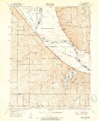 1948 Wolcott1954 Print · USGSThe Missouri River bottoms and Kansas uplands meet in the late 1940s, featuring a mix of prison farms, riverside towns, and new parklands. Genealogists can locate family names at Dunagan Cemetery or trace old school districts like Island Creek School and Center Point School.5 unique versions available
 - 1948 Map of Oak Mills, 1954 Print
 1948 Oak Mills1954 Print · USGSNortheastern Kansas in the late 1940s is captured here, showing the river bluffs and rail lines between Atchison and Leavenworth. Researchers can trace rural life through landmarks like Oak Mills, Lowemont, and numerous country schools such as Rock School and Wyman Sch.2 unique versions available
 - 1948 Map of Leavenworth, 1957 Print
 1948 Leavenworth1957 Print · USGSThe Missouri River corridor near Leavenworth and Weston was a vital hub of military and civic institutions in the late 1940s. Genealogists and historians can trace family roots at the Society of Sons of Death Cemetery or locate old schoolhouses like Coffin School and Hund School.4 unique versions available
 - 1948 Map of Jarbalo, 1967 Print
 1948 Jarbalo1967 Print · USGSLeavenworth County agricultural life is preserved here in the late 1940s, when small rural townships were dotted with family-named schools and creek-side cemeteries. You can trace the Union Pacific rail corridor or locate vanished local landmarks like Friendship Valley School, Jarbalo, and Eagle Cemetery.2 unique versions available
 - 1949 Map of Basehor, 1976 Print
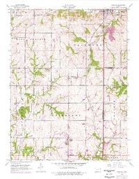 1949 Basehor1976 Print · USGSLeavenworth County agriculture and industry meet at the mid-century as the outskirts of Kansas City begin to stir. Genealogists can locate family sites like Holy Angels Cemetery, Little Stranger Church, and the grounds of the Kansas State Penitentiary.
 - 1950 Map of Basehor
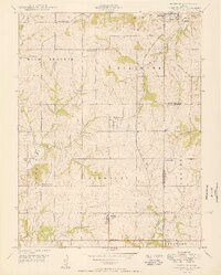 1950 Basehor1950 Print · USGSLeavenworth County agriculture and infrastructure are well-established by the late 1940s, centered on the growing community of Basehor. Researchers can trace old property landmarks like Little Stranger Church, the Kansas State Penitentiary, and Spring Hill School.3 unique versions available
 - 1950 Map of Kansas City
 1950 Kansas City1950 Print · USGSMid-century Kansas and Missouri are captured here during a period of industrial growth and shifting transportation. Genealogists and historians can trace rail lines like the Wabash RR or locate ancestral homes near the Potawatomi Indian Reservation and Horton.
 - 1950 Map of Easton
 1950 Easton1950 Print · USGSWestern Leavenworth County flourished as a dense network of farmstead communities at mid-century. Researchers can trace rural life through numerous landmarks like Eightmile House, St Joseph Church, and the Springdale School.2 unique versions available
 - 1950 Map of Lawrence
 1950 Lawrence1950 Print · USGSMid-century Kansas and Missouri come alive in this map of the river-valley corridors just as the interstate era was beginning. Researchers can trace the legacy of major rail lines like the Union Pacific RR and locate ancestral roots in towns from Lawrence to Harrisonville.
 - 1950 Map of Platte City
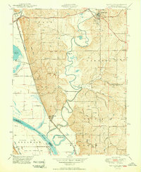 1950 Platte City1950 Print · USGSThe confluence of the Missouri and Platte Rivers at the mid-century reveals a landscape of fertile bottomlands and winding oxbows. Genealogists and historians can trace numerous rural sites like the Kansas State Penitentiary Farm, Hillsboro Church, and Hackberry School.2 unique versions available
 - 1950 Map of Jarbalo
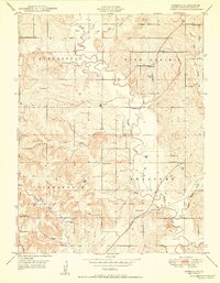 1950 Jarbalo1950 Print · USGSLeavenworth County at the mid-century reveals a landscape of thriving rural school districts and small crossroads communities. Researchers can trace the heritage of vanished country schools like Friendship Valley School and Hazel Ridge School or locate family plots at Eagle Cemetery.2 unique versions available
Showing maps 1-25 of 148
Top cities of Leavenworth County
- Leavenworth historical maps
- Lansing historical maps
- Fairmount historical maps
- Tonganoxie historical maps
- Basehor historical maps
- Kickapoo historical maps
See more
Frequently asked questions
- What are the different types of historical maps available for Leavenworth County?
- What is the oldest map of Leavenworth County?
- Where can I purchase historical maps of Leavenworth County for my home or office?
- Where can I download high-res historical maps of Leavenworth County?
- Are there historical topographic maps available for Leavenworth County?
- Is there historical aerial imagery available for Leavenworth County?
- Where are historical maps of Leavenworth County sourced from?