1970s Maps of Meade County, Kansas
Explore 6 historic maps of Meade County from the 1970s. These maps offer a rare glimpse into what life looked like during the 1970s — showing old roads, neighborhoods, homes, and landmarks that have changed or disappeared over time.
Whether you're researching your family's past, planning a metal detecting trip, or studying how Meade County's landscape evolved across the 1970s, these high-resolution maps are a powerful tool for exploring the history of this region.
- Focus on a specific era: All maps on this page are from the 1970s, giving you a focused view of this time period.
- See what’s changed: Compare century-old streets, trails, and buildings to today's modern landscape using overlays and satellite layers.
- Research with precision: Use these maps for genealogy, historical research, land use analysis, or educational projects.
- View, download, or print: Maps are fully viewable online in high resolution, and can be downloaded or printed for your own records.
Start exploring Meade County's history through authentic maps from the 1970s. This is your window into the past.
Meade County, KS maps
(6)- 1971 Map of Kismet, 1973 Print
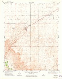 1971 Kismet1973 Print · USGSThe High Plains of Seward County are shown here in the early 1970s, as the energy economy transformed the local landscape. Genealogists and researchers can trace the rail corridor of the Chicago Rock Island and Pacific, locate the South Western Heights High Sch, and see the early footprint of Kismet.
 - 1971 Map of Kismet SW, 1973 Print
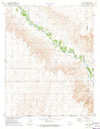 1971 Kismet SW1973 Print · USGSSeward County, Kansas, is captured in the early 1970s as an active energy landscape centered on the Cimarron River. Researchers can trace old family burial sites at Bixler Cem and locate the numerous Oil Wells that defined the local economy.
 - 1972 Map of Proffitt Lake, 1974 Print
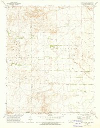
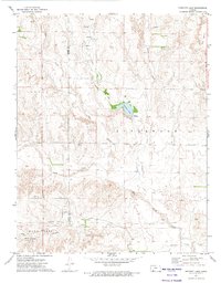 1972 Proffitt Lake1974 Print · USGSThe Kansas high plains near the turn of the 1970s reveal a landscape of creek drainages and historic borderlines. Researchers can locate the Old Indian Treaty Boundary, the Big Basin sinkhole, and remote Grave sites across the prairie.
 - 1972 Map of Proffitt Lake SW, 1974 Print
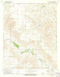 1972 Proffitt Lake SW1974 Print · USGSThe Kansas-Oklahoma border country comes into focus in the early 1970s as energy production and ranching define the landscape. Trace family history at Little Congregational Cem or follow the winding course of Crooked Creek past a remote Painter Landing Strip.
 - 1972 Map of Mount Helen, 1974 Print
 1972 Mount Helen1974 Print · USGSThe Kansas-Oklahoma borderlands in the early seventies reveal a landscape shaped by historical demarcations and modern energy production. Researchers can trace the Old Indian Treaty Boundary and locate family-interest landmarks like Mount Helen, Springs, and numerous early Gas Well sites.
 - 1972 Map of Proffitt Lake NW, 1974 Print
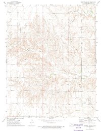 1972 Proffitt Lake NW1974 Print · USGSMeade County, Kansas, is captured in the early seventies as a landscape of energy exploration and quiet prairies. Genealogists and historians can locate the Little Congregational Cem and trace the riparian courses of Sand Creek and Twomile Creek.
End of results
Showing maps 1-6 of 6
Top cities of Meade County
Frequently asked questions
- What are the different types of historical maps available for Meade County?
- What is the oldest map of Meade County?
- Where can I purchase historical maps of Meade County for my home or office?
- Where can I download high-res historical maps of Meade County?
- Are there historical topographic maps available for Meade County?
- Is there historical aerial imagery available for Meade County?
- Where are historical maps of Meade County sourced from?