1900s (20th Century) Maps of Meade County, Kansas
Explore 28 historic maps of Meade County from the 1900s (20th Century). These maps offer a rare glimpse into what life looked like during the 1900s — showing old roads, neighborhoods, homes, and landmarks that have changed or disappeared over time.
Whether you're researching your family's past, planning a metal detecting trip, or studying how Meade County's landscape evolved across the 1900s, these high-resolution maps are a powerful tool for exploring the history of this region.
- Focus on a specific era: All maps on this page are from the 1900s, giving you a focused view of this time period.
- See what’s changed: Compare century-old streets, trails, and buildings to today's modern landscape using overlays and satellite layers.
- Research with precision: Use these maps for genealogy, historical research, land use analysis, or educational projects.
- View, download, or print: Maps are fully viewable online in high resolution, and can be downloaded or printed for your own records.
Start exploring Meade County's history through authentic maps from the 1900s. This is your window into the past.
Meade County, KS maps
(28)- 1955 Map of Dodge City, 1968 Print
 1955 Dodge City1968 Print · USGSSouthwest Kansas in the mid-fifties reveals an expansive landscape of cattle towns, early gas fields, and prairie outposts. Researchers can trace rural school districts like Moundview and Good Luck or locate the Kansas State Game Farm near Lakin.3 unique versions available
 - 1958 Map of Dodge City
 1958 Dodge City1958 Print · USGSSouthwest Kansas in the late fifties shows a landscape of river-valley agriculture and burgeoning energy infrastructure. Genealogists can trace rural life through numerous landmarks like Fairview Cemetery, the Goodwell School, and Concord Church.
 - 1959 Map of Dodge City
 1959 Dodge City1959 Print · USGSSouthwest Kansas in the mid-fifties is captured at its agricultural height, centered on the vital rail and river hubs of Dodge City and Garden City. Genealogists and local historians can trace rural school districts like Shockey School and Hickok School or locate the Fairview Cemetery.
 - 1962 Map of Irish Flats NE, 1964 Print
 1962 Irish Flats NE1964 Print · USGSMeade County is captured here in the early sixties as a landscape of rural schoolhouses and an expanding energy sector. Genealogists and researchers can locate the Meade Bible Academy, Emmanuel Ch, and numerous Gas Wells along Crooked Creek.2 unique versions available
 - 1962 Map of Irish Flats SE, 1964 Print
 1962 Irish Flats SE1964 Print · USGSThe Kansas-Oklahoma border comes alive in the early sixties, showing the rural landscapes of Meade and Beaver counties. Genealogists and historians can locate the Lutheran Cem and trace the winding path of Crooked Creek near the Odee terrain.
 - 1963 Map of Plains, 1964 Print
 1963 Plains1964 Print · USGSMeade County, Kansas, is captured here in the early 1960s as a thriving center for rail-side agriculture and resource extraction. You can trace the community layout of Plains (West Plains), the diagonal path of the Chicago Rock Island and Pacific railroad, and localized features like Wildhorse Lake.
 - 1963 Map of Kismet SE, 1964 Print
 1963 Kismet SE1964 Print · USGSCrossing the Kansas and Oklahoma border in the early sixties, this region preserves the cattle-ranching and energy landscape of the High Plains. Genealogists and historians can trace the footprints of the XI Ranch, the XIT Ranch, and the Friends Ch.2 unique versions available
 - 1963 Map of Kismet NE, 1964 Print
 1963 Kismet NE1964 Print · USGSMeade County, Kansas, is documented in the early 1960s during a period of significant petroleum and natural gas expansion. Researchers can trace the path of the Chicago Rock Island and Pacific railroad or locate early Gas Wells and the Pumping Station.
 - 1963 Map of Lake Larrabee, 1964 Print
 1963 Lake Larrabee1964 Print · USGSMeade County during the early 1960s reveals a transition from traditional ranching to an active energy landscape. Genealogists and historians can locate rural landmarks like Happy Hill Sch, the Atwater Cem, and the recreational hub of Lake Larrabee.2 unique versions available
 - 1963 Map of Irish Flats, 1964 Print
 1963 Irish Flats1964 Print · USGSThe Kansas-Oklahoma border comes alive in the early sixties as energy exploration reshapes the plains around Irish Flats. Genealogists and historians can trace the valley of the Cimarron River and find local landmarks like Blair Chapel.2 unique versions available
 - 1963 Map of Meade, 1964 Print
 1963 Meade1964 Print · USGSMeade and the surrounding High Plains are captured here in the early sixties, showing a landscape defined by the water-rich Artesian Valley. Researchers can trace family sites near Lockhart Cem, the local Cudahey Mine, and the Chicago Rock Island and Pacific rail line.2 unique versions available
 - 1963 Map of Missler, 1964 Print
 1963 Missler1964 Print · USGSMeade County, Kansas, is captured in the early sixties as a railroad-dependent landscape of high plains and vital water sources. Researchers can trace the path of the Chicago Rock Island and Pacific through Missler or locate local landmarks like Big Springs and Sandpits.
 - 1967 Map of Fowler SE, 1968 Print
 1967 Fowler SE1968 Print · USGSThe high plains of Clark County meet the winding drainages of the eastern Meade County line in the mid-1960s. Genealogists and local historians can trace the geography of early townships like Appleton and Vesta alongside the course of Old Indian Treaty Creek.
 - 1967 Map of Fowler SW, 1968 Print
 1967 Fowler SW1968 Print · USGSMeade County, Kansas, was a landscape of rail and ranching during the late sixties. Researchers can trace the path of the Chicago Rock Island and Pacific railroad past McClane Lake and the Fowler Cemetery.
 - 1967 Map of Minneola, 1968 Print
 1967 Minneola1968 Print · USGSMinneola and the surrounding plains were a hub of rail and regional boundary lines in the late 1960s. Genealogists and researchers can trace the Old Indian Treaty Boundary across the county line and locate sites like the Kennedy Glider Port and Minneola Cem.
 - 1967 Map of Plains NE, 1969 Print
 1967 Plains NE1969 Print · USGSThe High Plains of Meade and Gray Counties are captured here in the late sixties, a landscape of section lines and deep-well agriculture. Researchers can locate the Mertilla Cem and trace the drainage patterns around Wildhorse Lake and Spring Cr.
 - 1968 Map of Plains SW, 1969 Print
 1968 Plains SW1969 Print · USGSThe open High Plains of the Kansas panhandle come into focus during the late sixties, showing the intersection of Seward and Meade counties. Researchers can trace the early footprint of the local energy industry through recorded Oil Wells, a Pipeline, and landmarks in Morris and Fargo.
 - 1968 Map of Plains NW, 1969 Print
 1968 Plains NW1969 Print · USGSThe high plains at the corner of Haskell, Meade, and Seward counties are captured here in the late sixties during a period of expanding energy infrastructure. Researchers can locate family-named landmarks like Ellsaesser Pond and trace township boundaries from Lockport to Morris.2 unique versions available
 - 1968 Map of Meade NW, 1969 Print
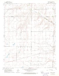 1968 Meade NW1969 Print · USGSSouthwestern Kansas during the late 1960s reveals a quiet landscape of agricultural sections and energy development. Researchers can trace the winding path of Crooked Creek and locate numerous resource wells scattered across Meridilla and West Hess.
 - 1969 Map of Meade NE, 1971 Print
 1969 Meade NE1971 Print · USGSMeade and Gray counties are captured here in the late sixties, showcasing a landscape of High Plains industry and drainage. Genealogists and historians can trace industrial landmarks like the Cudahay Mine, the Silica Pit, and the winding course of Crooked Creek.
 - 1969 Map of Fowler, 1971 Print
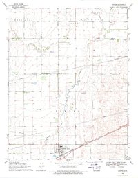 1969 Fowler1971 Print · USGSThe High Plains of Meade and Ford counties are captured here in the late sixties, centered on the Fowler settlement. Genealogists and historians can trace family locations near McCauley Cem, follow the Chicago Rock Island and Pacific rail line, or map the bends of Crooked Creek.2 unique versions available
 - 1971 Map of Kismet, 1973 Print
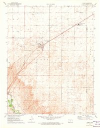 1971 Kismet1973 Print · USGSThe High Plains of Seward County are shown here in the early 1970s, as the energy economy transformed the local landscape. Genealogists and researchers can trace the rail corridor of the Chicago Rock Island and Pacific, locate the South Western Heights High Sch, and see the early footprint of Kismet.
 - 1971 Map of Kismet SW, 1973 Print
 1971 Kismet SW1973 Print · USGSSeward County, Kansas, is captured in the early 1970s as an active energy landscape centered on the Cimarron River. Researchers can trace old family burial sites at Bixler Cem and locate the numerous Oil Wells that defined the local economy.
 - 1972 Map of Proffitt Lake, 1974 Print
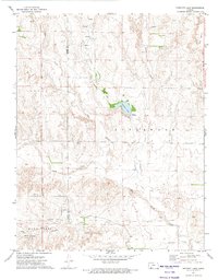 1972 Proffitt Lake1974 Print · USGSThe Kansas high plains near the turn of the 1970s reveal a landscape of creek drainages and historic borderlines. Researchers can locate the Old Indian Treaty Boundary, the Big Basin sinkhole, and remote Grave sites across the prairie.
 - 1972 Map of Proffitt Lake SW, 1974 Print
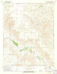 1972 Proffitt Lake SW1974 Print · USGSThe Kansas-Oklahoma border country comes into focus in the early 1970s as energy production and ranching define the landscape. Trace family history at Little Congregational Cem or follow the winding course of Crooked Creek past a remote Painter Landing Strip.
Showing maps 1-25 of 28
Top cities of Meade County
Frequently asked questions
- What are the different types of historical maps available for Meade County?
- What is the oldest map of Meade County?
- Where can I purchase historical maps of Meade County for my home or office?
- Where can I download high-res historical maps of Meade County?
- Are there historical topographic maps available for Meade County?
- Is there historical aerial imagery available for Meade County?
- Where are historical maps of Meade County sourced from?