Old Maps of Ottawa County, Kansas
Explore 158 old maps of Ottawa County, spanning from 1889 to today. These high-resolution historic maps reveal how streets, neighborhoods, landmarks, and natural features evolved over time — perfect for genealogy, metal detecting, research, and local history exploration.
What you can do with these maps:
- See how Ottawa County changed over time: Compare historical maps to modern-day views to trace roads, homesites, rail lines & more.
- View detailed metadata: Each map includes creators, publishers, year, scale, and archive source.
- Overlay maps with satellite & LiDAR: Visualize the past alongside modern tools to explore terrain & human change.
- Trusted historical sources: Maps sourced from the USGS, Library of Congress, and other archives.
- Access maps your way: View online, download high-res files, or order prints for personal or research use.
Start exploring old maps of Ottawa County to uncover forgotten places, hidden landmarks, and the deep history beneath your feet.
Ottawa County, KS maps
(158)- 1889 Map of Abilene
 1889 Abilene1889 Print · USGSAbilene and Dickinson County appear here in the late 1880s during the height of the Kansas railroad expansion. Genealogists and historians can trace the early development of Enterprise, Gypsum City, and Navarre along the complex network of the Union Pacific Railroad and competing lines.
 - 1891 Map of Clay Center
 1891 Clay Center1891 Print · USGSClay County and northern Dickinson County were defined by competing rail lines in the early 1890s as the river valleys were first being settled. Genealogists and historians can trace the early foundations of towns like Clay Center, Wakefield, and Manchester alongside the Republican River.5 unique versions available
 - 1892 Map of Salina
 1892 Salina1892 Print · USGSCentral Kansas at the close of the nineteenth century centers on the booming rail junctions and river valleys of the Smoky Hill region. Genealogists can trace family footprints in riverside settlements like Lindsborg and Assaria or the rail stops of Bavaria and Terra Cotta.6 unique versions available
 - 1892 Map of Minneapolis
 1892 Minneapolis1892 Print · USGSOttawa and Cloud counties appear here in the 1890s as the railroad and river networks solidified the region's agricultural layout. Genealogists and researchers can trace early homesteads and town sites along the Solomon River and railroads serving Minneapolis, Delphos, and Glasco.5 unique versions available
 - 1894 Map of Abilene
 1894 Abilene1894 Print · USGSCentral Kansas at the peak of the railroad era shows a landscape transformed by competing iron rails and river commerce. Genealogists and historians can trace family roots through early settlements like Abilene, Enterprise, and Hope, or locate old stops along the Missouri Pacific Railroad.6 unique versions available
 - 1942 Map of Salina
 1942 Salina1942 Print · USGSCentral Kansas during the early 1940s reveals a landscape transitioning between its deep agricultural roots and a massive new wartime footing. Researchers can trace the development of the Military Reservation and locate small rail-side settlements like Terra Cotta and Smolan.
 - 1952 Map of Glasco SW, 1954 Print
 1952 Glasco SW1954 Print · USGSThe Solomon River valley in the early fifties shows a rural Kansas landscape of small townships and family burial grounds. Local researchers can trace the locations of Bohemian Hall, Coursen Grove School No 2, and the path of the Union Pacific railroad.2 unique versions available
 - 1952 Map of Glasco, 1954 Print
 1952 Glasco1954 Print · USGSThe Solomon River valley in the early fifties shows a landscape of rail-connected towns and evolving infrastructure across Cloud and Ottawa counties. Genealogists and local historians can trace the streets of Glasco and Delphos or locate the St Paul Cem near the Union Pacific tracks.2 unique versions available
 - 1955 Map of Trenton, 1956 Print
 1955 Trenton1956 Print · USGSIn the mid-fifties, the Saline River and the Union Pacific railroad shaped the rural economy of central Kansas. Genealogists and researchers can locate the small communities of Marydel and Shipton, along with local landmarks like Shiloh Sch and Walnut Hill Cem.2 unique versions available
 - 1955 Map of Niles, 1956 Print
 1955 Niles1956 Print · USGSMid-century Kansas life unfolds along the winding Solomon River and the critical Union Pacific railroad line. Researchers can locate early schools and cemeteries like the Red Brick Sch (Abandoned) and Greenville Cem within the townships of Buckeye and Dayton.2 unique versions available
 - 1955 Map of Culver, 1956 Print
 1955 Culver1956 Print · USGSOttawa and Saline counties are captured in the mid-1950s, showing a landscape shaped by the Saline River and dual rail lines. Researchers can trace rural life through landmarks like Tripp Sch, Franklin Cem, and the tracks of the Union Pacific.2 unique versions available
 - 1955 Map of New Cambria, 1956 Print
 1955 New Cambria1956 Print · USGSThe confluence of the Solomon and Saline rivers defines this Kansas landscape in the mid-fifties, just as the local rail and radio infrastructure was maturing. Researchers can trace rural landmarks like the Saline Valley Gem Humbargar Sch, Highland Cem, and North Pole Mound.2 unique versions available
 - 1955 Map of Manhattan, 1964 Print
 1955 Manhattan1964 Print · USGSNorth Central Kansas is captured here in the mid-fifties, just as major flood control projects began reshaping the river valleys. Genealogists can locate family sites near St. Joseph Church, Sunset Cemetery, or along the busy tracks of the Rock Island RR.4 unique versions available
 - 1955 Map of Hutchinson, 1967 Print
 1955 Hutchinson1967 Print · USGSCentral Kansas in the mid-sixties reveals a landscape of growing reservoirs and evolving transportation corridors. Trace the development of towns like Hutchinson and Abilene alongside the Union Pacific Railroad and the expanding Interstate 70.3 unique versions available
 - 1956 Map of Manhattan
 1956 Manhattan1956 Print · USGSNorth-central Kansas in the mid-fifties reveals a landscape defined by the convergence of the Republican River and Smoky Hill River. Historians can trace the rail corridors of the Union Pacific RR and Missouri Pacific RR through towns like Manhattan and Clay Center.
 - 1957 Map of Manhattan
 1957 Manhattan1957 Print · USGSNortheast Kansas in the mid-1950s reveals a landscape of expanding military installations and new water projects. Genealogists and historians can trace the rail-to-river economy through the Union Pacific RR and old settlements like Clay Center or Marysville.
 - 1959 Map of Hutchinson
 1959 Hutchinson1959 Print · USGSCentral Kansas thrives at the intersection of rail and river in the mid-1950s, as post-war aviation infrastructure reshapes the prairie. Genealogists and historians can trace the paths of the AT&SF RR through Newton and Hutchinson, or locate military sites like Smoky Hill Air Force Base.2 unique versions available
 - 1961 Map of Tescott NE, 1963 Print
 1961 Tescott NE1963 Print · USGSOttawa County at the start of the 1960s shows a landscape of river bends and rail lines. Trace family sites near Fairview Cem or follow the paths of the Union Pacific and Atchison Topeka and Santa Fe railroads.
 - 1963 Map of Juniata, 1964 Print
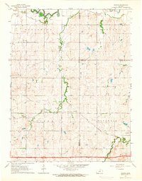 1963 Juniata1964 Print · USGSCentral Kansas at the start of the 1960s shows a landscape defined by the convergence of three counties and steady rail traffic. Genealogists and local historians can trace the paths of the Atchison Topeka and Santa Fe through Juniata and find the rural Monroe Cem.2 unique versions available
 - 1963 Map of Solomon, 1965 Print
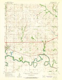 1963 Solomon1965 Print · USGSThe confluence of the Smoky Hill River and two major railroads defined life in central Kansas during the early sixties. Researchers can trace family landmarks like Willowdale Ch, Prairie Mound Cem, and the King Solomon Camp as the interstate era began.3 unique versions available
 - 1964 Map of Lamar, 1965 Print
 1964 Lamar1965 Print · USGSNorth-central Kansas prairie life is documented here in the early sixties, centered on the border of Cloud and Ottawa counties. Genealogists can locate family landmarks like the Rocky Hill Sch, Fairview Cem, and the small community of Lamar along the banks of Middle Pipe Creek.
 - 1964 Map of Idana, 1966 Print
 1964 Idana1966 Print · USGSClay and Ottawa counties are captured here in the mid-1960s, showing a rural landscape of winding creek beds and traditional townships. Genealogists can locate family landmarks like Shields Cem, Browndale Sch, and the quiet settlement of Idana.
 - 1964 Map of Miltonvale, 1966 Print
 1964 Miltonvale1966 Print · USGSMiltonvale stood as a thriving collegiate and railroad town in north-central Kansas during the mid-sixties. Local researchers can trace the grounds of Miltonvale Wesleyan College and follow the Atchison Topeka and Santa Fe rail line through the valley of Chapman Creek.
 - 1964 Map of Ada, 1966 Print
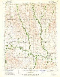 1964 Ada1966 Print · USGSNorth-central Kansas in the mid-sixties reveals a landscape shaped by the rail-and-river economy where the Atchison Topeka and Santa Fe meets the valley of Salt Creek. Researchers can locate family roots at the Bohemian National Cem or trace the early foundations of Ada and Milo.
 - 1965 Map of Minneapolis South, 1966 Print
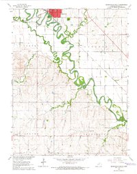 1965 Minneapolis South1966 Print · USGSOttawa County's river-bottom lands are shown in great detail during the mid-1960s, centered on the rail hub of Minneapolis. Genealogists and historians can trace local landmarks like Highland Cemetery, the small community of Lindsey, and the path of the Union Pacific railroad.2 unique versions available
Showing maps 1-25 of 158
Top cities of Ottawa County
- Minneapolis historical maps
- Bennington historical maps
- Delphos historical maps
- Tescott historical maps
- Culver historical maps
Frequently asked questions
- What are the different types of historical maps available for Ottawa County?
- What is the oldest map of Ottawa County?
- Where can I purchase historical maps of Ottawa County for my home or office?
- Where can I download high-res historical maps of Ottawa County?
- Are there historical topographic maps available for Ottawa County?
- Is there historical aerial imagery available for Ottawa County?
- Where are historical maps of Ottawa County sourced from?