Old Maps of Pottawatomie County, Kansas for Metal Detecting
Plan your next treasure hunt with 157 historic maps of Pottawatomie County. Find old homesites, ghost towns, trails, and gathering spots that may be lost to time — perfect for identifying promising metal detecting locations.
- Locate forgotten sites: Uncover places like long-lost settlements, abandoned rail lines, or gathering spots.
- Plan better hunts: Use map overlays combined with LiDAR or satellite views to narrow in on historically rich areas.
- Made for detectorists: Thousands of hobbyists use these maps to discover relics, coins, and hidden history.
Use these historic maps to boost your research and find new opportunities beneath the surface of Pottawatomie County.
Pottawatomie County, KS maps
(157)- 1886 Map of Junction City, 1960 Print
 1886 Junction City1960 Print · USGSNortheastern Kansas in the late nineteenth century centers on the strategic military and rail hubs of the Flint Hills. Genealogists can trace the early foundations of Junction City, the sprawling Fort Riley Military Reservation, and rail-stop towns like Garrison and Stockdale.
 - 1889 Map of Seneca
 1889 Seneca1889 Print · USGSNortheast Kansas was a bustling intersection of frontier rail lines in the late nineteenth century. Genealogists and local historians can trace the early development of towns like Seneca and Centralia along the Missouri Pacific Railroad and other historic transit corridors.
 - 1889 Map of Wamego
 1889 Wamego1889 Print · USGSNortheastern Kansas thrives along the river valleys in the 1880s, where rail networks and river crossings dictated the growth of the prairie. Genealogists can trace family roots in early hubs like Alma, St Marys, and Wamego, or find the path of the Union Pacific Railroad.
 - 1889 Map of Marysville
 1889 Marysville1889 Print · USGSMarshall County in the late nineteenth century was a bustling nexus of river trade and steam rail expansion. Genealogists and historians can trace early town sites like Marysville, Blue Rapids, and Irving along the Little Blue River and major rail lines.
 - 1889 Map of Junction City
 1889 Junction City1889 Print · USGSThe confluence of the Republican and Smoky Hill rivers defines this central Kansas landscape in the late nineteenth century. Genealogists and historians can trace the early footprints of Fort Riley, the rail hubs of Junction City and Manhattan, and vanished stops like Garrison and Bala.
 - 1894 Map of Junction City
 1894 Junction City1894 Print · USGSThe Kansas frontier of the late nineteenth century comes alive as the rail-and-river network expands around Junction City. Genealogists and historians can trace early townships and rural outposts like Riley Center, Bala, and the Fort Riley Military Reservation.7 unique versions available
 - 1894 Map of Seneca
 1894 Seneca1894 Print · USGSNortheastern Kansas is captured here in the late nineteenth century as a thriving rail and river corridor. You can trace early community sites like Guittard Station, Taylor Rapids, and America City along the Missouri Pacific Railroad.4 unique versions available
 - 1894 Map of Marysville
 1894 Marysville1894 Print · USGSMarshall County's river valleys and railroad corridors are intricately detailed in the 1880s, before modern highway expansion altered the rural landscape. Genealogists can locate family lands near Ballard Falls, Bremen, or the rail junctions at Marysville.4 unique versions available
 - 1894 Map of Wamego
 1894 Wamego1894 Print · USGSThe Kansas prairie in the late nineteenth century was a world of steam and river crossings, where the iron horse reshaped the frontier. Genealogists can trace family roots in established towns like Wamego, Alma, or the small settlement of Moodyville along Rock Creek.5 unique versions available
 - 1947 Map of Manhattan, 1954 Print
 1947 Manhattan1954 Print · USGSManhattan and the surrounding Kansas river valleys are shown here in the years immediately following World War II. Researchers can trace the extensive military works at Camp Funston, local education at College Hill Sch, and pioneer-era sites like St Patricks Cem.2 unique versions available
 - 1950 Map of Manhattan
 1950 Manhattan1950 Print · USGSManhattan and the surrounding Riley County landscape are captured in the late 1940s, showing a growing college town at the junction of the Kansas and Big Blue Rivers. Researchers can trace the mid-century footprint of Kansas State College, local rural schoolhouses like Oak Grove School, and early aviation at Mankan Airport.2 unique versions available
 - 1953 Map of Wamego, 1954 Print
 1953 Wamego1954 Print · USGSMid-century Kansas comes to life in this survey of the river valley settlements near the Pottawatomie and Wabaunsee county line. Genealogists and local historians can trace the paths of the Union Pacific, locate St. Bernard Cem, or find the historic Wabaunsee townsite.3 unique versions available
 - 1953 Map of St George, 1954 Print
 1953 St George1954 Print · USGSMid-century Pottawatomie County is defined here by the twin rail lines of the Union Pacific and the Rock Island flanking the river. Researchers can trace rural life through landmarks like Mt Zion Ch, Sunflower Sch, and the historic Pillsbury Crossing.4 unique versions available
 - 1953 Map of Belvue, 1954 Print
 1953 Belvue1954 Print · USGSThe Kansas River valley near the Pottawatomie and Wabaunsee county line is captured in the early fifties as a landscape of rail-fed towns and rural school districts. Genealogists can trace family footprints at Belvue Cem, Wells Creek Sch, and St Johns Ch.3 unique versions available
 - 1953 Map of St Marys, 1954 Print
 1953 St Marys1954 Print · USGSThe Kansas River valley in the early 1950s centered on the hub of St Marys, where the rail and river economies met. Genealogists and historians can trace local rural infrastructure through sites like St Marys Seminary, Turkey Creek Sch, and Mt Calvary Cem.2 unique versions available
 - 1955 Map of Manhattan, 1958 Print
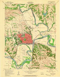 1955 Manhattan1958 Print · USGSManhattan and its surrounding river valleys are captured in the mid-fifties, just before massive hydraulic projects changed the local landscape. Genealogists and historians can trace neighborhood growth near Kansas State College or locate vanished rural landmarks like Hunters Island School and Rocky Ford.4 unique versions available
 - 1955 Map of Manhattan, 1964 Print
 1955 Manhattan1964 Print · USGSNorth Central Kansas is captured here in the mid-fifties, just as major flood control projects began reshaping the river valleys. Genealogists can locate family sites near St. Joseph Church, Sunset Cemetery, or along the busy tracks of the Rock Island RR.4 unique versions available
 - 1956 Map of Manhattan
 1956 Manhattan1956 Print · USGSNorth-central Kansas in the mid-fifties reveals a landscape defined by the convergence of the Republican River and Smoky Hill River. Historians can trace the rail corridors of the Union Pacific RR and Missouri Pacific RR through towns like Manhattan and Clay Center.
 - 1957 Map of Manhattan
 1957 Manhattan1957 Print · USGSNortheast Kansas in the mid-1950s reveals a landscape of expanding military installations and new water projects. Genealogists and historians can trace the rail-to-river economy through the Union Pacific RR and old settlements like Clay Center or Marysville.
 - 1964 Map of Louisville, 1965 Print
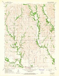 1964 Louisville1965 Print · USGSThe town of Louisville and its surrounding farmsteads are documented here in the mid-1960s, just after the era of aerial photogrammetry. Genealogists can trace family plots at the Old County Farm Cem or locate the historic Old Indian Treaty Boundary that bisects the county.2 unique versions available
 - 1964 Map of Westmoreland, 1965 Print
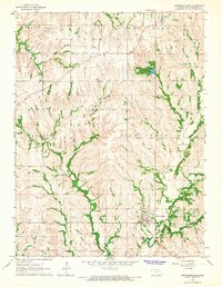 1964 Westmoreland1965 Print · USGSWestmoreland and the surrounding Pottawatomie County prairies are captured here in the mid-sixties, showing a landscape of deep creek valleys and rural farmsteads. Genealogists can trace family lines through numerous burial sites like St Columbkilles Cem, Huff Cem, and Old Westmoreland Cem.3 unique versions available
 - 1964 Map of Onaga NE, 1965 Print
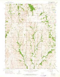 1964 Onaga NE1965 Print · USGSNortheastern Kansas rural life in the mid-1960s is preserved here, centered on the historic Old Indian Treaty Boundary. Genealogists and historians can locate family landmarks like Fairview Cem, Bucks Grove Ch, and local Quarries.
 - 1964 Map of Tuttle Creek Dam, 1965 Print
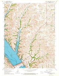 1964 Tuttle Creek Dam1965 Print · USGSThe Big Blue River valley was recently transformed into a massive reservoir during the mid-sixties. Genealogists and researchers can locate family landmarks like Carnahan-Garrison Cem and Hayes Cem alongside the newly formed Tuttle Creek Reservoir.2 unique versions available
 - 1964 Map of Laclede, 1965 Print
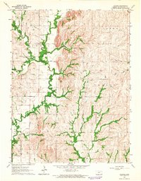 1964 Laclede1965 Print · USGSPottawatomie County during the mid-1960s reveals a rural landscape shaped by the winding Vermillion Creek. Genealogists and local historians can trace the exact locations of family burial sites like Polly Creek Cem and Vieux Cem or the small hub of Laclede.2 unique versions available
 - 1964 Map of Onaga, 1965 Print
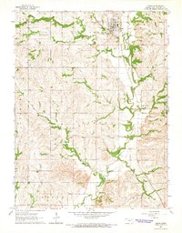 1964 Onaga1965 Print · USGSThe community of Onaga and its surrounding townships are documented here during the mid-1960s. Genealogists and local historians can trace the OLD INDIAN TREATY BOUNDARY and locate rural landmarks like the Vienna Cem and Vermillion Valley Sch.
Showing maps 1-25 of 157
Top cities of Pottawatomie County
- Wamego historical maps
- Saint Marys historical maps
- Westmoreland historical maps
- Onaga historical maps
- Emmett historical maps
- Belvue historical maps
See more
Frequently asked questions
- What are the different types of historical maps available for Pottawatomie County?
- What is the oldest map of Pottawatomie County?
- Where can I purchase historical maps of Pottawatomie County for my home or office?
- Where can I download high-res historical maps of Pottawatomie County?
- Are there historical topographic maps available for Pottawatomie County?
- Is there historical aerial imagery available for Pottawatomie County?
- Where are historical maps of Pottawatomie County sourced from?