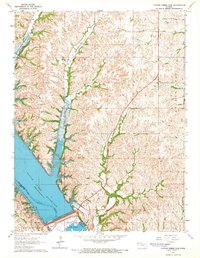
1964 Map of Tuttle Creek Dam
USGS Topo · Published 1965About this map
Tuttle Creek Reservoir dominates this landscape on the border of Riley and Pottawatomie counties, created by the massive earth-fill Tuttle Creek dam. The map details the newly altered geography following the reservoir's completion, showing the submerged river valley and the creation of Spillway State Park and River Pond State Park just below the dam. To the north, the terrain is deeply dissected by tributaries like Carnahan Creek and McIntire Creek, where family heritage is preserved at the Carnahan-Garrison Cem. Industrial activity is evident at the Quarries near the dam, while the eastern portion of the sheet remains largely agricultural within Pottawatomie and Green townships. The map serves as a primary record of the mid-1960s transformation of the Blue River valley into a major water management and recreation area.
Find a feature on this map
20 named features on this map. Tap any name to fly to it.
Don’t see what you’re looking for? This feature index may not catch every label — zoom into the map to look around manually.
Map Details
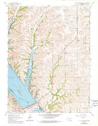
Editions of this 1964 Tuttle Creek Dam Map
2 editions found
Other maps of this area

1886 · Junction City
USGS Topo · 1:125,000

1889 · Wamego
USGS Topo · 1:125,000

1889 · Junction City
USGS Topo · 1:125,000

1894 · Junction City
USGS Topo · 1:125,000

1894 · Wamego
USGS Topo · 1:125,000

1947 · Manhattan
USGS Topo · 1:62,500

1950 · Keats
USGS Topo · 1:24,000

1950 · Manhattan
USGS Topo · 1:24,000

1953 · St George
USGS Topo · 1:24,000
1955 · Manhattan
USGS Topo · 1:24,000