
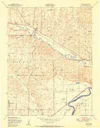
1950 Map of Keats
USGS Topo · Published 1950About this map
The Fort Riley Military Reservation dominates this central Kansas landscape, showcasing the extensive network of training grounds and internal boundaries that shaped the region during the mid-century. Within the reservation, numerous ruins and a Vehicle Firing Range indicate the intense military utility of the land, while the Military Reservation Boundary sharply divides these tactical areas from the surrounding agricultural and civic life. Outside the base, the settlement of Keats sits at the junction of the Chicago Rock Island and Pacific railroad and the winding Wild Cat Creek. To the southeast, the Kansas River valley facilitates vital infrastructure, including the Union Pacific tracks and the Manhattan Airport. Notable local landmarks like the Rebekah IOOF Home, a Cemetery, and Washington Marlatt Memorial Park provide clear points of interest for genealogical research and community history in the Ashland and Ogden districts.
Find a feature on this map
28 named features on this map. Tap any name to fly to it.
Don’t see what you’re looking for? This feature index may not catch every label — zoom into the map to look around manually.
Map Details
Editions of this 1950 Keats Map
2 editions found
Other maps of this area

1886 · Junction City
USGS Topo · 1:125,000

1889 · Junction City
USGS Topo · 1:125,000

1894 · Junction City
USGS Topo · 1:125,000

1947 · Manhattan
USGS Topo · 1:62,500

1947 · Fort Riley
USGS Topo · 1:62,500

1950 · Manhattan
USGS Topo · 1:24,000

1950 · Junction City
USGS Topo · 1:24,000

1951 · Swede Creek
USGS Topo · 1:24,000

1951 · Ogden
USGS Topo · 1:24,000

1951 · Wind Creek
USGS Topo · 1:24,000